Highest Mountain Peak in China
China's mountain landscape stretches from the world's highest summit down through glaciated ranges in the west to accessible pilgrim peaks in the east. For foreign visitors, the draw is simple: you do not need to be a mountaineer to stand before some of the planet's most dramatic peaks. You can drive to Everest Base Camp, take a cable car above the snowline at Jade Dragon Snow Mountain, or hike through alpine meadows beneath Mount Siguniang. Each peak offers a different combination of altitude, access, and cultural setting, and knowing which ones are reachable without technical climbing makes the planning much simpler.
This guide ranks the ten tallest peaks in China, explains how to visit the most dramatic viewpoints, and compares practical factors such as transport connections, ticket costs, and altitude risk so you can plan a mountain itinerary that matches your fitness level and schedule.
The 10 Highest Mountain Peaks in China
Of the ten tallest peaks in China, only four are readily accessible to non-expedition visitors. The rest require technical climbing permits, specialist guides, and weeks of logistical preparation. The table below ranks all ten peaks by elevation, noting border status and general access level so visitors can immediately see which peaks allow a straightforward visit.
* Everest elevation from the 2020 China-Nepal joint survey.
Mount Everest — China's Highest Peak
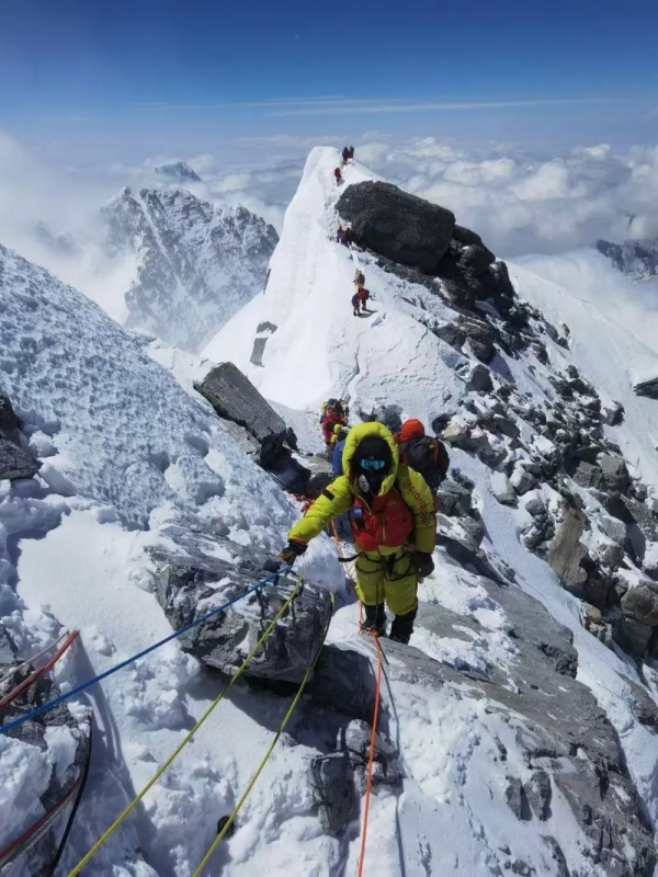
Mount Everest (Chinese Highest Mountain)
Mount Everest rises to 8,848.86 metres, confirmed by the 2020 China-Nepal joint survey. It straddles the border between the Tibet Autonomous Region and Solukhumbu District in Nepal, making it both the highest peak in China and the highest point on Earth's surface. The summit sits on the Main Central Thrust where the Indian tectonic plate pushes beneath the Eurasian plate, a collision that continues to lift the Himalayas by roughly 5 millimetres per year. The Tibetan name, Chomolungma, translates to "Goddess Mother of the World"; the Nepali name, Sagarmatha, means "Goddess of the Sky".
From the Tibetan north side, non-climbers can reach Everest Base Camp by vehicle. This makes the peak uniquely accessible among the world's eight-thousanders — you do not need ropes, crampons, or high-altitude experience to stand before the mountain. The trade-off is the altitude: the base camp sits at approximately 5,000 metres, and altitude sickness becomes a real risk above 4,500 metres.
🏔️ Plan a Trip to High-Altitude Summits: If you want to view 8,000-meter peaks up close, explore permit requirements, route details, and altitude tips in our guide to Chinese Highest Mountain.
Where Mount Everest Stands
The massif extends roughly 55 kilometres in an east-west direction along the Himalayan crest. China holds the north face and the summit triangulation marker, first installed in 1975 and refreshed in 2005. The mountain's position along an active tectonic boundary means the surrounding landscape changes visibly — glaciated valleys on the Tibetan side give way to deep gorges on the southern Nepal flank. Most visitor access comes from the Tibet side, where infrastructure and permits are more straightforward for foreign nationals travelling independently or through tour operators.
Reaching Everest Base Camp from Tibet
The standard overland route starts in Lhasa and follows the Qinghai–Tibet Highway south through Gyantse and Shigatse before turning west toward Rongbuk. The four-day itinerary covers roughly 1,000 kilometres round trip and climbs steadily from Lhasa's 3,650 metres to EBC's 5,000 metres. Flying into Lhasa Gonggar Airport (LXA) is the quickest way to reach the start of this route. An alternative is the overland approach from Kathmandu via the China-Nepal Friendship Highway and the Zhangmu border crossing, though this requires the correct permits and is only feasible with a pre-arranged tour.
- Day 1: Lhasa → Gyantse (Kumbum Stupa, Pelkhor Chode Monastery) → Shigatse (Tashilhunpo Monastery); overnight in Shigatse
- Day 2: Shigatse → Tingri County → Rongbuk Monastery (world's highest monastery at ~5,000 m) → Everest Base Camp; overnight at Rongbuk tent camp or monastery guesthouse
- Day 3: Sunrise at EBC → depart via the same highway → return to Shigatse
- Day 4: Shigatse → Lhasa (rest and acclimatisation)
Permits, Prices, and Conditions
Foreign visitors cannot travel independently in Tibet — the Tibet Travel Permit (TTP) is mandatory and must be arranged through a registered Tibet travel agency before arrival. Processing takes 7–15 working days. Once in Tibet, an Alien's Travel Permit is required for border areas including the Everest zone. Climbing permits for the summit are a separate process handled through expedition operators and are not available to casual visitors at EBC.
On the ground, expect two ticket costs at EBC: an entry fee of about $25 (¥180) and a mandatory sightseeing vehicle fee of roughly $17 (¥120) for the final approach road. The environment is harsh. Temperatures at EBC drop below freezing even in summer. Visitors should carry a down jacket, sunglasses, sunscreen, lip balm, and layered clothing regardless of the season.
- Tibet Travel Permit: arranged by tour operator 7–15 working days in advance
- Alien's Travel Permit: covers the Everest border zone; issued after TTP
- EBC entry fee: about $25 (¥180)
- Mandatory sightseeing bus: about $17 (¥120)
Mount Gongga — King of Sichuan Mountains
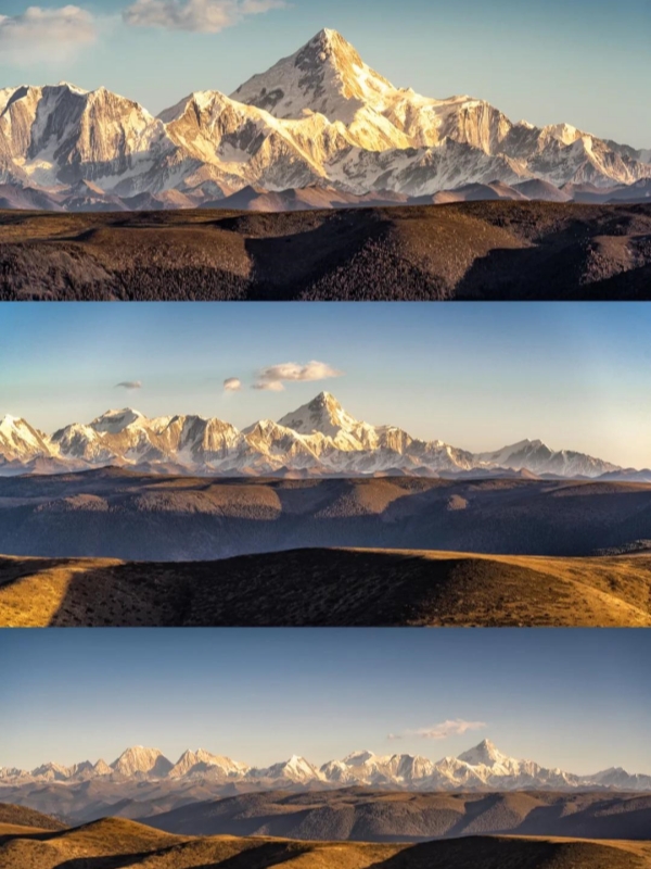
The Mount Gongga
Mount Gongga, also known as Minya Konka, reaches 7,556 metres in Garzê Tibetan Autonomous Prefecture. It holds two notable records: the highest peak in Sichuan and the easternmost 7,000-metre summit on Earth. The mountain's steep granite faces and heavy glaciation have claimed 21 lives among 32 successful summits as of 2017, giving it one of the highest fatality rates among 7,000-metre peaks.
For non-climbers, Hailuogou Glacier Park on the eastern slopes offers the best view. The Grand Ice Fall — a glacier with roughly 1,000 metres of vertical drop — is visible from a dedicated viewpoint without any climbing. The park also contains hot springs, red rock formations, and primitive forest trails. Entry costs about $21 (¥150) and the internal sightseeing bus adds roughly $14 (¥95).
- Elevation: 7,556 m — highest in Sichuan, easternmost 7,000 m peak globally
- Non-climber access: Hailuogou Glacier Park, Grand Ice Fall viewpoint
- Death rate: 21 fatalities among 32 recorded ascents (2017)
- Logistics: Registration via Sichuan Mountaineering Association for summit attempts; tourist tickets via Trip.com or Klook
🌄 Explore Major Geographic Ranges: Discover how multi-province mountain belts divide climate zones and river basins in our comprehensive guide to China Mountain Ranges.
Mount Siguniang — The Alps of the East
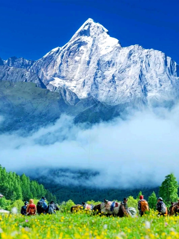
The Mount Siguniang
The Siguniang Mountains dominate the landscape roughly 160 kilometres northwest of Chengdu. The highest summit, Yaomei Feng, rises to 6,250 metres and is nicknamed the "Queen of Sichuan Mountains". Across the range, 52 peaks exceed 5,000 metres, creating a dramatic alpine environment. Four valleys provide different access levels, from bus tours to technical climbs.
- Shuangqiao Valley: paved sightseeing bus route; easiest access
- Changping Valley: multi-day trekking through alpine meadows
- Haizi Valley: advanced alpine climbing and glacier travel
- Balang Valley: high viewpoint at 4,480 m; panoramic across the range
Entry to the main scenic area costs about $14 (¥100) plus a bus fee of roughly $11 (¥80). Technical climbing permits for Yaomei Feng and other 5,000-metre summits are issued through the Sichuan Mountaineering Association. Most visitors spend one to three days across the valleys, using Shuangqiao and Balang for a first impression and Changping for a longer trek.
🌲 Discover Chongqing's Alpine Trails: Pair high-altitude viewing platforms with forest hikes by exploring our regional itinerary guide for the Chongqing Mountains.
Jade Dragon Snow Mountain — Lijiang's Snowy Spine
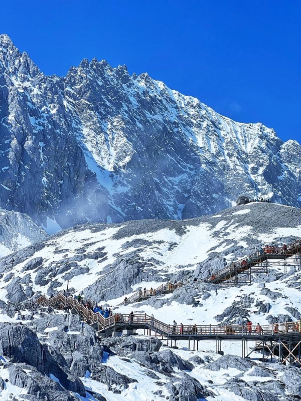
The Jade Dragon Snow Mountain
Thirteen snow peaks line up north of Lijiang Old Town, with Shanzidou at 5,596 metres as the highest. The mountain is a sacred site for the Naxi people and sits at the convergence of the Hengduan Mountains. A cable car system lifts visitors to Glacier Park at 4,506 metres, bringing the summit zone within reach without any mountaineering.
- Glacier Park cable car: reaches 4,506 m; about $20 (¥140)
- Yak Meadow cable car: mid-altitude scenic access; about $10 (¥70)
- Spruce Meadow cable car: lower-elevation forest zone; about $8 (¥60)
Blue Moon Valley at the base features turquoise travertine pools that attract photographers year-round. Oxygen canisters are sold on the mountain for visitors experiencing altitude effects. Cultural performances in Lijiang town provide context on the Naxi relationship with the mountain. Entry to the overall scenic area costs about $14 (¥100).
🗺️ Explore Vast Mountain Ranges: Beyond elevation alone, discover the mountain massifs that cover the greatest land area in our article on China Largest Mountain.
Comparing China's Highest Peaks for Visitors
The single most useful filter for choosing a peak is not its elevation but its logistics. Whether you can reach the summit area by cable car, the distance from the nearest high-speed rail station, and whether on-mountain accommodation exists determine how many days your trip will take. The table below compares ten peaks across difficulty, accommodation, and HSR access so you can match a mountain to your schedule.
Planning Tips for Visiting China's Tallest Mountains
Timing your visit around weather windows and altitude acclimatisation makes the difference between a memorable trip and a miserable one. The peaks in this guide span from 3,000 to 8,800 metres, so planning principles vary by region. Booking tickets through channels that foreign visitors can actually access — Trip.com and Klook — avoids the problem of needing a mainland phone number or WeChat Pay.
Best Seasons and Altitude Planning
Season windows and acclimatisation needs differ sharply between Tibet and the eastern ranges. For Everest and the Tibet peaks, the clearest skies fall in April–May and late September–November. The summer monsoon (June–August) brings clouds and reduced visibility. In Sichuan and Yunnan, the pattern reverses slightly: April–June and September–October offer the best balance of snow cover and stable weather.
- Everest and Tibet peaks: April–May and September–November for clearest views; avoid the summer monsoon
- Sichuan peaks: April–June and September–October; snow returns by November
- Eastern scenic peaks (Emei, Hua, Tai, Fanjing, Wutai): March–November; shoulder seasons (April–May, September–October) offer fewer crowds
- Acclimatisation: 2–3 days in Lhasa (3,650 m) before ascending to EBC; 1–2 days in Lijiang before Jade Dragon; minimal acclimatisation needed for peaks below 3,200 m
Permits, Tickets, and Booking Channels
Permit requirements scale with altitude. The Tibet Travel Permit (TTP) and Alien's Travel Permit are mandatory for any visit to the Everest area and must be arranged by a licensed tour operator before your arrival in Tibet. For technical climbing on Gongga or Siguniang, the Sichuan Mountaineering Association issues the relevant permits. The eastern scenic peaks — Emei, Hua, Tai, Fanjing, Wutai — require only a standard scenic area ticket, all bookable on Trip.com or Klook.
- Tibet permits: Tibet Travel Permit via licensed agency 7–15 days ahead; Alien's Travel Permit for border zones
- Sichuan technical climbs: Sichuan Mountaineering Association registration for Gongga summit and Siguniang climbing routes
- Eastern peaks: Cable car and entry tickets on Trip.com or Klook; no permit needed beyond the scenic area ticket
- What to bring: Layered clothing, sturdy hiking shoes, sunscreen, lip balm, sunglasses, altitude medication if prescribed; confirm any prescribed medication with your doctor before travel
Frequently Asked Questions
Q: What is the highest mountain peak in China?
Mount Everest is the highest mountain peak in China at 8,848.86 metres, measured by the 2020 China-Nepal joint survey. The summit lies on the border between the Tibet Autonomous Region and Nepal, but the peak is counted as part of China's mountain landscape and holds the distinction of being the highest point on Earth.
Q: What is the highest mountain peak entirely within China?
Namcha Barwa at 7,782 metres is the highest peak entirely within Chinese territory. It stands in southeastern Tibet near the Yarlung Tsangpo Grand Canyon. Namcha Barwa is not accessible for summit climbs by casual visitors, but viewpoint access exists in the surrounding area.
Q: Can tourists visit Mount Everest Base Camp without climbing?
Yes. From the Tibetan north side, visitors can drive to Everest Base Camp at approximately 5,000 metres via Rongbuk Monastery. No technical climbing is required. All visitors need a Tibet Travel Permit arranged through a licensed tour operator and a tour package covering the Lhasa-to-EBC route.
Q: Which of China's highest peaks are suitable for non-climbers?
Several of China's tall peaks are accessible without technical climbing. Mount Everest Base Camp allows a drive-up visit. Jade Dragon Snow Mountain operates cable cars to 4,506 metres. Mount Emei, Mount Tai, Mount Hua, Mount Fanjing, and Mount Wutai all have cable car systems and well-maintained trails. Mount Gongga is viewable from Hailuogou Glacier Park without any climbing.
Q: Do I need a Tibet permit to visit Everest Base Camp?
Yes. The Tibet Travel Permit is mandatory for all foreign visitors entering the Tibet Autonomous Region. It must be arranged by a registered Tibet travel agency 7–15 working days before your intended entry date. Once in Tibet, an additional Alien's Travel Permit is required for the Everest border zone.
Q: When is the best season to visit the highest mountain peaks in China?
April–May and late September–November are the best windows for Everest and the Tibet peaks, when skies are clearest and visibility is highest. For Sichuan and Yunnan peaks, April–June and September–October offer the most stable weather with less cloud cover. The lower eastern peaks — Emei, Tai, Hua, Fanjing, Wutai — can be visited from March through November, with shoulder seasons being less crowded.
Q: How long should visitors acclimatize to high altitude?
For Everest Base Camp, plan 2–3 days in Lhasa at 3,650 metres before ascending to the base camp at 5,000 metres. For Jade Dragon Snow Mountain, 1–2 days in Lijiang (2,400 m) provides sufficient adjustment before the cable car ascent to 4,506 metres. Peaks below 3,200 metres, such as Mount Emei, require minimal acclimatisation for most visitors. Anyone with concerns about altitude should consult a physician before travel.
Q: Are English-speaking guides available at China's highest peaks?
English-speaking guides are available at the major tourist peaks through pre-booked tours on Trip.com or Klook — this covers Jade Dragon, Emei, Siguniang, Tai, Hua, Fanjing, and Wutai. For Everest Base Camp and Namcha Barwa, English-speaking Tibetan guides are standard in licensed tour packages. Booking in advance is strongly recommended outside peak season.