China Mountain Ranges
China's topography reads like a textbook on dramatic elevation. From the roof of the world in the west to the coastal lowlands of the east, the country hosts an extraordinary diversity of mountain landscapes that have shaped its history, climate, and culture. For travelers, this means access to everything from world-class trekking in the high Himalayas to cable-car tourist circuits among cloud-wrapped peaks in Anhui and Hunan.
This guide covers the seven principal mountain range groups that organize China's terrain: the Himalayas and Karakoram along the southwestern frontier, the sweeping Kunlun–Tian Shan–Altai arc across the far northwest, the deeply carved Hengduan Mountains of the southwest interior, the Qinling as a central climate divide, and the gentler but richly developed eastern ranges. Whether you want a technical climb or a scenic day trip by gondola, each range has a distinct character and a different set of access requirements.
Quick Facts
What Counts as a China Mountain Range
China Mountain Ranges
A mountain range is not simply a single peak—it is a geological chain where connected ridges, valleys, and massifs share a common origin and orientation. Peak elevation alone does not define a range; rather, it is the shared tectonic structure and directional continuity that matter. Mount Everest, for instance, belongs to the Himalayas rather than standing alone as an isolated giant. Understanding this distinction helps travelers make sense of China's layered landscape, which descends in three broad steps from west to east.
China's topography is often described as a three-step staircase. The first and highest step is the Tibetan Plateau and its surrounding high mountain walls, averaging over 4,000 meters. The second step consists of the interior mountain basins and intervening ranges such as the Hengduan and Qinling, typically between 1,000 and 2,000 meters. The third and lowest step is the eastern lowland zone—hills, plains, and mountains under 1,000 meters where most of China's population lives and travels.
- Range vs. Peak: A range is a connected chain; a peak is a single summit. The Himalayas include dozens of named peaks above 7,000 meters, all linked by ridgelines along the same tectonic belt.
- Three-Step Topography: Western plateau (step one) → interior mountains and basins (step two) → eastern lowlands and hills (step three). Each step has distinct accessibility, climate, and tourist infrastructure.
⛰️ Overview of China's Most Famous Peaks: Whether you are planning a high-altitude expedition, a scenic day hike, or a cable-car ascent up granite massifs across the country, check out our guide to Mt in China.
The Major Ranges That Shape China
China's mountain landscape runs from the Pamir Knot in the far west in a rough E-shape pattern. The western arc (Kunlun, Tian Shan, Altai) curves north of the plateau; the southwestern rim (Himalayas, Karakoram) borders the Indian subcontinent; the interior chains (Hengduan, Qinling) cut across the country's midsection; and the eastern hills (Wuyi, Nanling, and the scenic ranges around Huangshan and Zhangjiajie) form the tourist-friendly backdrop to the Yangtze and Pearl River plains.
The Himalayas and Karakoram
China Mountain Ranges
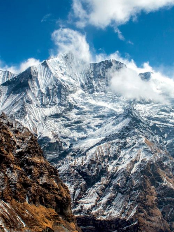
The Himalayas form the great southern rim of the Tibetan Plateau, running roughly east to west along the border of Tibet with Nepal, Bhutan, and India's northern tier. Four of the world's fourteen peaks above 8,000 meters lie on or near the China border: Mount Everest at 8,848.86 meters (jointly measured by China and Nepal in 2020), Lhotse, Makalu, and Cho Oyu. On the Tibet side, Shishapangma completes the list of China's eight-thousanders as the fourteenth and lowest of the group.
The Karakoram extends westward from the Pamir Knot into Xinjiang, running parallel to the Himalayas. K2 (8,611 m) sits on the China–Pakistan border in disputed-administered territory. The range continues with Broad Peak and Gasherbrum I and II—all among the world's highest mountains and all requiring serious mountaineering expertise.
- Mt. Everest (8,848.86 m): The world's highest peak; the north-side base camp in Tibet is the primary tourist access point
- Lhotse (8,516 m): Fourth highest; shares the Everest massif; visible from the north-side approach
- Makalu (8,485 m): Fifth highest; located east of Everest in Nepal, but the border region is accessible from Tibet with a permit
- Cho Oyu (8,188 m): Sixth highest; known as the "easiest" eight-thousander due to its straightforward climbing route from Tibet
- Shishapangma (8,027 m): Fourteenth highest and the only eight-thousander entirely within China; located in Tibet
- K2 (8,611 m): Second highest globally; the China–Pakistan border peak; Karakoram base access only
- Rongbuk Monastery: The world's highest monastery at roughly 5,000 meters; the starting point for the north-side Everest base camp approach
The Kunlun–Tian Shan–Altai Arc
Kunlun, Tian Shan, and Altai form a sweeping arc across China's far northwest, separating the plateau from the deserts of Xinjiang and Mongolia. The Kunlun range runs roughly east to west along the northern edge of the Tibetan Plateau, stretching an estimated 3,000 kilometers in commonly cited references—some sources extend this to 3,500 kilometers. Its peaks are high but less sharp than the Karakoram; the Kunlun is often described as a broad, glaciated wall.
The Tian Shan range arcs west-to-east across Xinjiang, positioned just south of Ürümqi and the Junggar Basin. Its two most significant peaks for visitors and climbers are Tomur (7,443 m) and Khan Tengri (7,010 m), both straddling international borders with Kazakhstan and Kyrgyzstan. The Altai Mountains occupy the far northwestern corner where China meets Mongolia, Russia, and Kazakhstan—lower in elevation than the Tian Shan but scenically distinct with broad valleys and alpine lakes.
- Usu Daban (~7,723 m): Often cited as the highest Kunlun summit; remote and rarely visited
- Tomur Peak (7,443 m): Highest in the Tian Shan; accessible through Tomur Peak Nature Reserve, offering glacier hiking without technical climbing
- Khan Tengri (7,010 m): Border peak with Kazakhstan and Kyrgyzstan; a technical mountaineering objective
- Muzart Peak (6,622 m): One of the most climbed peaks in the Tian Shan; a common first expedition for altitude experience
The Hengduan Mountains
China Mountain Ranges
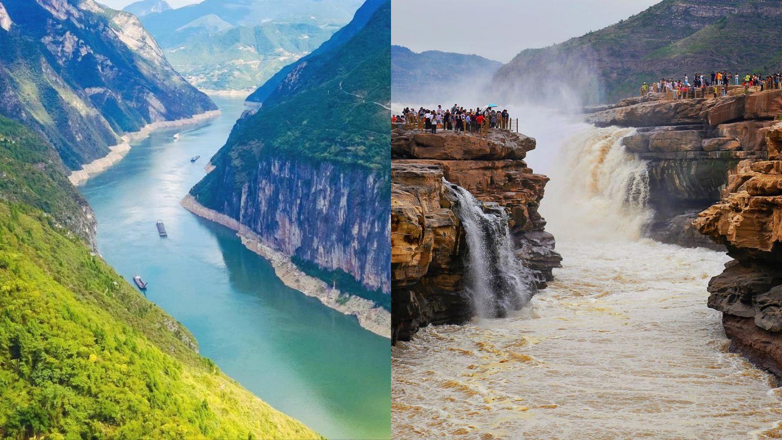
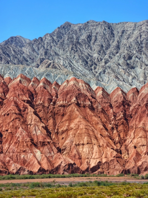
The Hengduan run northwest to southeast across southwest China, bridging the Tibetan Plateau and the Sichuan Basin. Three of Asia's great rivers—the Jinsha (Yangtze), Lancang (Mekong), and Nu (Salween)—carve deep parallel valleys through the range, a landscape carved over millions of years by glacial and river action.
The range includes several well-known sub-ranges. The Gongga or Minya Konka massif (Minya Konka, 7,556 m) is the highest peak in the Hengduan and a serious mountaineering goal. Siguniang Shan (Four Girls Mountain) to the east rises with four distinct peaks above 5,000 meters; its highest summit, Shan, reaches 6,250 meters and requires acclimatization and a hiking permit. Near Lijiang, Yulong Snow Mountain's thirteen peaks are led by Jade Dragon at 5,596 meters; the range offers multiple access points through cable cars and village trails.
- Minya Konka / Gongga (7,556 m): Highest Hengduan peak; technical climbing routes; base camp accessible with local guide
- Siguniang Shan (6,250 m at highest peak): Four summits above 5,000 m; popular multi-day trek with permit; hiking trail gains over 4,000 m
- Yulong Snow Mountain (5,596 m): Accessible from Lijiang; cable car to Spruce Meadow (3,240 m) and Glacier Park (4,506 m)
- Qionglai and Daxiang ranges: Form the western wall of the Sichuan Basin; lower but culturally significant
The Qinling and Central Belt
The Qinling forms China's most important natural north–south divide. Roughly 1,600 kilometers in length, the range separates the warm, humid south from the drier, cooler north—a line so significant that Chinese geographers have traditionally described it as the country's natural boundary. During the last Ice Age, plant and animal species differentiated on either side of this ridge, creating distinct biological zones that persist today.
East of the main Qinling spine, the Funiu, Dabie, and Wuling chains extend the central mountain belt across central China toward the Yangtze basin. Huashan, one of the Five Sacred Mountains of Taoism, lies within this central corridor about 120 kilometers from Xi'an—a two-hour drive. The mountain is famous for its plank walk, a series of wooden walkways and ladders bolted to near-vertical cliff faces at over 2,000 meters elevation, where hikers traverse narrow ledges above sheer drops.
- Qinling main ridge: ~1,600 km east–west; Huaiyang Line is the conventional climate boundary between north and south China
- Funiu and Dabie ranges: Extend the central belt east toward Anhui; lower and more forested than the western plateau ranges
- Huashan (2,154 m): One of the Five Sacred Mountains; plank walk is a bucket-list hike; Taoist temples line the ascent from the north gate
The Eastern and Southeastern Ranges
The eastern ranges are China's most accessible mountain country. Gentler in elevation than the western plateau systems, many have been developed for tourism with cable cars, paved trails, and UNESCO designations. Taihang runs along the Hebei–Shanxi border north of Beijing. Wuyi Shan straddles the Fujian–Jiangxi border and is a UNESCO World Heritage Site. Nanling forms the watershed between the Yangtze and Pearl River basins, while Xuefeng and Wuling cut through Hunan and Guizhou.
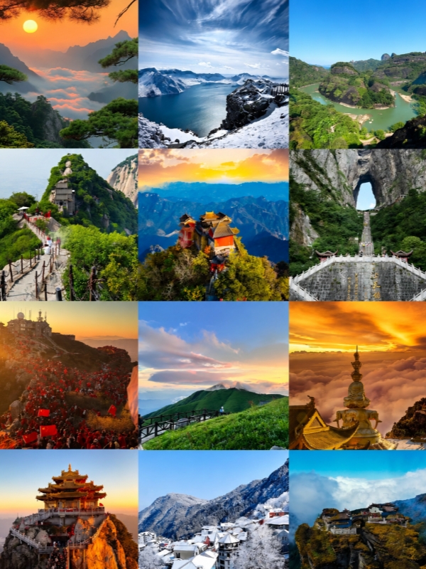
Within this group, Huangshan in Anhui is the most celebrated. At 1,864 meters, it is lower than many hills in the west, yet its granite pillars, cloud seas, and centuries-old pines make it one of China's most painted and photographed landscapes. The UNESCO-listed villages of Hongcun and Xidi lie nearby, their Song-dynasty courtyard architecture a filming location for Crouching Tiger, Hidden Dragon.
Famous Mountain Attractions & Quick Reference List
Wuling stretches west through Zhangjiajie, one of China's most visited scenic areas. Tianmen Mountain features Tianmen Cave, a natural arch at the summit, and the 999 Steps climb to the cave entrance. The glass skywalk circles the cliff edge. Yuanjiajie, reached by the Bailong Elevator—one of the world's tallest outdoor lifts at 326 meters—holds the famous Qiankun Pillar, the inspiration for the floating Hallelujah Mountains in the film Avatar. Tianzi Mountain and Golden Whip Stream complete the main circuits. In Guizhou, Fanjing Mountain is a UNESCO site whose Red Clouds Golden Summit features twin golden Buddhist pagodas joined by a narrow bridge at 2,336 meters.
- Huangshan (1,864 m): UNESCO peak; cable car from the base towns; Hongcun and Xidi villages nearby for cultural visits
- Wuling Mountains / Zhangjiajie: Yuanjiajie pillars, Tianzi Mountain, Golden Whip Stream; Bailong Elevator access; Tianmen Cave and 999 Steps
- Fanjing Mountain (2,576 m): UNESCO site in Guizhou; Red Clouds Golden Summit with twin pagodas and the Mushroom Stone formation
- Taihang (3,000+ m peak elevation): North of Beijing; less developed but popular for hiking and rock climbing
- Wuyi Shan (2,157 m): UNESCO site on Fujian–Jiangxi border; peaks, temples, and boat rides on Nine-Bend Creek
⛩️ Discover Sacred Mountains & Cultural Capitals: Beyond their sheer geographical scale, many of China's most famous eastern and central peaks hold centuries of spiritual heritage and ancient temples. Learn more in our guide to Holy Cities of Daoism.
The Border Ranges: India's and Nepal's Frontier with China
China Mountain Ranges
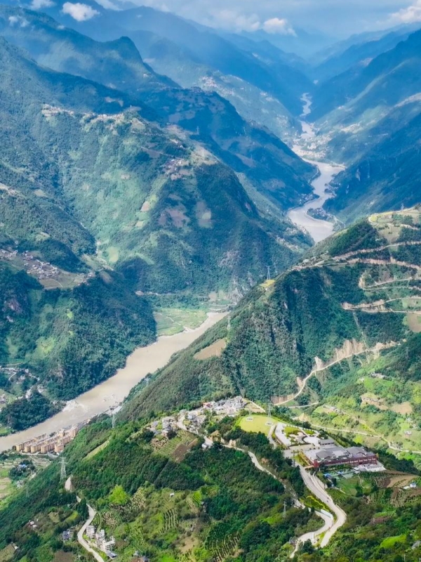
Two mountain systems handle the border between China and the Indian subcontinent. The Himalayas run along the full southern edge of Tibet, touching Nepal, Bhutan, and seven Indian states: Sikkim, West Bengal (Darjeeling), Arunachal Pradesh, Uttarakhand, Himachal Pradesh, Jammu and Kashmir (Ladakh), and the union territory of Ladakh. The Karakoram takes over from the northwest, extending from the Pamir region and forming part of the boundary between Xinjiang and Pakistan-administered Gilgit-Baltistan, including the disputed border zone around K2.
For travelers, border access is tightly controlled. Several passes have historical significance and limited tourist use. Nathu La on the Sikkim–Tibet border has been open for trade and pilgrim crossings with the correct permits since 2006. The Karakoram Highway through the Khunjerab Pass links Xinjiang to Pakistan; foreign tourists can travel it in organized transport. Shergotty, Muktinath, and Linize passes serve local and pilgrim traffic and are not open to general tourism. All border-crossing status can change without notice—confirm current conditions with the local Public Security Bureau before planning any route near the frontier.
- Khunjerab Pass (4,693 m): Overland border crossing between Xinjiang and Pakistan; the Karakoram Highway is open to foreign tourists in organized vehicles
- Nathu La (4,310 m): Historic trade and pilgrim pass between Sikkim and Tibet; open to holders of the correct border-entry permits
- Banagongr Pass: Used for local border trade between Tibet and India; access is restricted
- Qiangmu Pass: Occasional crossing point; confirm current status locally
- Linize Pass: Minor pass used for local trade and pilgrimage between Tibet and Nepal; not generally open to foreign visitors
Tourist-Visitability: Which Ranges Welcome Visitors
China Mountain Ranges
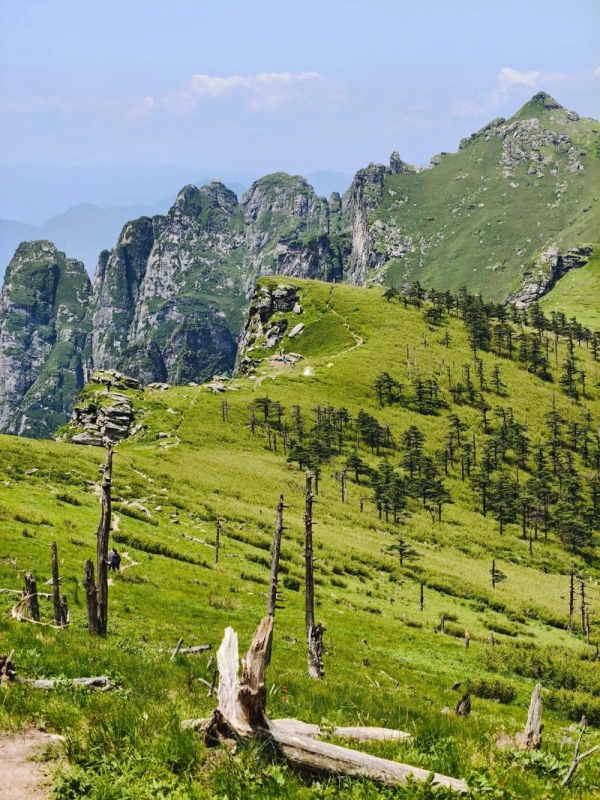
Access to China's mountains depends on infrastructure, altitude, and permit requirements. The eastern ranges are fully open to independent travelers with standard tickets. Tibet and some Xinjiang zones require advance permit arrangements through licensed travel agencies. The high Karakoram and Kunlun interior are mountaineering domains with no established tourist infrastructure. Use the table below as a planning framework, and always verify current access conditions before departure.
Getting to these ranges is increasingly straightforward for the easy-access tier. High-speed rail reaches Huangshan from Shanghai in about four hours (from about $27 (¥192) second class from Changsha). The Zhangjiajie airport connects to major hubs. Yulong Snow Mountain is a short flight from Kunming to Lijiang (from about $70 (¥500)), followed by a cable car to Spruce Meadow and Glacier Park. For Siguniangshan, plan two days minimum with an overnight at Changpingba or nearby towns. Tibet requires a Tibet Travel Permit arranged through an operator before booking flights to Lhasa. Everest North Base Camp has a separate entry fee of about $28 (¥198) per person, with camping available on-site. Most cable-car operations run 07:30–17:30 in summer and 08:00–17:00 in winter.
Range-by-Range Route Recommendations
Rather than routing between individual peaks, these itineraries loop through complete range systems—so travelers experience the geological character of each group rather than a single summit. Each plan is self-contained and can be shortened or extended depending on pace.
- Eastern Ranges Loop (9–12 days): Shanghai → Huangshan (1–2 nights; cable car to the summit, UNESCO villages Hongcun and Xidi nearby) → High-speed rail to Wuyi Shan (day visit or overnight; peaks, temples, Nine-Bend Creek boat ride) → Wuling extension: Zhangjiajie (2–3 nights; Yuanjiajie, Tianzi Mountain, Bailong Elevator, Golden Whip Stream, Tianmen Mountain day trip) → Fanjing Mountain in Guizhou (1 night; Red Clouds Golden Summit, Mushroom Stone, overnight temple stay) → Return via Guiyang or Chongqing.
- Southwest Mountains Circuit (8–10 days): Chengdu → Siguniangshan (2 days; multi-peak trek, overnight at high altitude in guesthouse) → Drive to Lijiang (about 5 hours; Yulong Snow Mountain cable car to Spruce Meadow and Glacier Park; Lijiang Old Town evening) → Shangri-La (about 4 hours; Napa Lake wetlands, Songzanlin Monastery).
- Frontier Route: Tibet and Everest (9–12 days): Xi'an (Huashan plank walk day trip; ~2-hour drive) → Fly to Lhasa → Lhasa city (2 nights; Potala Palace, Jokhang Temple) → Gyantse (day stop; Korola Glacier viewpoint) → Everest North Base Camp (1 night camping; $28 (¥198) entry) → Return to Lhasa → Fly out. Tibet Travel Permit is required and must be arranged through a licensed operator before booking flights; all travel in Tibet must be on approved itineraries. International flights to Lhasa typically route through Beijing, Shanghai, Chengdu, or Xi'an.
Frequently Asked Questions
Q: How many mountain ranges are in China?
No fixed official count exists. Most geographic references identify roughly seven to ten major systems: the Himalayas, Karakoram, Kunlun, Tian Shan, Altai, Hengduan, Qinling, and the eastern hill groups such as Wuyi, Nanling, and Taihang. The total rises when sub-ranges are counted separately.
Q: What are the major mountain ranges in China?
The primary systems are the Himalayas (southwest), Karakoram (west), Kunlun (north Tibetan plateau), Tian Shan (northwest Xinjiang), Altai (far northwest), Hengduan (southwest), Qinling (central), and the eastern ranges including Wuyi, Nanling, Taihang, Xuefeng, and Wuling. Each forms a distinct geographic corridor with its own access requirements and scenery.
Q: What is the highest mountain range in China?
The Himalayas contain the highest peaks, including Mount Everest at 8,848.86 meters on the China–Nepal border. The Karakoram holds K2 at 8,611 meters on the China–Pakistan border. Both ranges are among the world's highest mountain systems.
Q: What is the largest mountain range in China?
The Kunlun is typically cited as the longest range in Asia by length, with estimates around 3,000 kilometers in commonly referenced sources and some listings extending this to approximately 3,500 kilometers. This variation reflects different definitions of where the range begins and ends.
Q: What mountain range separates India and China?
The Himalayas form the main boundary along most of the frontier, separating Tibet from Nepal, Bhutan, Sikkim, Uttarakhand, Himachal Pradesh, and Arunachal Pradesh. The Karakoram takes over in the western sector, running between Xinjiang and Pakistan-administered Gilgit-Baltistan and marking the border near K2.
Q: What mountain range lies to the south of China?
The Himalayas border China along its southern rim, where Tibet meets Nepal, Bhutan, and India's northern states. Within China's southeastern interior, the Nanling range forms the watershed dividing the Yangtze River basin from the Pearl River basin.
Q: What mountain range lies west of China?
West of China, the Pamir and Karakoram systems extend into Tajikistan, Kyrgyzstan, Afghanistan, and Pakistan. To China's northwest, the Tian Shan and Altai ranges continue across Central Asia. The Kunlun, while running east–west along the northern Tibetan Plateau, originates near the Pamir region in the west.
Q: Which mountain range separates Kinnaur and Spiti from China?
The Great Himalaya and the Zanskar Range form the high ridgeline separating the Indian regions of Kinnaur and Spiti (in Himachal Pradesh) from Tibet. The border follows the main Himalayan crest in this sector.
Q: Are China's mountain ranges open to tourists?
Access varies significantly. The eastern ranges—Huangshan, Huashan, Wuyi Shan, Zhangjiajie, Fanjing—are fully open to visitors with standard tickets and no special permits. Siguniangshan and Qinling require hiking permits and some physical preparation. Tibet-side ranges including Everest North Base Camp require a Tibet Travel Permit arranged through a licensed agency. The Karakoram and Kunlun interior are mountaineering destinations with no tourist infrastructure.