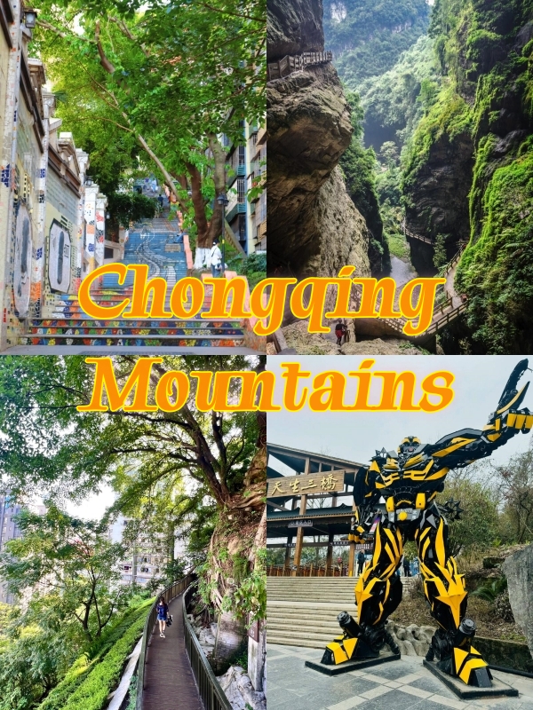
Chongqing Mountains:Gorges, Forests & Mountain Attractions
Chongqing mountains define one of the world’s most weirdly built cities. Shuttered onto ridges where the Yangtze and Jialing rivers are carving through the mountains, Chongqing is not only surrounded by peaks, it is stacked on them. A lobby on the tenth floor might open out on to a road at the top of a hill, while a “ground floor” out the back is six floors up. Wherever you stroll, up and down staircases is part of your walk: there is no skipping leg day in Chongqing. Our guide tackles everything from the downtown Mountain City Trail to the UNESCO-listed Wulong Karst, and the ice caves and ghost town beyond, to esoteric alpine meadows where you’ll know exactly where to go and how to hike.
Quick Facts
Geographic Definition of the Mountain City
The numbers do the talking. About three-quarters of Chongqing’s administrative territory is mountainous or hilly (the highest proportion of any Chinese provincial-level city). The Yangtze and Jialing don’t just flow through—it runs of water actually carve through the region, cutting deep gorges that drop below the 300m-mark from the ridge lines; more canyon than plain. At the Wushan section of the Yangtze you’re at 75m of elevation, at the top of Yintiaoling in the Daba Mountains you’re at 2,799m. That’s a spread of 2,724m crammed into a city smaller in area than Austria.
What makes Chongqing unique isn't just the numbers—it's how the city responds to them. The official nickname "Mountain City"—Shancheng in Chinese—dates to the city's founding on the parallel ridges of the eastern Sichuan basin. Streets don't follow a grid; they contour. Neighborhoods stack rather than sprawl. This isn't a city with mountains in the background. The mountains are the background, the foreground, and everything in between.
Walking the Shancheng Trail in Chongqing
You don't need to leave the city center to feel the mountain. Shancheng Trail—the literal "Mountain City Trail"—is where Chongqing's vertical personality is most accessible.
Shancheng Trail Route and Highlights
-

- Tongyuanmen
-
- Trails Near Tongtianmen
-

- Brown Sugar Ice & Spiral Potatoes
-
- Shancheng Teahouse
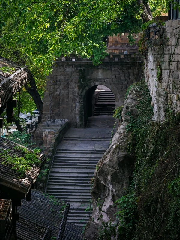
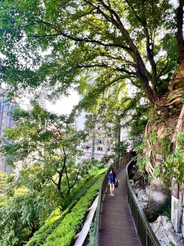
Start at Tongyuanmen, a restored Ming-dynasty gate that formed the western reach of the old walled city. The path dips gently for 70 meters as it descends 1.5 kilometers to Zhongxing Road—a rolldown that allows you to consider all the layers rather than snap at quads.
- Trail length and elevation: Approximately 1.5km from Tongyuanmen (approx. 280m elevation) down to Zhongxing Road (approx. 210m). The downhill grade is gentle—about a 5% slope—so it's kind on knees and suitable for most fitness levels.
- What you will see along the way: The trail threads through the old concession district, past crumbling consulate buildings from the 1920s, then swings onto a suspended wooden walkway pinned to the cliff face. From here, the Yangtze River Bridge emerges between two ridges—a view that changes every few steps as the trail curves.
- Best time to go: Hit the trail between 7:00 and 9:00 AM, or after 5:00 PM. Morning light filters through the trees and the city below is still waking up; after 5:00, the heat breaks and the golden hour light on the bridge is worth the timing. Midday crowds thin the experience and the sun is brutal on the exposed sections.
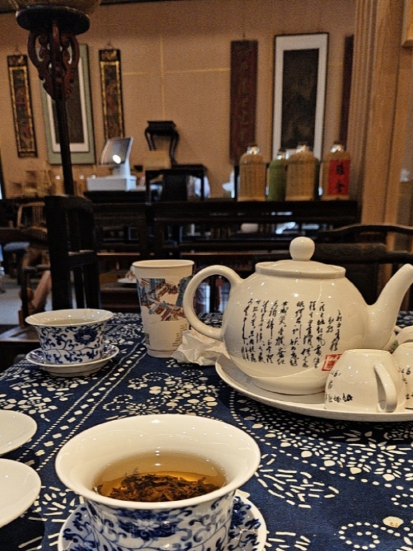
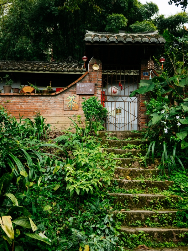
- Food & drink stops: Halfway, a vendor sets up near the viewing platform selling bingfen—a brown-sugar shaved-ice dessert—and spiral-cut potato fritters. At the top, the Shancheng Teahouse pours local green tea for about 15 yuan a cup. Take a seat on the terrace, look down at the bridge, and watch the locals play cards—a ritual that's been running at this spot for at least two decades.
Other Downtown Mountain Trails
-
- Zhangjia Garden Trail
-
- Huangge Ancient Trail
-
- Qingshui Creek
-
- Qingshui Creek Trail
Beyond Shancheng Trail, the city's southern bank offers three more historic routes that rarely see foreign visitors.
- Zhangjia Garden Trail: One kilometer of pure stone steps with 90 meters of vertical gain. Giant banyan roots drape over old stone walls—this is where the film Your Journey, My Journey shot a pivotal scene. At the trailhead, a woman sells roasted sweet potatoes and candied hawthorn skewers. Sweet potato in one hand, steep steps underfoot—that's the authentic experience.
- Huangge Ancient Trail: This route dates to the Tang Dynasty and once connected Sichuan to Guizhou province. Four kilometers of shaded stone paving, lined with banyan trees that are over a century old. Canopy cover exceeds 80%, making it a rare shaded walk in a famously hot city. Along the way, stalls sell "laoyin cha"—a local aged-leaf tea brewed dark and strong, 5 yuan a cup. It's bitter, sweet, and exactly what you need after the climb.
- Qingshui Creek Trail: A stream accompanies the entire walk. During the rainy season, water spills over the steps, and you hear the flow the whole way. Summer temperatures here feel 5–8°C cooler than the city below. At the end, a farmhouse restaurant serves douhua fan—silky tofu with a spicy dipping sauce—and stir-fried cured meat with seasonal greens. A proper meal for a proper walk.
From here, the Yangtze River Bridge emerges between two ridges—a view that changes every few steps as the trail curves. For more ideas on exploring the city on foot, check out this guide to Chongqing city walking tours.
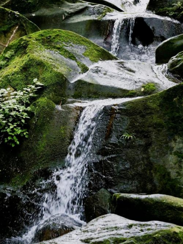
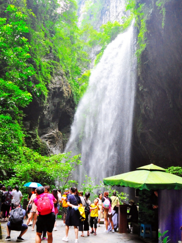
Wulong Karst's Gorges, Bridges and Peaks
Two and a half hours northeast of downtown by car, the landscape shifts from urban canyon to something prehistoric. Wulong Karst is a UNESCO World Heritage site and hands-down the most dramatic mountain scenery within reach of Chongqing.
Three Natural Bridges Trail
-
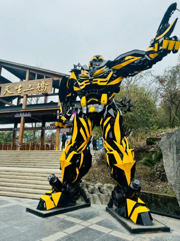
- Bumblebee Statue At Three Natural Bridges
-
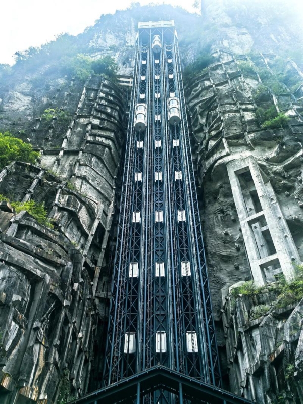
- Tianlong Rotating Cliff Elevator
Three natural arch bridges—Tianlong, Qinglong and Heilong—cross the same valley in what is perhaps the world’s most spectacular geological triple-header at over 100 meters high. You descend 135 meters to the valley floor in a glass elevator built into the cliff. It’s a ride that takes less than two minutes, but it drops you back in the Jurassic.
The 2-kilometer loop trail winds beneath these bridges, passing through caves, alongside underground rivers, and through sections where the bridge overhead blocks all direct light—a twilight zone in the middle of the day. Transformers 4 filmed here, and while the film is forgettable, the scale is not. The trail is entirely paved and gentle, but the real workout is looking up.
Longshuixia Fissure Gorge
-
- Gorge Waterfall Of Longshuixia
-
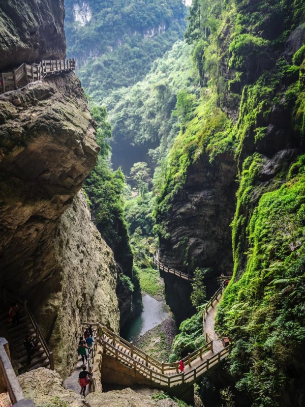
- Longshuixia Cliff Boardwalk
If the Three Bridges are great, Longshuixia is small. This fissure gorge is cut into the earth by groundwater over the centuries: a 2 kilometre hallway between walls rising 250 to 300 metres on either side. The ground is sodden year round; moss dresses the rock in a jade green.
- Key features: Emerald pools reflect the narrow sky. At the far end, a waterfall drops 80 meters into a misty basin—you'll feel the spray before you see the fall. The final stretch is narrow enough to touch both walls at once.
- Practical info: Entry fee is 105 yuan. Opening hours are 8:30–16:30, extended to 17:00 during peak season. Budget 1.5 to 2 hours for the full walk.
- Atmosphere note: The gorge runs 8–10°C cooler than the surface. It's wet, mossy, and quiet except for the constant echo of dripping water. In places, the walls pinch so tight only one person can pass at a time—it feels closer to a cave than a canyon.
Fairy Mountain National Forest Park
-
- Grassland Loop Train
-
- Grassland Highway At Fairy Mountain
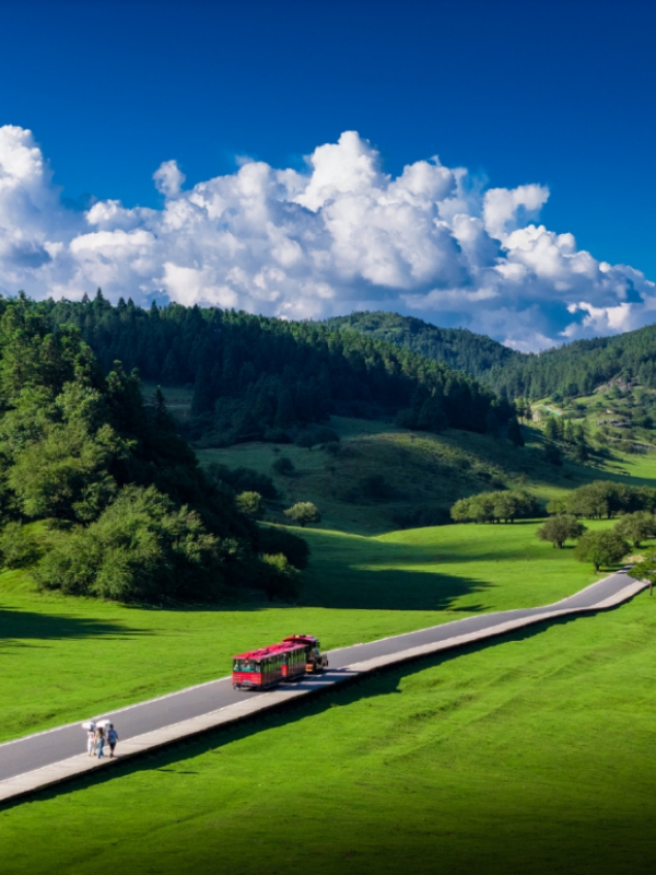
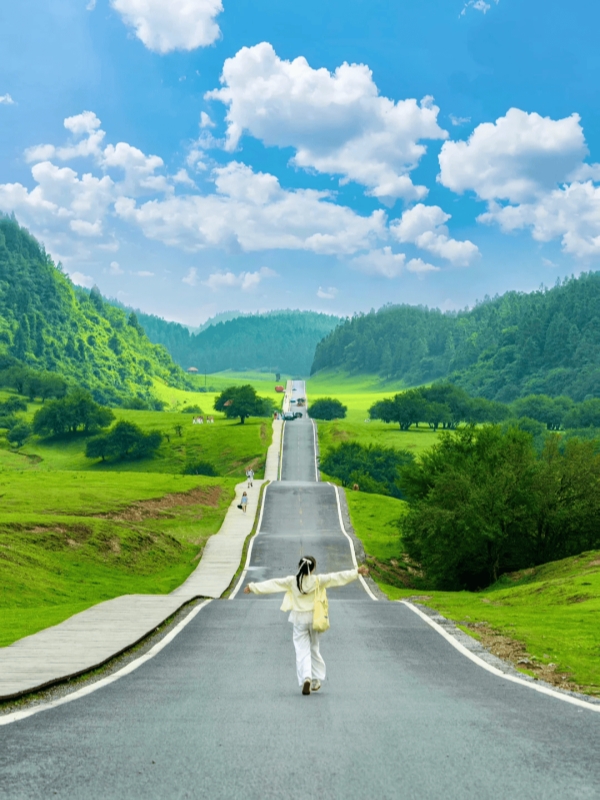
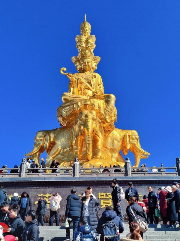
Locals call it “Switzerland of China” with a wink (it’s not entirely marketing hype)—Fairy Mountain (or, Xiannüshan), rises to 1,900 meters, with high-altitude grassland where horses graze, a summer meadow and a ski field open from December through February.
The grassland is gentle—flat enough for a stroll, high enough to feel the air thin. In winter, the same meadow becomes a snow field, and the ski lift runs on weekends. The mini train loops the perimeter; if you're walking, it's about 5 kilometers around the meadow. The horses are semi-wild—keep a respectful distance.
Furong Cave
-
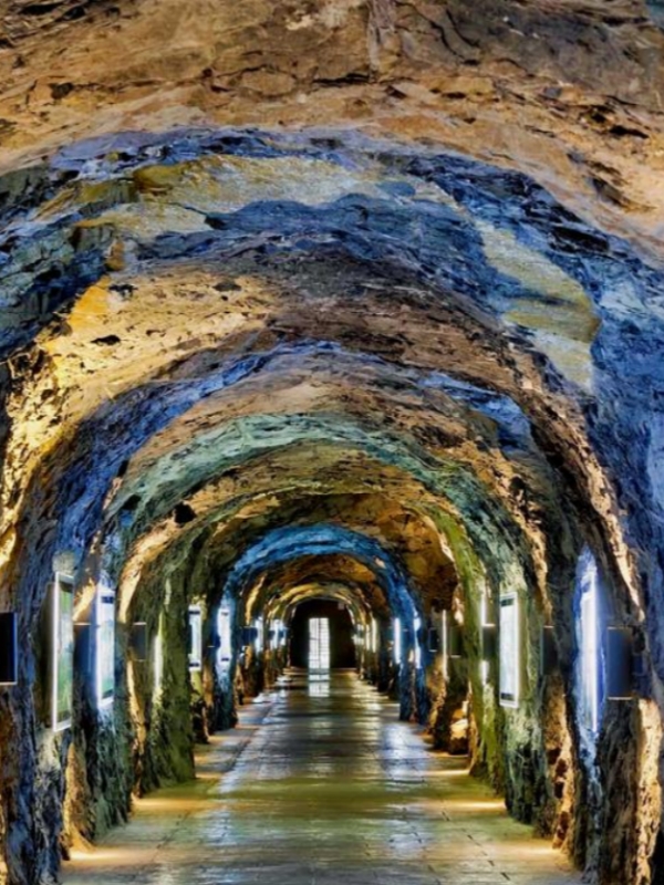
- Stone Corridor Inside Furong Cave
-
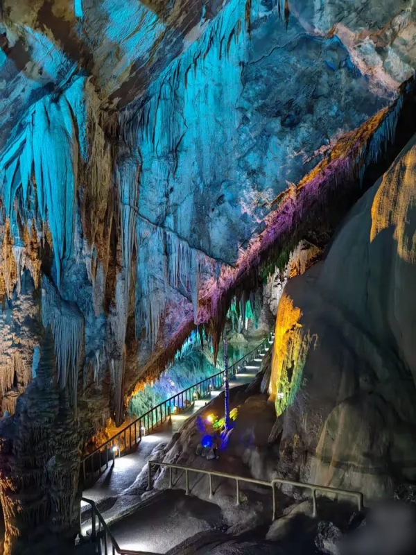
- Coral Pool Cave Passage
Furong Cave is a limestone solution cave developed in the Cambrian system—a technical way of saying it's ancient and weird. Over 30 types of cave formations have been identified here, including some that are rarely seen outside China.
- Highlights: Stalagmites that reach 30 meters, translucent soda-straw stalactites in the "Coral Pool" section, and a lighting system that's theatrical but not overdone. The largest chamber is tall enough to fit a 10-story building.
- Practical info: Entry fee is 80 yuan. Hours: 9:00–15:30 in low season (November–March), 8:30–16:00 in high season (April–October).
- Getting there: About a 2-hour drive from Jiefangbei. Best combined with Three Natural Bridges on the same day—bridges in the morning, cave in the afternoon.
Wuling Mountain's Great Rift Valley
This is a different kind of mountain experience—less pastoral, more raw. Wuling Mountain's Great Rift Valley is a 180-meter-long suspension bridge threaded through a natural arch, 200 meters above the canyon floor.
Sky Gate Suspension Bridge and Cableway
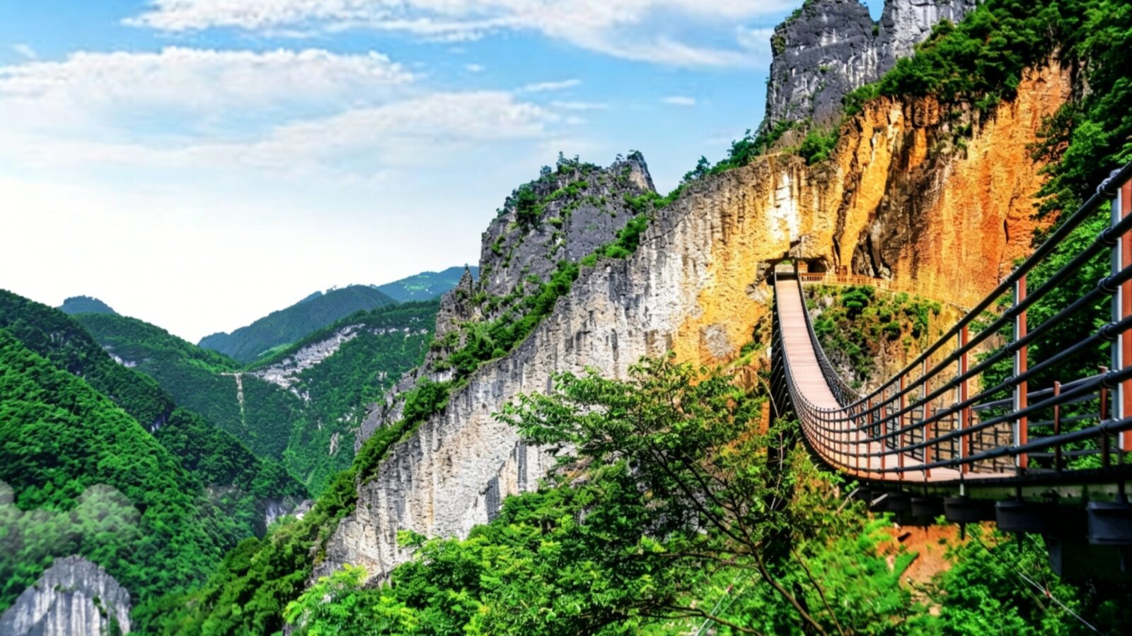
Sky Gate Suspension Bridge Of Wuling Rift Valley
The core attraction is Tianmen Cave—a natural tunnel through the mountain. The Sky Gate Suspension Bridge runs directly through it. Two routes are available, and the choice depends entirely on your legs.
- Long route (hiking): Walk across the Sky Gate Suspension Bridge—180 meters long, 200 meters above the ground—then descend along the cliff-side trail through the rift. The full loop takes about 3 hours and requires reasonable fitness. The bridge is steel-cable with a wooden deck; it moves slightly in the wind, which is the point.
- Short route (cableway): Take the Ping'an Pavilion Cableway directly from the top of the rift to the bottom. The ride gives you a bird's-eye of the entire fissure and takes about 1 hour total. This is the family-friendly option, and it still delivers the same view—just from above rather than inside.
- Atmosphere comparison: The hiking route puts you inside the darkness of the rift, with the bridge high above and the gorge closing in. The cableway shows you the scale from a distance. Both are impressive; which one you choose depends on how much you trust your ankles.
- Practical info: Entry fee is 75 yuan. Hours are 9:00–15:30 (low season) and 8:30–16:00 (peak season). Cableway ticket is sold separately at the entrance.
Black Mountain Valley's Forest Trails
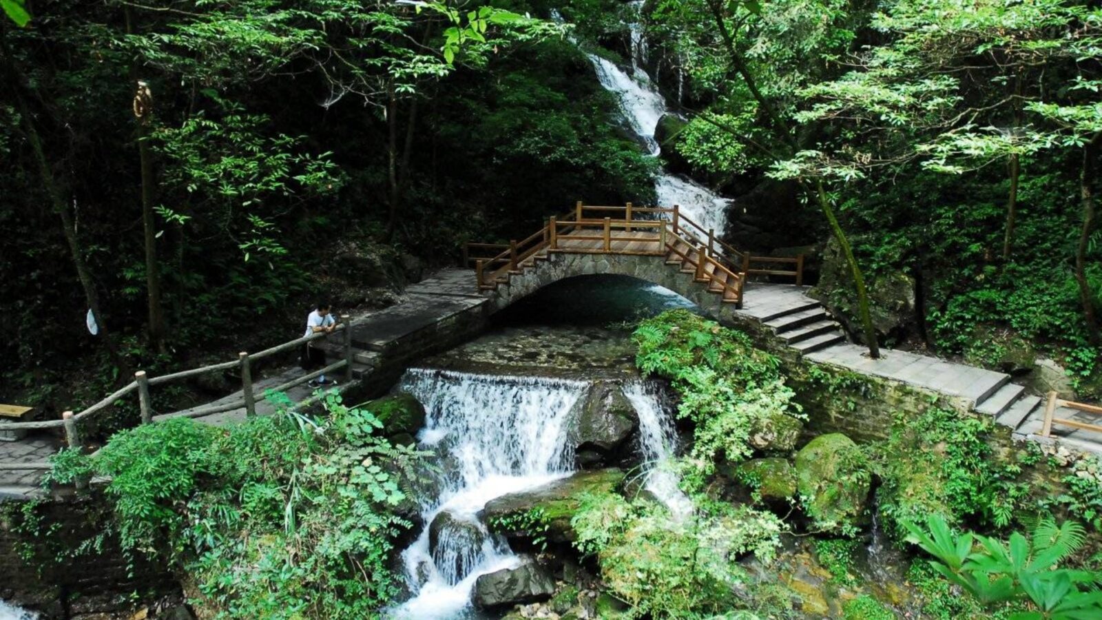
Stream & Stone Arch Bridge In Black Mountain Valley
Black Mountain Valley is all about trees - 97% the lot! Hike the 13km trail that follows the Liyu River gorge and you’ll reach a section of canyon that is less than 2m at its narrowest point. Locals call it “one hand touches both mountains” as you can literally hold your hands in the air and touch the two cliff walls at once.
The trail is largely flat with minimal elevation gain, making it accessible for all ages. Route recommendation: Enter through the south gate and exit through the north gate—the south is higher, so the entire walk is downhill. Shuttle buses run from the north gate back to the south. Entry fee: 85 yuan in peak season (March–November), 60 yuan in low season (December–February). Opening hours: 8:00–17:00.
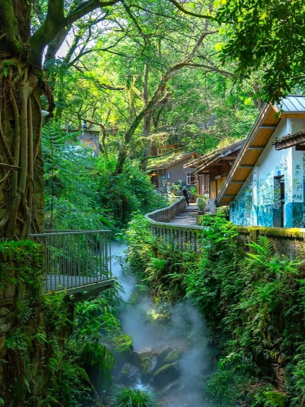
Jingangbei's Hot Springs and Old Town
-
- Jingangbei Misty Creek Lane
-
- Old Street Grilled Jialing River Fish
Here’s a dust mote of a river town—planted three centuries ago by the banks of the Jialing River after the city had been an export point for coal from the hills nearby, then reinhabited to become a hot-spring resort. The slate lanes are still Qingscale; the old tea houses, bars, boutique guesthouses scrambling to cling to the sides of the restored wooden houses as they duck down toward the creek and to the Jialing. The ritual is to perch beside the creek and drink your bowl of hot Chongqing tuo tea, poured from a gaiwan (lidded cup) in the height of the sun’s heat, watching the water flow past.
- Hot spring experience: Multiple public pools and private onsen-style rooms are scattered through the village. Water temperature holds at about 40°C, with noticeable sulfur content.
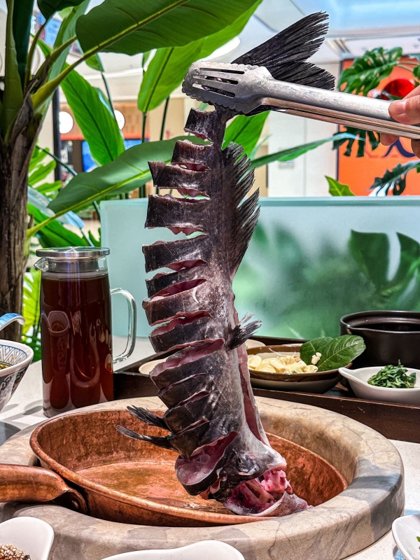
- Food to try: After soaking, the "Old Street Grilled Fish" is the local standout—Jialing River fish cooked over charcoal with dried chilies and Sichuan peppercorns, skin crisp and flesh tender. Hand-made tofu pudding—served with a spicy dipping sauce—and brown-sugar sticky rice cakes round out the meal.
- Getting there & hours: About 1 hour by car from Jiefangbei. Open 10:00–22:00. Arrive near sunset, soak in the hot springs, watch the Jialing night view, then eat grilled fish—a solid way to close a mountain day.
Food to try: After soaking, the "Old Street Grilled Fish" is the local standout—Jialing River fish cooked over charcoal with dried chilies and Sichuan peppercorns, skin crisp and flesh tender. Hand-made tofu pudding—served with a spicy dipping sauce—and brown-sugar sticky rice cakes round out the meal. For a deeper dive into the city's signature dishes, see our Chongqing hotpot and local food guide.
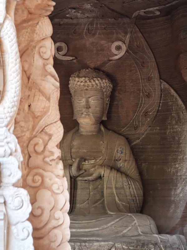
Dazu Rock Carvings on the Cliffs
Two hours west of the city, cut into the cliffs of Dazu, a series of rock carvings spans the 9th to 13th centuries. This is a UNESCO site, but it's also a mountain temple complex where art and devotion meet stone.
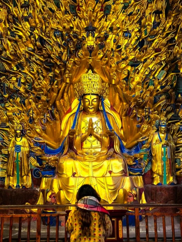
Baodingshan
-
- Dazu Thousand-Hand Kwan-yin
-
- Cliff Buddha Statues Of Dazu
Baodingshan is the largest of the Dazu sites—a U-shaped cliff face carved over several decades by a single monk, Zhao Zhifeng, during the Southern Song Dynasty. The carvings run about 500 meters along the rock face.
- Highlights: The Thousand-Hand Guanyin—a bodhisattva figure with 1,007 hands radiating outward, each holding a different implement. It's the largest thousand-hand Guanyin in Chinese grotto art. The Ox-Herding series and the Wheel of Rebirth offer a narrative walk through Buddhist teaching—less devotional art, more stone-bound storyboard.
- Practical info: Entry fee is 110 yuan (March–November) or 115 yuan (December–February). Hours: 8:30–18:00 (March–November), 9:00–17:00 (December–February).
- Museum access: The Dazu Rock Carvings Museum is included with your ticket and shows restoration work and digital reconstructions—worth 30 minutes.
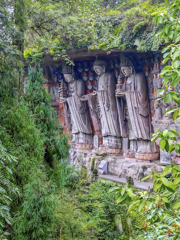
Beishan
-
- Golden Samantabhadra Sculpture
-
- Ancient Cave Buddha Statue
Beishan is smaller and feels more personal. The carvings here date from the late Tang to the Southern Song, arrayed in over 300 individual niches packed like a honeycomb against the cliff.
- The "Oriental Venus": Niche No. 136 holds a seated Samantabhadra bodhisattva with a serene, graceful expression—Chinese art historians call it the "Oriental Venus," and the comparison isn't hyperbole.
- Night illumination: Beishan is lit up with colored lights in the evening (19:00–21:00). The light comes from below, emphasizing the depth of the carvings in ways daylight can't match.
- Practical info: Entry fee is 70 yuan (March–November) or 110 yuan (December–February). Night tickets are sold separately from daytime admission.
Three More Hikes Around Chongqing
Beyond the headline names, these three lesser-known hikes are where locals go when they want mountains without the tourist bus. If you're deciding between the two cities for your next outdoor adventure, this Chongqing vs Chengdu outdoor travel comparison can help you choose.
Gele Mountain National Forest Park
Gele Mountain sits just 30 minutes from downtown Shapingba by taxi. Locals call it the "Emerald of Shancheng" for its 6 designated eco-hiking trails.
- Hiking routes: Six trails range from 800 meters to 3 kilometers, graded beginner to advanced. All are stone steps or wooden boardwalks—no scrambling required.
- Recommended trail for first-timers: The "Rensheng Road" trail is about 1.5 kilometers and takes about an hour. It passes several viewpoints where you can see the entire Shapingba district laid out below—a useful orientation for anyone new to the city.
- Getting there and cost: Park entry is free (some sections charge separately). From downtown, take Metro Line 1 to Lieshimu Station, then transfer to Bus 210 which stops at the park entrance.
Huangge Ancient Trail and Other City Fringe Walks
On the southern bank, the Nan'an district preserves three ancient trails along the Nan Mountain ridge—these are where local hikers go on weekends.
- Huangge Ancient Trail: Tang Dynasty origins, once part of the Sichuan-Guizhou trading route. About 4 kilometers long on original stone slabs, shaded by banyan trees that are easily over a century old.
- Qingshui Creek Trail: Stream-side the whole way. In the rainy season, the water sound accompanies every step. The end of the trail opens to a view of the Yuzhong Peninsula skyline.
- Fangniu Village Trail: A pastoral route through tea plantations and bamboo groves. In spring, the rapeseed fields bloom yellow. About 2.5 kilometers, very gentle grade.
Qiluping Meadow Loop
Qiluping is tucked into the Wuling Mountains near Fuling, sitting at about 1,800 meters. This is an undeveloped alpine meadow with no ticket booth and no souvenir stalls—just grassland, pine forest, and livestock.
- Loop trail features: The loop is about 6 kilometers along the meadow edge, passing through pine groves and past pastures with grazing cattle and goats. No boardwalks, no handrails—just a dirt path and open sky.
- Difficulty level: Very gentle grade, suitable for beginners and families. At a normal walking pace, allow about 2.5 hours for the full loop.
- Cost and access: Free entry. A round-trip charter from Fuling town costs about 150 yuan. Best paired with Wuling Mountain Great Rift Valley on a two-day itinerary.
How to Get to the Mountains
The mountains are accessible, but how you get there changes everything. Three main options, each with a different trade-off. For a broader look at getting around the city and beyond, including Chongqing transport costs, check our detailed breakdown.
Private Car Charter
This is the most flexible option, especially for groups of 3–4.
- Cost estimate: About S$69 per person for a 12-hour charter (based on 3 people sharing), including fuel, tolls, and driver waiting time. Overtime is charged separately.
- What to know: Drivers know the recommended visit times for each site—they'll suggest an itinerary. But private cars can only go as far as the visitor center. Inside the parks, you transfer to park shuttles—no private vehicles on the trails.
- Recommended itinerary pace: Two attractions per day (e.g., Three Natural Bridges + Fairy Mountain). Three or more and you're rushing.
Small Group Tours
Group tours (up to 8 people) offer fixed itineraries with hotel pickup and drop-off.
- Pros: No planning required. Vehicles are usually 7–9-seater vans with decent comfort. Fixed price, no surprise fees.
- What to watch for: The driver handles transport and basic guidance but does not enter the attractions with you. Inside, it's free exploration—no guide inside the park.
- Booking channel: Book through Klook, Trip.com's international site, or your hotel front desk. Confirm at least 2 days in advance.
Public Transport (High-Speed Rail and Bus)
The budget option. Works best if you have time and don't mind transfers.
- High-speed rail to Dazu: Shapingba Station → Dazu South Station. 20–40 minutes, second-class tickets from 38 yuan. From the station, take a bus (about 1.5 hours) or taxi (about 40 minutes) to the carvings.
- Train to Wulong: Chongqing North Station → Wulong Station. About 2 hours, second-class tickets around 60 yuan. Exit the station and transfer to a park shuttle or local minibus to the visitor center.
- General tip: Book tickets via 12306.cn or the Railway 12306 app. Passports work for ticket collection at manual windows. Last return trains from mountain areas usually depart before 5:00 PM—give yourself plenty of buffer.
Practical Travel Tips for Mountain Day Trips
A few things nobody tells you—until it's too late. And if you're planning to pick up gear or souvenirs before your hike, here's a quick guide on what to buy in Chongqing.
Footwear and Clothing
- Footwear requirement: Closed-toe shoes with deep tread (hiking or trail-running shoes). Flip-flops, canvas flats, and leather-soled shoes are dangerous on wet stone steps.
- Temperature difference: Mountains run about 15°C cooler than the city. Even in summer, carry a layer for Fairy Mountain or Qiluping. In winter, a down jacket and traction cleats for icy paths.
- Rain gear: Pack a lightweight rain jacket, not an umbrella—wind gusts in the gorges and on suspension bridges will turn an umbrella inside out before you can react.
Passports and Mobile Payment
- Passport requirement: All park ticket counters and turnstiles require the physical passport for verification. Photos won't work. At some gates, staff manually enter your passport number.
- Mobile payment setup: Vending machines, shuttle-bus ticket kiosks, and small shops inside the parks often don't take cash. Link Alipay or WeChat Pay to an international card before you go.
- Cash backup: Mobile payment can fail in patchy signal areas. Carry 200–300 yuan in cash as emergency backup.
Navigation Apps (Amap vs Google Maps)
- Amap advantage: More accurate for mountain roads, trailheads, and shuttle-bus stops. Has an English interface. Download offline map for Chongqing in advance (Wi-Fi recommended).
- Google Maps limitations: Often shows "no road data" in Wulong and Black Mountain Valley. Walking navigation tends to send you on detours.
- Offline preparation: Screenshot your itinerary and key locations before leaving the hotel—signal dead zones are common in the mountains.
Language and Communication
- Essential phrases (pinyin + Chinese): "Ménpiào duōshao qián?" (How much is the ticket?), "Xǐshǒujiān zài nǎli?" (Where is the restroom?), "Zhèli kěyǐ yòng xiànjīn ma?" (Can I use cash here?).
- Translation apps: Download Google Translate or Microsoft Translator's offline Chinese pack (about 150MB) to translate menus and signs without signal.
- Written signage: Major attractions have English on the main signs, but small trailside directional signs are Chinese-only. Snap a photo of the park map at the entrance so you can refer back to it.
Frequently Asked Questions
Q: Is Chongqing really built on mountains?
Yes. About 76% of Chongqing's territory is mountainous, and the city is literally built into the Chongqing mountains themselves. Buildings stack across hills and ridges—what looks like the top floor from one street may be ground level from another. That vertical layering is exactly why it's called the "Mountain City."
Q: What are the mountains in Chongqing called?
The Chongqing mountains include several major ranges: Wuling Mountains (home to Wulong Karst), Daba Mountains (highest peak Yintiaoling), and Gele Mountain near the city center. Individual peaks like Fairy Mountain (Xiannüshan) and Jinfo Mountain are also popular for hiking and skiing.
Q: How do I get to Wulong Karst from Chongqing Mountains city?
To explore the Chongqing mountains at Wulong, it's about a 2.5-hour drive from downtown. Options include private car charter (~S$69/person for 12 hours), small group tours, or high-speed rail from Chongqing North to Wulong Station (~2hrs, ~60 CNY) with a local bus transfer to the park entrance.
Q: Is Fairy Mountain worth visiting in winter?
Yes—winter is peak season for skiing at Fairy Mountain Ski Field, open late December to late February. This part of the Chongqing mountains turns into a snowy landscape, earning the nickname "Switzerland of China." Dress warmly; temperatures drop far below city levels.
Q: Do I need a guide for Wulong Karst in Chongqing Mountains?
Not necessarily—trails in the Chongqing mountains are well-marked and elevators are available at Three Natural Bridges. However, a driver-guide can help with logistics if you're visiting multiple sites. Note that most tour drivers don't enter the attractions with you—they handle transport only.
Q: Is it safe to hike in Chongqing mountains alone?
Generally yes—popular routes in the Chongqing mountains have steady foot traffic. But wear proper grip shoes (stone gets slippery after rain), download offline maps (cell signal is patchy), and inform someone of your route. Avoid remote trails like Black Mountain Valley off-season if going solo.
Q: Can I use Google Maps in Chongqing?
Google Maps works but is less accurate for walking directions in the Chongqing mountains. Download Amap (AutoNavi)—it's more precise for mountain roads and trails in the Chongqing mountains and has an English interface. Always download offline maps before heading out.
Q: What should I pack for a Chongqing mountain day trip?
For a day in the Chongqing mountains, pack closed-toe shoes with strong grip, passport (required for entry), mobile payment (Alipay/WeChat), layers (the Chongqing mountains run 15°C cooler than the city), snacks, a portable charger, and Amap pre-downloaded. Cash 200–300 CNY as backup for signal dead zones.