Mount Everest (Chinese Highest Mountain)
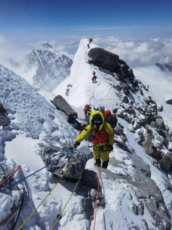
Mount Everest, known as Qomolangma in Mandarin and Chomolungma in Tibetan, which is the Chinese highest mountain, rises to 8,848.86 meters on the border between Tibet and Nepal. The summit technically sits in Chinese territory, placing this peak at the top of China's elevation record. For foreign visitors, the Chinese side offers two distinct approaches: the accessible North Ridge route through Rongbuk Monastery, and the expedition-grade East Ridge via the Kangshung Face. This guide covers practical access from Lhasa, seasonal climbing and visiting windows, and a proven staged ascent strategy for the altitude at North Base Camp.
Quick Facts
North Ridge (Tibet) Access Route
Mount Everest (Chinese Highest Mountain)
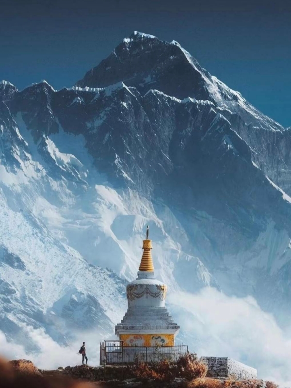
The North Ridge is the standard approach to Mount Everest from mainland China, and it is the only realistic option for ordinary foreign visitors. The climbing route is technically known as the North Col line, but visitors without mountaineering credentials stop at the Rongbuk Monastery area and the North Base Camp viewpoint at roughly 5,200 meters above sea level. This section describes the practical route from Lhasa and the vehicle options available.
The journey follows four sequential legs from Lhasa to the base camp viewpoint. First, travelers depart Lhasa at 3,650 meters and typically stop overnight in Shigatse at approximately 3,800 meters. From there, the route continues north through Tingri Old Town or Lhatse, both around 4,300 meters, before reaching the final destination at Rongbuk and the North Base Camp enclosure at 5,200 meters.
From Lhasa to Base Camp Viewpoint
The full Lhasa-to-Rongbuk itinerary typically spans four to seven days, with a night in Shigatse as a standard rest stop. The Friendship Highway (National Road 318) provides paved tarmac from Lhasa to Shigatse, then continues through challenging terrain toward Tingri. Road conditions past Tingri vary seasonally, and the permit checkpoint at Tingri marks the boundary of the restricted zone.
Photo stops along the way commonly include Yamdrok Lake and Karola Glacier, though these are optional add-ons rather than mandatory stops. The final approach through the Rongbuk Monastery area delivers visitors to the most photographed viewpoints of Mount Everest from the north, with sunrise and sunset considered the prime viewing moments at this altitude.
Permits, Tickets & Booking
Foreign visitors cannot self-apply for permits in Tibet. A registered tour operator must handle all documentation on your behalf. The required documents include the Tibet Tourism Permit (the primary entry authorization), the Alien's Travel Permit for Shigatse prefecture, and a separate Alien's Travel Permit for Tingri County. Your passport will be checked at every checkpoint along the Friendship Highway.
- Tibet Tourism Permit: Applied through a licensed tour operator before entering Tibet
- Alien's Travel Permit (Shigatse): Covers travel within Shigatse prefecture
- Alien's Travel Permit (Tingri): Specific authorization for Tingri County entry
- Passport: Required at all checkpoints throughout the journey
The Everest Nature Reserve charges a scenic-area entry fee of about $28 (¥180) plus a mandatory eco-shuttle of roughly $14 (¥120), bringing the total visitor cost to approximately $42 (¥298) for a single-day nature reserve access. Note that the access road to the base camp enclosure closes when the Friendship Highway closes for winter snow conditions — verify current status with your tour operator before departure.
🏔️ Explore Southwestern Mountain Ranges: Before heading into high-altitude Tibet, many travelers acclimatize by hiking through the spectacular snow-capped peaks and deep gorges of neighboring provinces. Plan your route with our guide to Mountains in Yunnan.
East Ridge (Kangshung Face) Access
Mount Everest (Chinese Highest Mountain)
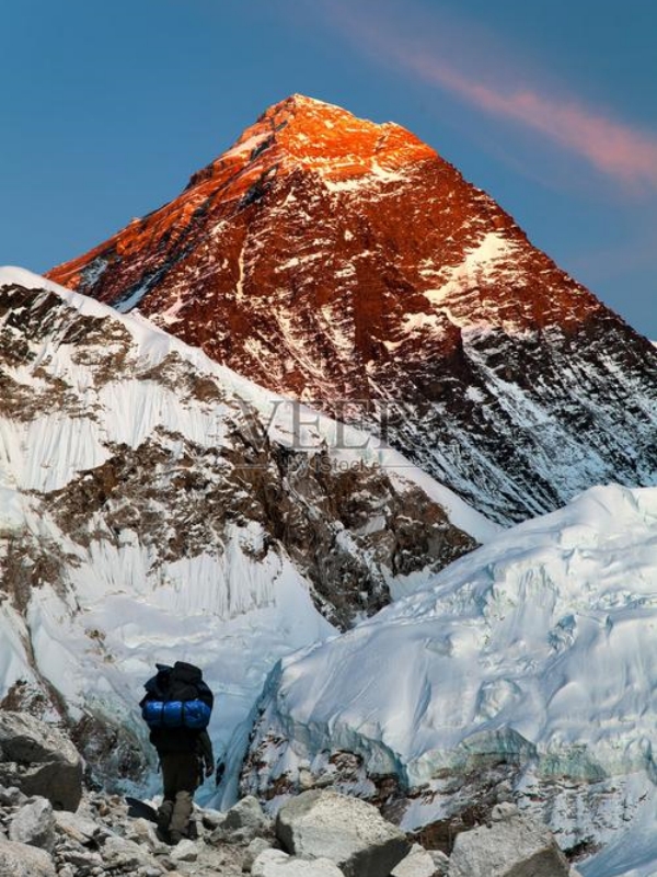
The East Ridge, also known as the Kangshung Face or East Face, rises from the Kangshung Glacier on the eastern side of Mount Everest within Tibet. This is one of the most technically severe faces on the peak, and it is reserved entirely for organized mountaineering expeditions. Unlike the North Base Camp, there is no public viewing platform or casual visitor access to this side of the mountain.
- Administrative status: Same Tibetan side (Tingri County, Shigatse prefecture) as the North Ridge approach
- Audience restriction: Expedition climbers only — no public access or viewing point exists
- Technical grade: One of the most demanding lines on the peak, involving sustained steep snow, ice, and rock sections
- Permit envelope: Shares the same Tibet Tourism Permit and Alien's Travel Permit requirements as the North Ridge
Historical attempts from the east include the 1921 British reconnaissance, the 1924 Mallory-Irvine disappearance attempt, the 1988 American Earth-Air-Fire-Water expedition (first complete East Face direct ascent), and contemporary commercial departures that remain small and infrequent.
Kama Valley Approach
The Kama Valley trek is the closest legitimate non-climbing access to the East Face. Trekkers follow a multi-day guided route that terminates on the upper moraine with views toward the Kangshung Face. Overnight stops require a local guide and appropriate equipment. This approach is less regulated than the Rongbuk enclosure but demands a higher fitness level and is not suitable as a casual day trip. Note that the East Face and the East Ridge are distinct climbing lines that share a common face — they are not the same route.
Historic Routes and Modern Expeditions
The 1921 British reconnaissance under Mallory was the first expedition to reach the north side from Tibet, establishing what would become the classic northern approach. The 1924 attempt, which ended in Mallory and Irvine's disappearance, launched from the North Col along a route that corresponds to the modern East Ridge definition in climbing taxonomy. The 1988 American expedition achieved the first complete direct ascent of the East Face, a milestone in Himalayan climbing history. Modern commercial expeditions continue to operate from the Kangshung side, though the frequency remains far lower than on the North Ridge or the popular Southeast Ridge in Nepal.
⛩️ Discover China's Sacred Peaks & Cities: While Everest holds immense spiritual reverence in Tibetan Buddhism, China is also home to ancient sacred mountains and cultural hubs tied to Daoist philosophy. Learn more in our guide to Holy Cities of Daoism.
Other Notable Highest Peaks in China
Mount Everest (Chinese Highest Mountain)
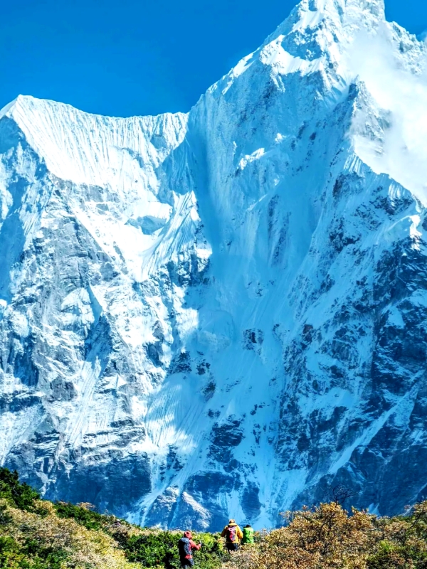
After Mount Everest, China contains several more peaks that rank among the highest on Earth. These range from restricted 8,000-meter giants to accessible 7,000-meter summits suitable for experienced foreign climbers. A brief note on the Five Sacred Mountains contextualizes the cultural peak tradition that sometimes overlaps with elevation-related searches.
- K2 / Chogori: 8,611 m; Karakoram Range, China-Pakistan border; technically restricted and rarely accessed from the Chinese side via Kashgar and the Karakoram Highway
- Gongga Shan (Minya Konka): 7,556 m; Sichuan Province; highest peak entirely within China's historical eastern boundary; one of the most technically dangerous non-8,000-meter peaks with a very narrow weather window
- Muztagh Ata: 7,546 m; Xinjiang; the most commercially developed 7,000-meter peak for foreign climbers, accessible via a 4-week expedition from Kashgar with established international outfitters
- Namcha Barwa: 7,782 m; southeastern Tibet; remote location limits access
- Tomur Peak (Tuomuer Shan): 7,443 m; Tian Shan Range, Xinjiang
- Yu Long (Kawagebo): 6,740 m; Yunnan; the local Tibetan authorities formally prohibit climbing on this sacred mountain
K2 / Chogori and the Karakoram
K2, known locally as Chogori, is China's second-highest peak at 8,611 meters and the world's second-tallest mountain overall. The Karakoram side of K2 is accessed via Kashgar and the Karakoram Highway into the China-Pakistan border zone. Climbing from the Chinese side is technically restricted and rarely permitted. No ordinary visitor route exists on this approach.
Gongga Shan and Muztagh Ata
Gongga Shan (Minya Konka) in Sichuan is widely regarded as one of the most beautiful but also most dangerous non-8,000-meter peaks in China, with a climbing window that lasts only a few days each year. Muztagh Ata in Xinjiang presents a very different proposition — it is the most commercially accessible 7,000-meter peak for foreign climbers, with established international outfitters offering 4-week expeditions from Kashgar. A typical Muztagh Ata expedition costs roughly $10,000-$15,000 per person.
Five Sacred Mountains in Context
The Wuyue (Five Sacred Mountains) represent China's imperial and cultural mountain tradition, not its highest physical summits. The five are Mount Tai in Shandong, Mount Hua in Shaanxi, Mount Heng in both Hunan and Shanxi (separate peaks sharing the same name), and Mount Song in Henan. Their elevations range from approximately 1,300 to 2,155 meters.
- Mount Tai: ~1,545 m; known for the Heavenly Emperor's Temple and over 7,200 steps to the summit; UNESCO World Heritage site
- Mount Hua: ~2,155 m; steep trails with chain-assisted sections; one of China's most dramatic ascents
- Mount Heng (Hunan): ~1,289 m; scenic sandstone peaks
- Mount Heng (Shanxi): ~2,017 m; nearby Hanging Temple (Xuankong Si) adds a pilgrimage dimension
- Mount Song: ~1,494 m; UNESCO World Heritage site; location of the Shaolin Temple
⛰️ Discover China's Iconic Peaks: From legendary alpine giants like Qomolangma to sacred taoist summits and granite massifs across the country, explore China's most famous ranges in our guide to Mt in China.
Best Climbing and Visiting Season
Mount Everest supports only two narrow climbing and visiting windows each year, and the same constraints apply to non-climbing visitors on the Tibetan side. The upper-atmosphere jet stream sits over the summit for most of the year, producing sustained winds that make both summit attempts and surface access dangerous. The popularly-used operating limit is around 35 meters per second for summit attempts. Weather conditions on the Friendship Highway and at the Rongbuk enclosure follow the same calendar constraints.
Why Only April-May and September-October
The jet stream, a fast-moving band of winds in the upper atmosphere, normally sits over the summit of Mount Everest. From approximately late May through mid-September, the jet stream shifts northward, briefly opening a weather window for summit attempts. The remainder of the year, the jet stream rests over the peak and generates sustained dangerous winds at the summit elevation.
During the monsoon months of June through August, moisture-laden clouds roll in from the Indian Ocean, producing persistent low cloud cover and unstable snow conditions on the northern approaches. Winter months close the Friendship Highway segments above Lhatse and the base camp enclosure road. The transition months of late April and mid-September often deliver the clearest skies at the Rongbuk enclosure for non-climbing visitors.
Tourist Visit vs Summit Window
Both climbing expeditions and ordinary tourists share the same May and October windows. This concentration means the front-row viewpoints at Rongbuk fill with summit-bound teams during late May and again in late September. Visitors seeking photography opportunities without competing with expedition traffic should consider late April or the first week of October as alternatives — the weather can still be clear, and the crowds are significantly thinner.
Altitude Acclimatization Strategy
The altitude is the defining challenge at Mount Everest, even for visitors who never leave the viewpoint at Rongbuk. At approximately 5,200 meters, the North Base Camp sits well above the threshold where altitude-related illness becomes a genuine risk for people unaccustomed to high elevation. A staged ascent profile starting from Lhasa is the standard approach for managing this risk effectively.
The minimum hydration target during the ascent is 3 liters of water per day. Alcohol should be avoided entirely from Lhasa onward, as it exacerbates dehydration and impairs acclimatization. The staged profile above keeps sleeping altitude gains manageable and allows the body time to adjust at each elevation before pushing higher.
AMS Prevention and Practical Tips
Acute Mountain Sickness (AMS) affects a significant proportion of visitors who ascend rapidly to altitudes above 3,500 meters. The following widely-accepted practices reduce risk and manage symptoms if they occur.
- Gradual ascent: Once above 3,000 meters, limit sleeping-altitude gains to approximately 600 meters per day
- Recognize symptoms: Headache, nausea, insomnia, and dizziness are early AMS signs — descend rather than push on
- Acetazolamide: A widely-used prophylactic medication prescribed by travel clinics before departure; confirm dosage with the prescribing clinician
- Portable oxygen: Available from vendors in Tingri and at the base camp enclosure; shoulder months may have limited availability — confirm with your tour operator
- Hydration: Minimum 3 liters daily; electrolyte supplements help maintain hydration balance at altitude
- Pre-trip fitness: Cardiovascular training at home reduces but does not eliminate AMS risk
Frequently Asked Questions
Q: What is the Chinese highest mountain?
Mount Everest (Qomolangma) is the highest mountain in China at 8,848.86 meters, as confirmed by the joint 2020 China-Nepal official survey. The summit lies on the border between Tibet and Nepal, with the Chinese-side peak located in Tingri County, Shigatse prefecture, Tibet Autonomous Region. China officially claims this as its highest point.
Q: Can tourists visit Everest North Base Camp in Tibet?
Yes. Non-climbing foreign tourists can visit the Rongbuk Monastery area and the North Base Camp viewpoint at approximately 5,200 meters through a guided tour from Lhasa. The permit and transport must be arranged through a registered tour operator. Transport options and route details are covered above.
Q: Which permits do foreign visitors need for Everest Which is the Chinese Highest Mountain?
Foreign visitors need the Tibet Tourism Permit, the Alien's Travel Permit for Shigatse prefecture, and the Alien's Travel Permit for Tingri County. All permits are arranged through a registered tour operator — self-application is not available for foreign nationals visiting Tibet.
Q: When is the climbing season for Mount Everest Which is the Chinese Highest Mountain?
Two narrow windows exist: mid-April through May and late September through early October. Outside these periods, the jet stream generates sustained high-altitude winds, and the monsoon season brings persistent cloud cover and unstable snow conditions that effectively close both the climbing routes and visitor access on the Tibetan side.
Q: How cold is it at Everest Base Camp?
Daytime temperatures at the North Base Camp typically range from -10°C to +5°C during May. Shoulder months and winter nights drop below -20°C, with wind chill making conditions feel significantly colder. Pack full winter clothing regardless of the season you visit.
Q: How long should acclimatization take before Everest Which is the Chinese Highest Mountain?
A minimum of two to three nights in Lhasa at 3,650 meters is the recommended starting point, followed by at least one night each at Shigatse and Tingri before ascending to the Rongbuk area at 5,200 meters. Skipping the staged ascent dramatically increases the risk of altitude illness.
Q: What is the difference between the North and East ridges?
Both lie on the Chinese side of the peak. The North Ridge is the standard climbing line from Tibet and also hosts the accessible Rongbuk viewpoint for non-climbers. The East Ridge (Kangshung Face) is a separate, technically demanding route on the eastern face reserved for expedition climbers — it has no public viewing access and involves different terrain.
Q: Can visitors fly by helicopter over Everest from Tibet Which is the Chinese Highest Mountain?
Helicopter scenic flights operate from Lhasa during clear weather windows in May and October. Packaged operators on international booking platforms list these flights typically around $1,400-$1,800 per person for a Lhasa-to-Everest-and-return circuit. Book well in advance and confirm the operator's weather-cancellation policy before committing.