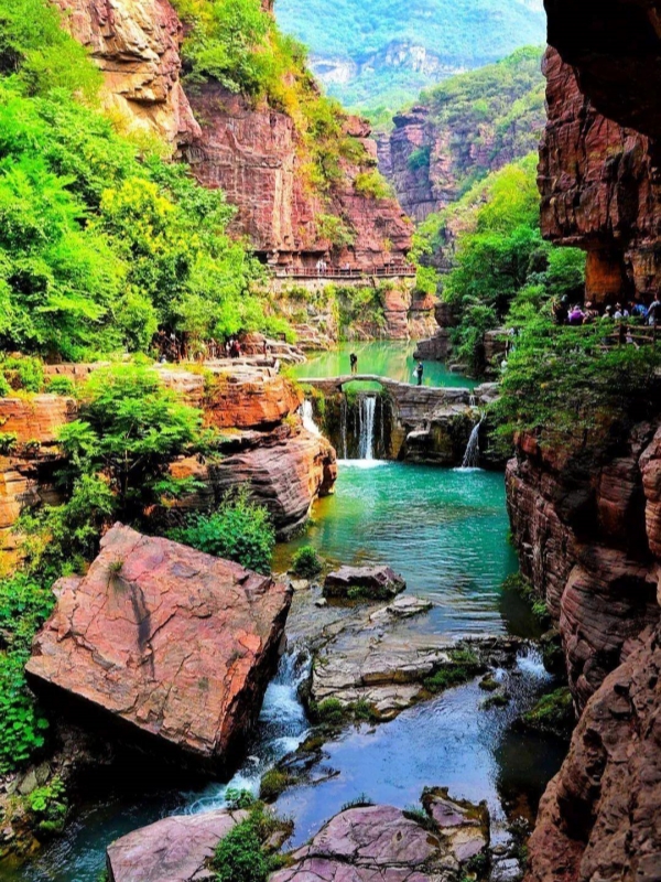
Climate Zones in China
China stretches over 55 degrees of latitude, from the tropical beaches of Hainan to the subarctic forests of Heilongjiang. This massive east–west and north–south span, combined with terrain that rises from sea level to the Tibetan Plateau, creates five distinct climate zones. Each zone shapes what you pack, when you go, and what you experience on the ground. Understanding the framework — both China's domestic five-zone system and the international Köppen classification — gives travelers a practical advantage when planning routes across provinces that can differ by 30 degrees Celsius on the same day.
Quick Facts
China's Five Climate Zones
China's national climate regionalization system divides the country into five major zones. This framework reflects a fundamental geographic reality: the territory spans from tropical latitudes in the far south to subarctic conditions in the far north, while the stepped terrain — the Pacific-facing lowlands, the broken mountain chains, and the Tibetan Plateau — layers elevation on top of latitude. The result is a climate map that changes faster across 100 kilometers in western China than across 1,000 kilometers on the eastern plain.
- Tropical Monsoon: Year-round warmth with heavy summer rainfall. Hainan, southern Yunnan, southern Taiwan, and southern Guangxi fall here. Winter beach escapes work well; summer brings heat and downpours.
- Subtropical Monsoon: The largest zone by area — the Yangtze basin, the southeast coast, and the Sichuan Basin. Four seasons with cool damp winters and hot humid summers. Spring blossoms and autumn foliage coincide with the most comfortable travel weather.
- Temperate Monsoon: The North China Plain and Loess Plateau margins — Beijing, Tianjin, Xian, Luoyang, Jinan. Cold dry winters, hot rainy summers. Spring is short and often dusty; autumn is the prime travel window.
- Temperate Continental: Inland and northeastern China — Heilongjiang, Jilin, Liaoning, Inner Mongolia, northern Xinjiang. Long severely cold winters, brief warm summers, low and uneven precipitation. Harbin's Ice Festival draws visitors into the coldest months.
- Alpine Plateau: The Tibetan Plateau and Qinghai, extending into western Sichuan and northern Yunnan valleys. Cold year-round with large daily swings, strong ultraviolet radiation, and thin air. Acclimatization matters as much as the calendar.
For more, see our guide to Kids Indoor Playground in.
Tropical Monsoon Climate

Xishuangbanna(Tropical Monsoon Climate)
The tropical monsoon zone covers Hainan, the southern tier of Yunnan (Xishuangbanna), southern Taiwan, southern Guangxi, Hong Kong, and Macau at the tropical-subtropical fringe. Annual mean temperatures sit around 22–28°C. Summer monsoon moisture arrives between May and October, bringing heavy rain. Winters are mild and dry. For visitors, this zone offers one clear advantage: it is warm enough for beach travel even in January. Summer, however, is hot and humid, with frequent afternoon downpours that can interrupt outdoor plans. Xishuangbanna and Hainan are the most extensive tropical areas; Guangzhou and Hong Kong sit on the subtropical border but share some tropical warmth in winter.
See also our Best Time to Visit Hainan Island guide.
Subtropical Monsoon Climate

Hangzhou(Subtropical Monsoon Climate)
This zone covers the largest share of China's land area. It runs from the middle and lower Yangtze River basin across the southeast coast and into the Sichuan Basin. Four distinct seasons define the year. Winters are cool and damp — monthly means fall between 0 and 10°C — while summers push 25 to 32°C with high humidity. Major cities include Shanghai, Hangzhou, Suzhou, Nanjing, Wuhan, Chengdu, Changsha, Guilin, and Zhangjiajie. The travel sweet spot is spring, when blossoms line the canal cities, and autumn, when humidity drops and foliage turns gold along the Yangtze. Summer heat and heavy rain make July and August less comfortable for outdoor sightseeing.
For more, see our guide to Leshan Sichuan.
Temperate Monsoon Climate

Xian(Temperate Monsoon Climate)
The temperate monsoon zone covers the North China Plain and the edges of the Loess Plateau. Beijing, Tianjin, Xian, Luoyang, Jinan, and Zhengzhou sit within this region. Winters are cold and dry — January monthly means range from -10 to 0°C. Summers are hot and rainy, with July temperatures reaching 25–31°C. Spring is brief and often accompanied by dust storms from Inner Mongolia. Autumn, by contrast, brings clear skies and cooler air, making it the most popular travel season. Visitors should expect a pronounced seasonal swing; packing for Beijing in October and Beijing in July requires nearly opposite wardrobes.
Temperate Continental Climate
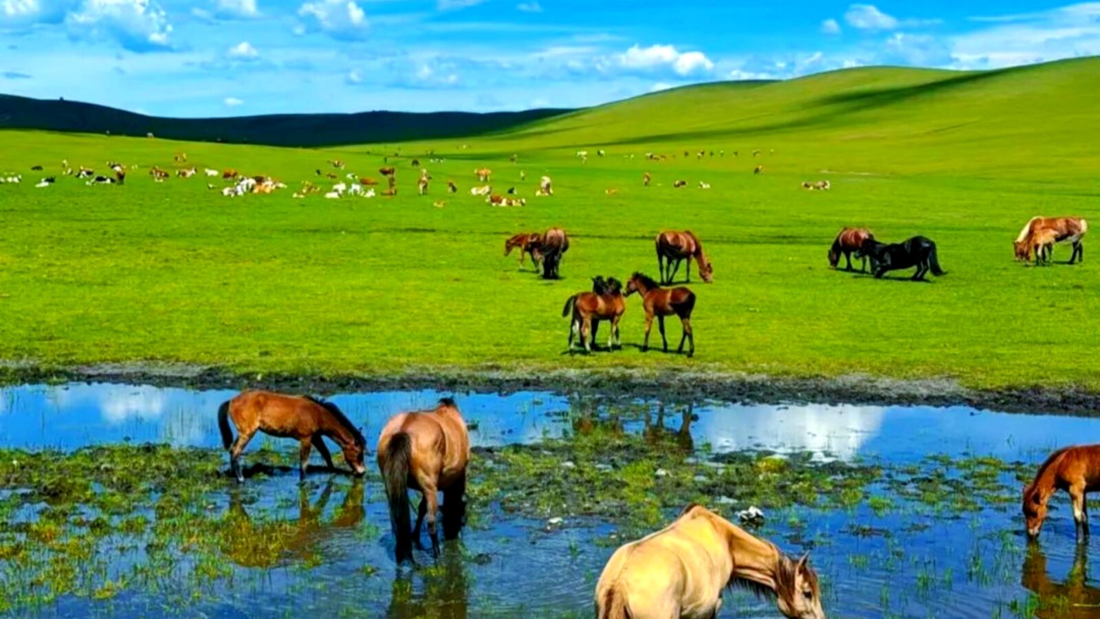
Inner Mongolia(Temperate Continental Climate)
This zone dominates inland and northeastern China — much of Inner Mongolia, Heilongjiang, Jilin, Liaoning, northern Xinjiang, Gansu, and Ningxia. Winters are long and severe; January monthly means drop to -20°C or lower across the north. Summers are warm but short. Precipitation is sparse and uneven. For most travelers, June through September offers the most manageable conditions. Harbin's International Ice and Snow Sculpture Festival (December through February) deliberately draws visitors into the coldest period. The far north, including Heilongjiang, can be intensely cold even in early spring. Summer opens roads and hiking trails that are impassable during the long snow season.
Alpine Plateau Climate

Tibetan Plateau(Alpine Plateau Climate)
The alpine plateau zone covers the Tibetan Plateau, Qinghai, and the high valleys of western Sichuan and northern Yunnan. Lhasa, Xining, and Shangri-La are the main travel bases. Temperatures remain cold year-round, with monthly means ranging from roughly -15 to 20°C depending on elevation and season. Diurnal swings are large — daytime sun can feel warm while nights drop below freezing even in summer. Solar radiation is intense. Precipitation is low overall, though afternoon and evening thunderstorms are common in summer. For visitors, high altitude is the dominant factor. Altitude sickness — not cold — is the primary health concern at elevations above 3,000 meters. acclimatization in Lhasa for one to two days before ascending further is standard advice.
The Köppen Classification for China
The Köppen–Geiger climate classification, originally developed by Wladimir Köppen in 1884 and updated by Peel et al. (2007) and Beck et al. (2018), provides a globally standardized system that allows China's five domestic zones to be compared against climate regions worldwide. Each zone maps to one or more Köppen letter codes, which encode temperature and precipitation patterns in shorthand. The table below translates China's climate zones into Köppen equivalents.
How China Maps to Köppen Zones
The Köppen letter codes condense climate expectations into two to four characters. A first letter indicates the major type: A = tropical, B = dry, C = temperate, D = continental (cold), E = polar. A second letter gives the precipitation pattern; a third gives the temperature subtype. For example, Cfa means temperate (C), fully humid summer (f), and warm summer (a) — a humid subtropical pattern matching Shanghai. Dwd breaks down as D = continental (cold winter), w = dry winter, and d = extremely cold winter — the subarctic classification that applies to Mohe, China's northernmost inhabited point. This shorthand lets travelers compare Shanghai's climate with, say, New York or Milan, using the same classification system.
Where the Boundaries Shift
China's climate zones do not end at neat provincial borders. Transition zones create confusion for travelers relying on broad labels. A narrow strip of the Tarim Basin in southern Xinjiang registers as BSk (cold semi-arid) — drier than the temperate continental classification suggests. The Loess Plateau around Yan'an and Lanzhou sits at the monsoon arid boundary, where summer rain still arrives but totals are modest. The Sichuan Basin defies its inland location with humid subtropical (Cfa) conditions, kept mild and damp by surrounding mountains. Most notably, the Tibetan Plateau does not fit neatly into any single Köppen letter. Elevations above roughly 4,500 meters register as ET (tundra), while valleys at 3,000–4,000 meters may classify as Dwb. Visitors moving between Lhasa and the surrounding highlands cross climate zones within a single day of travel.
Regional Climate Breakdown
This table aggregates the five climate zones into nine travel sub-regions, matching the regional divisions most visitors actually plan around.
Monsoon, Typhoons, and Extreme Weather

Typhoon Season
The East Asian monsoon is the single most important climate driver across most of China. It sets the rhythm of wet and dry seasons, shapes temperature patterns, and creates the weather hazards visitors need to plan around. Three distinct phenomena — the monsoon cycle, typhoons along the coast, and episodic extreme events — cover the risks that affect the widest range of destinations.
The East Asian Monsoon Cycle
The monsoon drives two distinct air-mass regimes over China each year. The summer monsoon, May through September, draws warm moist air from the western Pacific inward across the southeastern coast. The winter monsoon, October through April, Funnels cold dry air southward from the Siberian interior. The contrast between these two patterns explains the sharp seasonal rainfall gradient from southeast to northwest.
- Summer monsoon span: May through September brings the majority of annual precipitation to eastern China
- Winter monsoon span: October through April keeps northern and central China dry and cold
- Precipitation gradient direction: Rainfall drops from roughly 2,000 mm per year on the southeast coast to below 100 mm in the far northwest
Typhoon Season
Typhoons form over the western Pacific and track westward or northward, striking China's southern and eastern coastline. Guangdong, Hainan, Fujian, Zhejiang, and Taiwan bear the brunt. The season runs from May onward, with peak intensity concentrated in July, August, and September.
- Peak months: July, August, and September record the highest frequency and intensity
- Most-affected provinces: Guangdong, Hainan, Fujian, Zhejiang, and Taiwan face the highest risk
- Visitor takeaway: Flexible travelers should reschedule coastal plans if a named storm is forecast in the region
Sandstorms, Floods, and Smog
Beyond the monsoon and typhoons, episodic hazards affect specific zones and seasons. These are the events that can disrupt otherwise well-planned itineraries.
- Sandstorms: Peak February through April, centered on the Tarim Basin (southern Xinjiang), southwestern Qinghai, western Tibet, central and western Inner Mongolia, and central-northern Gansu
- Floods: June through August, concentrated in the south and southeast — Guangdong, Guangxi, Zhejiang, Jiangsu, and also Anhui, Liaoning, Hunan, Guizhou, and Yunnan
- Smog: November through January brings elevated particulate levels to parts of the North China Plain, including Shijiazhuang, Xianyang, Handan, and Tianjin
Planning Your Trip by Climate Zone
Knowing which climate zone your destination falls in tells you more than a weather forecast — it tells you the season to target, the gear to pack, and the crowds to expect. This section turns climate data into travel decisions.
Best Months by Zone
Spring and autumn cover most of eastern China. Summer opens the plateau and the far north. Winter belongs to the tropical coast and the snow festivals. The following windows are the safest choices for each zone.
- Tropical Monsoon: November through April — dry season, warm but not extreme
- Subtropical Monsoon: March through May and September through November — avoid the humid summer peak
- Temperate Monsoon: April through May and September through October — autumn is the clearest and most comfortable
- Temperate Continental: June through September for general travel; December through February for snow festivals
- Alpine Plateau: May through September — winter snow closes many roads and passes
Packing Across Climate Zones
The larger your north–south or east–west span, the more layers you need. A single trip from Beijing in October to Guilin in November to Lhasa in December requires a wardrobe covering three seasons. Use layers rather than bulk.
- Layers for spring and autumn in North China: Light windbreaker, long-sleeve shirts, a mid-layer fleece
- Down jacket for winter: Essential for NE China, Inner Mongolia, and Tibet from November through March
- Breathable quick-dry clothing for summer: Humidity in the Yangtze basin makes cotton uncomfortable; synthetic or wool dries faster
- Rain jacket for monsoon zones: April through September in subtropical and tropical regions — sudden afternoon downpours are common
- Sun protection for Tibet: SPF 50, UV-blocking sunglasses, and lip balm with SPF; radiation is intense at altitude
- Sturdy walking shoes: Any itinerary crossing multiple zones benefits from break-in-proof, waterproof footwear
- Pollution mask for winter smog: N95-rated masks reduce particulate exposure in the North China Plain from November through January
Crowds, Golden Week, and Climate
Climate and Chinese public holidays drive crowd patterns together. The best weather window can also be the busiest one — unless you know when to be somewhere else.
- National Day Golden Week: October 1–7 (often extended to 8 days when Mid-Autumn Festival overlaps) is the country's busiest travel week and falls in a good climate window for most regions
- Spring Festival: Late January through February — the largest annual migration, with cold weather in most zones and potential transport disruption in the north
- Summer school holidays: July and August push domestic family travel to Jiuzhaigou, Zhangjiajie, the Great Wall, and the Forbidden City — expect long queues
- Climatic off-season opportunities: Hainan in summer and Harbin in summer are cheaper and less crowded, though heat and cold respectively limit outdoor comfort
Frequently Asked Questions
Q: How many climate zones are there in China?
China's national climate regionalization recognizes five major zones: tropical monsoon, subtropical monsoon, temperate monsoon, temperate continental, and alpine plateau. The international Köppen–Geiger classification overlays additional subtypes within those five.
Q: What climate zone is Beijing in?
Beijing sits in the temperate monsoon zone — cold dry winters (monthly mean around -3 to -1°C in January) and hot humid summers (around 25–26°C in July). On the Köppen map it is classified as Dwa.
Q: What places in China are in the tropical climate zone?
The tropical zone covers Hainan, southern Yunnan (Xishuangbanna), southern Taiwan, southern Guangxi, plus Hong Kong and Macau at the tropical–subtropical fringe. Xishuangbanna and Hainan are the most extensive tropical areas.
Q: Where do subarctic climate zones occur in China?
Subarctic conditions (Köppen Dwd) appear in the far north of Heilongjiang — most notably Mohe, China's northernmost inhabited point, and parts of the Greater Khingan range. January monthly mean temperatures can drop below -28°C.
Q: What is the biggest climate zone in China?
The subtropical monsoon zone covers the largest land area — most of the Yangtze basin and southeastern China, including Shanghai, Hangzhou, Suzhou, Wuhan, Changsha, Guilin, and Zhangjiajie. It is also the most densely populated.
Q: Does China have a Mediterranean climate zone?
Not in the strict sense. A narrow strip of the Yarlung Tsangpo valley in southern Tibet has mild dry winters and wetter summers, but China has no large area classified as Köppen Csa or Csb (Mediterranean).
Q: Western China is in what climate zone?
Western China splits across two zones: the temperate continental zone (much of Xinjiang, Gansu, and Ningxia) and the alpine plateau zone (Tibet, Qinghai, and parts of western Sichuan and northern Yunnan). Together they cover most of China's land area.
Q: When is the best time to visit China across climate zones?
For eastern China (temperate and subtropical monsoon): April through May and September through October. Then, for the Tibetan Plateau: May through September. For the tropical south: November through March. For the far north (Harbin): December through February for snow, June through August for general travel.