Maps for Hong Kong
Hong Kong packs extraordinary density into a compact space. Steep hillside neighbourhoods, a world-class metro, ferries to outlying islands and more than 1,100 square kilometres of territory — all of it needs mapping. This guide covers every practical map a tourist needs: digital apps, offline downloads, printable PDFs, the MTR metro network and neighbourhood-by-neighbourhood attractions. Whether you are arriving at the airport, riding the Peak Tram or hiking Lantau's country parks, the right map is never far away.
Quick Facts
District Map and Top Attractions
Maps for Hong Kong
Hong Kong Island
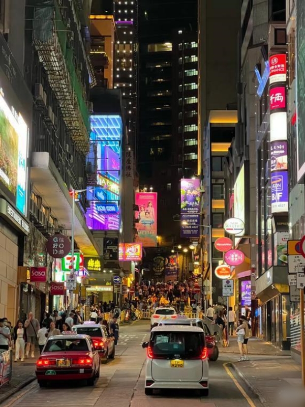
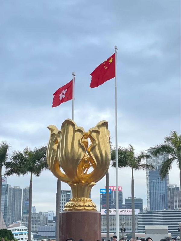
The island's northern shore runs from Sheung Wan through Central to Wan Chai and Causeway Bay. Hollywood Road holds Man Mo Temple and the PMQ creative hub; IFC Mall anchors the financial district. Victoria Peak rises above the mid-levels and is reached by the Peak Tram from Garden Road — the ride takes roughly six minutes. Wan Chai's waterfront promenade and the Golden Bauhinia Square anchor the district's renewal. Moving east, Victoria Park offers open space on a former racecourse site, and Lei Yue Mun village provides a compact seafood experience. The southern side runs from Aberdeen and its typhoon shelter through Repulse Bay to Stanley Market, where visitors find a long-established bazaar near the water.
Kowloon
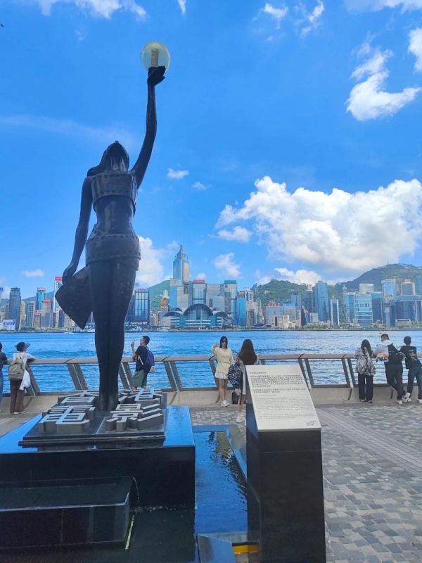
Yau Tsim Mong is the most visited corner of Kowloon. The Tsim Sha Tsui promenade runs along Victoria Harbour with the Avenue of Stars, and Nathan Road slices northward through the district toward Mong Kok. Temple Street Night Market and the Ladies' Market on Tung Choi Street draw evening crowds. Nearby, K11 Musea and Chungking Mansions anchor very different ends of the commercial spectrum. The Hong Kong Museum of History and Hong Kong Science Museum share combined ticketing at roughly $13 (HK$100). Westward, Kowloon City's Wong Tai Sin Temple (managed by Sik Sik Yuen) draws worshippers and tourists alike, while the adjacent Chi Lin Nunnery and Nan Lian Garden offer free-entry tranquil gardens. Sham Shui Po's Apliu Street flea market and Golden Computer Arcade attract a different crowd — locals hunting electronics and vintage goods. Kwun Tong on the eastern edge has seen rapid redevelopment, with the Kwun Tong Promenade and MEGAbox shopping centre marking the district's new profile.
New Territories
The New Territories stretch from the city fringe to the Shenzhen border and cover the bulk of Hong Kong's land area. Sai Kung town is a base for coastal country parks and beaches reachable by green minibus. Sha Tin houses the Hong Kong Heritage Museum and Ten Thousand Buddhas Monastery, which ascends a hillside above the town in a procession of gilded statues. The Hong Kong Railway Museum occupies the former Tai Po Market station building and is free to enter. Yuen Long's Ping Shan Heritage Trail links historic clansmen halls and a Tin Hau Temple along a paved path. Tsuen Wan and Tuen Mun anchor their respective towns with shopping malls and local markets. The North District touches the border at Lo Wu and Lok Ma Chau, where the East Rail Line crosses into mainland Shenzhen.
Outlying Islands (Lantau, Lamma, Cheung Chau)
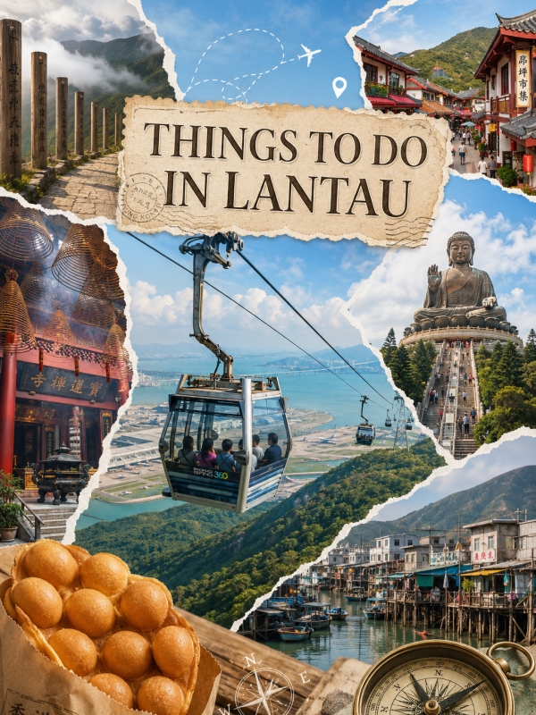
Lantau is the largest island and holds two major draws. The Tian Tan Buddha sits on Ngong Ping plateau above the Po Lin Monastery, reached by the Ngong Ping 360 cable car from Tung Chung (standard round-trip about $30 / HK$235). Tai O village at the island's western tip retains stilt houses and a fishing-village character. Hong Kong Disneyland occupies its own corner of Lantau, accessible via the Disneyland Resort Line. Lamma Island connects Sok Kwu Wan and Yung Shue Wan by a family-friendly hiking trail of roughly one hour; neither village has road vehicles. Cheung Chau is a small island known for the annual Bun Festival in April or May and its seafood restaurants along the waterfront. Peng Chau is a quieter residential island reached by a 20-minute ferry from Central. Ferries depart Central Piers for Lantau (Mui Wo), Lamma (Yung Shue Wan and Sok Kwu Wan) and Cheung Chau; Aberdeen also serves Lamma.
🏝️ Discover Island Attractions: From the Giant Buddha and Ngong Ping cable car to scenic hiking trails and quiet fishing villages, Hong Kong's largest island offers endless outdoor adventures. Explore our list of top Things to Do in Lantau.
Best Online Maps for Hong Kong

Maps for Hong Kong
Four apps handle virtually every mapping need for foreign visitors in Hong Kong. None requires a VPN — connectivity is open and unrestricted across all services.
Google Maps in Hong Kong
Google Maps is the default choice for most visitors and covers the widest range of transport modes. Transit directions include MTR, KMB bus, Citybus, tram, Star Ferry, Light Rail, green minibus, taxi and walking routes. Live MTR delay alerts appear within one to two minutes of an incident being reported. Bus arrival times are available for most KMB and Citybus routes. The map view switches between Traditional Chinese, Simplified Chinese and English through the app settings menu.
Transit coverage summary:
- MTR: all 10 lines, colour-coded to match the official MTR system map
- Buses: KMB, Citybus and most green minibus routes with live arrivals
- Rail and tram: MTR, Light Rail, Hong Kong Tramways
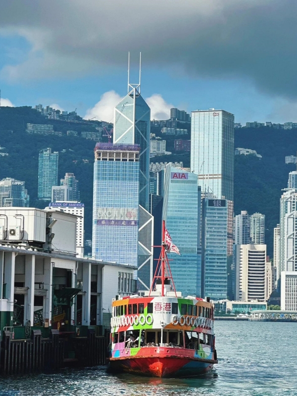
- Ferry: Star Ferry routes across Victoria Harbour
- Walking and driving: step-by-step directions with real-time traffic
- Street View: dense coverage across Hong Kong Island, Kowloon and major New Territories towns
- Offline: pan to Hong Kong and tap "Download" to save a region of roughly 50–80 MB
Apple Maps, HERE Maps and Citymapper
Apple Maps renders a clean interface and offers turn-by-turn walking and driving with Look Around (Apple's equivalent of Street View) covering the main tourist areas. Transit data is improving but remains less comprehensive than Google Maps. Offline maps require iOS 17 or later.
HERE WeGo stands out as a lightweight alternative. It handles walking, driving and transit and includes built-in offline map downloads without requiring a separate step. Users who prefer to avoid Google services find HERE a practical substitute for city navigation and for pre-downloading Hong Kong before arrival.
Citymapper is the best specialist option for transit-heavy trips. It provides step-by-step MTR, bus, tram and ferry routing with platform numbers and exit guidance at major interchange stations such as Admiralty and Central. Live arrival data is shown for each route. Citymapper and HERE both support offline region downloads on iOS and Android.
🏙️ Explore Greater Bay Area Hubs: Hong Kong serves as an ideal springboard for discovering the vibrant urban centers, historic towns, and economic hubs across Southern China. Plan your regional side trips with our guide to Cities Near Hong Kong.
Offline Maps, Apps and Printable PDFs
Maps for Hong Kong
Hong Kong's urban core has near-universal 4G and 5G coverage, and every MTR station offers free Wi-Fi. An offline map is still valuable for hiking trails, ferry crossings to outlying islands where signal drops, and the first hour after landing before roaming activates.
Best Offline Map Apps for Hong Kong
- Maps.me renders OpenStreetMap data and is particularly strong for hiking trails and narrow alleys in older districts. The app is free on iOS and Android and downloads regions without requiring an account.
- Google Maps offline region for Hong Kong takes roughly 50–80 MB depending on the zoom levels saved. Download before departure or connect at an airport Wi-Fi hotspot before clearing immigration.
- HERE WeGo and Citymapper both allow offline region downloads for city navigation. HERE WeGo is the lighter option; Citymapper is larger but adds transit-specific features such as platform numbers.
Printable PDF Maps and How to Print
Two official sources publish free, print-friendly PDFs in English. The Hong Kong Tourism Board tourist map covers the whole territory with a district overview and an inset MTR map. The MTR Corporation publishes the official metro map at mtr.com.hk — designed for A4 and Letter print, it shows all 10 lines and a station index.
To print at home: open the PDF in any browser, select File → Print, then choose "Fit to page" so the inset maps scale correctly. A4 and Letter both work. Physical copies are also available free at the HKTB Visitor Centre at Tsim Sha Tsui Star Ferry Pier (Pier 7, daily roughly 09:00–18:00) and the HKTB Visitor Centre at Hong Kong Station (IFC mall, Central, same hours).
🚢 Plan Your Cross-Border Trip: Navigating the transport connections across the Pearl River Delta is fast and simple via high-speed ferry, local bus, or the sea bridge. Learn about routes and border crossings in our Hong Kong to Macau guide.
MTR Hong Kong Metro Map and Lines
Maps for Hong Kong
The Mass Transit Railway is the fastest way to move between Hong Kong's districts. Ten lines serve the territory, including the Airport Express and the Disneyland Resort Line.
MTR Lines and Routes at a Glance
Key Interchange and Cross-Harbour Stations
Victoria Harbour carries four MTR lines under the water. Admiralty on Hong Kong Island is the busiest four-line hub, connecting Island, Tsuen Wan, South Island and East Rail lines on cross-platform transfers. Central and Hong Kong Station sit next to each other — Tsuen Wan and Island lines serve Central, while Airport Express and Tung Chung Line serve Hong Kong Station. East Tsim Sha Tsui connects to Tsim Sha Tsui via a covered pedestrian walkway of roughly three minutes. Quarry Bay and North Point both link the Island Line with the Tseung Kwan O Line across the eastern harbour corridor.
Airport Express and Tourist Day Pass
Single-journey MTR fares run roughly $0.50–$7 (HK$4–HK$55) depending on distance. Tourists can use a single-journey ticket, pay by contactless card, or load an Octopus card for a small discount.
The Airport Express has three in-town stations — Hong Kong (Central), Kowloon and Tsing Yi — before reaching the airport. One-way Octopus fares are about $13 (HK$100) to Hong Kong Station, about $12 (HK$90) to Kowloon, and about $8 (HK$60) to Tsing Yi. Journey time from the airport to Central is 24 minutes. Both Hong Kong and Kowloon stations offer in-town check-in, allowing passengers to drop bags hours before their flight.
The Tourist Day Pass costs about $13 (HK$100) and provides unlimited MTR rides on the day of issue, excluding Airport Express, Light Rail and MTR buses. It is sold at Airport Express customer service centres. An Octopus card requires a HK$50 deposit plus stored value; deposits are refundable at any MTR station.
🚄 Board High-Speed Rail into Mainland China: West Kowloon Station connects directly to top scenic destinations across the country, including the famous avatar-like sandstone pillars. Check train schedules and route details for Hong Kong West Kowloon to Zhangjiajie.
Maps for Airport, Disneyland and Walking
Maps for Hong Kong
Hong Kong International Airport Map
Hong Kong International Airport occupies Chek Lap Kok Island. Terminal 1 handles the vast majority of passenger flights. Terminal 2 reopened recently as a self-service hub for coaches, ferries and autonomous transport trials, with limited commercial flight activity. SkyPlaza links the terminals and hosts retail and dining. Free in-airport Wi-Fi covers all concourse areas. The official HKIA map PDF lists every gate, check-in island, dining cluster and the Airport Express boarding area. In-town check-in at Hong Kong Station and Kowloon Station lets travellers drop bags and receive boarding passes before arriving at the airport on departure day.
Hong Kong Disneyland Map
The park arranges eight themed lands in a hub-and-spoke layout around the central Sleeping Beauty Castle. Main Street USA leads into Adventureland, Fantasyland and Tomorrowland; Toy Story Land, Grizzly Gulch, Mystic Point and World of Frozen extend outward on dedicated branches. The free park map PDF is downloadable from the official Hong Kong Disneyland website and is also handed out at the entrance. One-day adult tickets run about $82 (HK$639) on standard days and about $101 (HK$789) on peak dates including Chinese New Year week, Christmas week and Golden Week early October. The Disneyland Resort Line (pink) connects Sunny Bay interchange to the park; a single ride costs roughly $6 (HK$50). Most visitors allocate nine to ten hours to cover all lands. Arriving 30 minutes before park opening helps secure a smooth entry through security and bag checks.
Walking and Hiking Maps
The AFCD publishes free PDF trail maps for all 24 country parks in Hong Kong. Trails are graded easy, moderate or difficult. Three popular routes draw visitors with distinct profiles:
- Dragon's Back — Shek O Country Park, ~4 hours, easy grade, ~285 m peak elevation, ranked among Asia's best urban walks
- Lion Rock — Lion Rock Country Park, ~3 hours, moderate grade, ~495 m summit, panoramic view over Kowloon
- Lantau Trail Section 1 — Mui Wo to Nam Shan, ~3 hours, easy grade, scenic introduction to Lantau's interior
Maps.me and other OpenStreetMap-based apps render most marked country-park trails accurately. OpenStreetMap data for Hong Kong is generally well maintained. Visitors should stay on designated paths — country park regulations require it.
🏙️ Compare China’s Leading Financial Hubs: Deciding where to travel or spend more time during your trip? Read our detailed head-to-head comparison on Shanghai vs Hong Kong to see how their atmospheres, costs, and attractions differ.
Frequently Asked Questions
Q: How do I print a map for Hong Kong?
Download the free tourist map PDF from the Hong Kong Tourism Board official site (discoverhongkong.com) or the official MTR metro map from mtr.com.hk. Open the PDF in any browser, select File → Print and choose "Fit to page" so insets scale correctly. Both A4 and Letter paper work. Physical printed copies are also available free at the HKTB Visitor Centre at Tsim Sha Tsui Star Ferry Pier (Pier 7) and the HKTB Visitor Centre at Hong Kong Station (IFC mall, Central).
Q: Does Google Maps work well in Hong Kong?
Yes. Google Maps is the most-searched map for Hong Kong and covers MTR, KMB and Citybus, tram, Star Ferry, Light Rail, minibus and walking directions. Street View is dense across Hong Kong Island and Kowloon. Live bus arrival times display on most routes. An offline region can be downloaded before arrival or while connected to free airport Wi-Fi.
Q: What is the best map app for tourists in Hong Kong?
For most visitors, Google Maps covers 95% of needs across transit, walking and driving. Citymapper adds platform numbers and exit guidance at interchange stations for transit-heavy trips. Maps.me uses OpenStreetMap and handles hiking trails accurately. Apple Maps works well on iOS as an alternative. All four are free.
Q: Where can I download a free Hong Kong city map PDF?
The Hong Kong Tourism Board publishes a free tourist map PDF on its official site. The MTR Corporation publishes a free metro map PDF at mtr.com.hk. Both are in English, print-friendly and updated regularly. The AFCD publishes free country-park trail maps separately.
Q: Is there a printable Hong Kong MTR metro map?
Yes. The MTR Corporation hosts an official MTR system map PDF at mtr.com.hk in English, Traditional Chinese and other languages. It is designed for A4 and Letter print and shows all 10 lines with a station index. Printed copies are also handed out at Airport Express customer service centres and major MTR stations.
Q: Are Hong Kong maps accurate for walking and hiking?
Google Maps and Apple Maps are reliable for urban walking and street-level directions. For hiking, OpenStreetMap-based apps such as Maps.me align closely with the AFCD trail maps published by the Agriculture, Fisheries and Conservation Department. Downloading the AFCD PDF for specific country parks before setting out is recommended.
Q: Do I really need an offline map in Hong Kong?
For the city centre, 4G and 5G are universal and every MTR station provides free Wi-Fi — an offline map is optional rather than essential. Download one for hiking in country parks, ferry crossings to Lamma and Cheung Chau where signal weakens, and the first hour after landing before a local SIM or eSIM activates.
Q: Is there a Pokemon Go map for Hong Kong?
Hong Kong is an active Pokemon Go region with high-density Pokestops in Tsim Sha Tsui, Mong Kok, Victoria Park and Sha Tin. Community maps exist on fan sites but are unofficial. The official Pokemon Go app includes its own tracker; Niantic does not publish an approved third-party map.
Q: How do I navigate from Hong Kong Airport to the city?
Three options suit different budgets and schedules. The Airport Express reaches Hong Kong Station (Central) in 24 minutes at about $13 (HK$100) with an Octopus card. Airport buses such as the A11 run to Central in roughly 80 minutes for about $6 (HK$45). A taxi costs roughly $50–60 (HK$380–450) and takes about 45 minutes including tunnel and luggage fees. The Airport Express is the fastest option and offers in-town check-in at Hong Kong and Kowloon stations.