Linzhi Tibet China
Southeastern Tibet sits apart from the high-altitude plateau most visitors imagine. Linzhi—known locally as Nyingchi—occupies a river valley system threaded by the Yarlung Tsangpo and Niyang rivers, where average elevations run 500–800 metres lower than Lhasa. Oak, pine, and rhododendron forest cover the slopes, and the climate carries a damp subtropical highland character, drawing roughly 600–900 mm of rainfall annually, mostly between June and September. This guide covers the practical nuts and bolts: a bloom-by-elevation festival timeline, the four scenic areas most visitors actually reach, transport options including the 2021 Lhasa–Nyingchi Railway, and the trekking routes that work for group-based itineraries.
Quick Facts
Why Linzhi Is Tibet's Most Approachable Region
Nyingchi occupies a geographical niche within the Tibet Autonomous Region. The Yarlung Tsangpo and Niyang rivers have carved a valley corridor that sits 500–800 metres below the Lhasa plateau, producing a visibly greener landscape and a climate that receives the bulk of Tibet's rainfall. Average annual precipitation lands around 600–900 mm, concentrated in June through September, which sustains the oak, pine, and rhododendron forest covering the valley walls. Most first-time visitors to Tibet report noticeably fewer altitude symptoms here than in Lhasa, which sits at roughly 3,650 m against Nyingchi's 2,990 m town centre. The region therefore functions as a practical acclimatisation stop—visitors often spend two or three nights here before heading west. Beyond altitude, the draws are concrete: the world's deepest canyon system, a spring peach blossom festival held every year since 2001, and one of China's lowest-elevation glacier walking approaches at Midui.
🏔️ Cultural Significance & Landmarks: Learn about the rich heritage, landscapes, and iconic traditions by exploring What Is Tibet Known For.
Must-See Scenic Areas in Linzhi
Four named areas dominate any Nyingchi itinerary. Each is covered below with practical details for planning.
Yarlung Tsangpo Grand Canyon
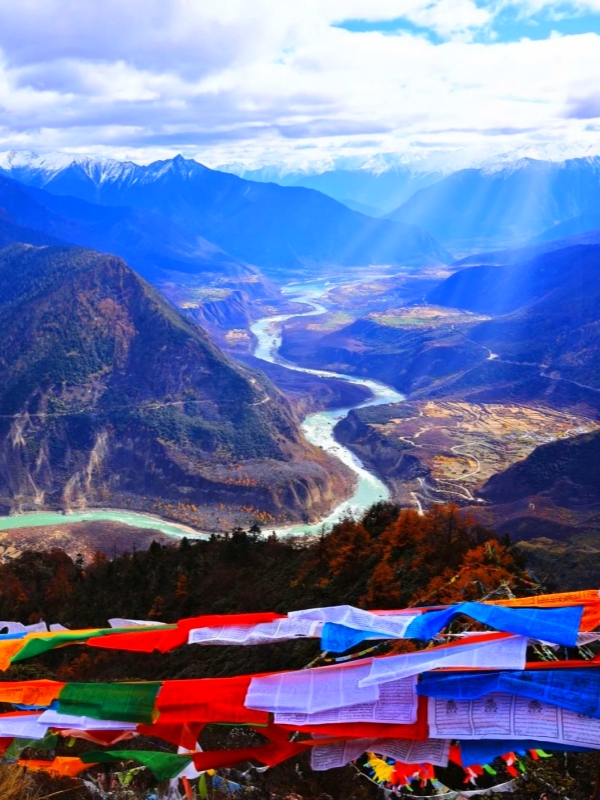
Yarlung Tsangpo Grand Canyon
The Yarlung Tsangpo Grand Canyon is a 504-kilometre canyon system on the Yarlung Tsangpo River, with a measured depth of approximately 6,009 metres from rim to river—making it one of the deepest gorges on earth. The main viewing point is the village of Su-song, which sits roughly two hours' drive from Nyingchi town on a road that follows the river eastward. Most itineraries pair the canyon with an overnight stay in Su-song itself, where basic Tibetan-run guesthouses provide a night above the gorge. The entrance fee is about $14–21 (¥100–150) and is booked through the tour agency as part of the group itinerary.
Basum Lake (Basum Tso)
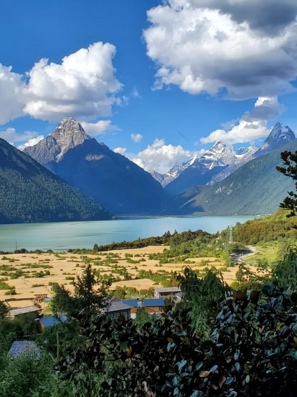
Basum Lake (Basum Tso)
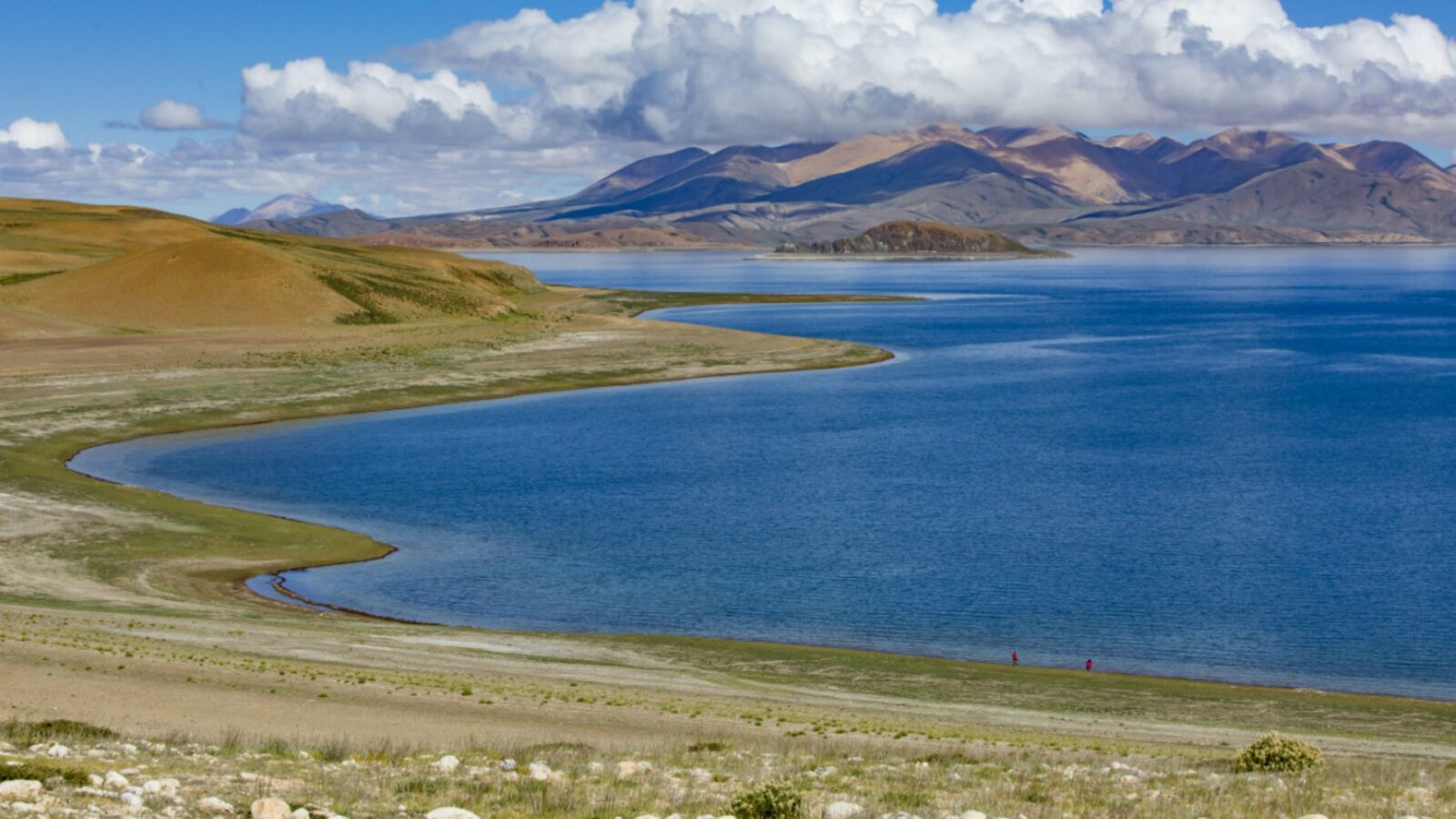
Basum Lake is a glacial lake at approximately 3,500 m covering 70 square kilometres. A small island in the centre holds Tsodzong Monastery, reachable by boat in season. The lake lies about four hours from Nyingchi town by road, making it a long day trip or an overnight stop. Entrance is about $7–14 (¥50–100), with optional boat rides on the lake itself. The higher elevation means cooler temperatures and a later bloom in spring, which makes Basum a strong choice for visitors arriving in mid-to-late April.
Lulang Forest Sea and Sejila Pass
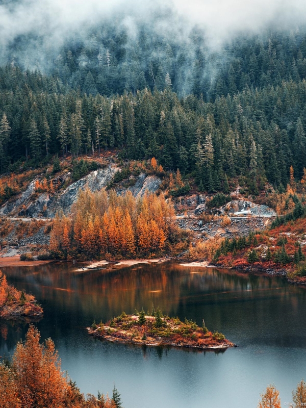
Lulang Forest Sea
The Lulang Forest Sea runs along a 15-kilometre stretch of primeval pine forest on the G318 Sichuan-Tibet Highway between Nyingchi and Gongbujiangda. Access is free, and the forest is a common stopover for travellers moving between Nyingchi and Lhasa by road. Above the forest corridor, Sejila Pass reaches approximately 4,500 m and is often capped with seasonal snow from November through March. The pass is a striking viewpoint but demands a gradual ascent from town to avoid altitude symptoms.
Midui Glacier and Ranwu Lake
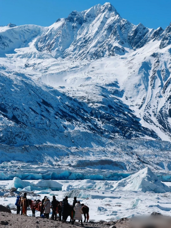
Midui Glacier
Midui Glacier is notable as one of China's lowest-elevation glaciers, with its terminus sitting near 2,400 m—low enough that the walk to the viewpoint is feasible for day-trippers without high-altitude mountaineering experience. Ranwu Lake lies roughly 30 km north of Midui, and the two are often combined in a single itinerary heading east toward Bomi. Both sites have free access. The road from Nyingchi takes three to four hours and passes through progressively higher terrain before descending to the lake. Best access is May through October, when the road is clear of snow.
🌊 Sacred Pilgrimage Waters: Discover the spiritual history and pristine natural beauty surrounding Mapang Yongcuo.
Best Hiking and Trekking Routes in Nyingchi
Four named routes cover the range from short day walks to multi-day village-to-village treks. Permit requirements apply to all of them.
Yarlung Tsangpo Grand Canyon Rim Trails
The rim trails run village-to-village from Su-song eastward, passing through a sequence of small Tibetan settlements above the gorge. The full route takes three to four days of walking, with basic accommodation in village guesthouses along the way. The route is organised exclusively through a Tibet-licensed travel agency as part of the group itinerary, and it operates in the dry season only—typically April through October when the trail is passable. The canyon rim is steep in places and requires a reasonable fitness level. Elevation on the upper sections runs above 3,500 m.
- Distance: Multi-day, village-to-village
- Time: 3–4 days
- Difficulty: Moderate to demanding
- Best season: April–October (dry season only)
- Permit note: Organised through licensed Tibet agency; not independently accessible
Basum Lake Circuit
A 15-kilometre loop trail circles Basum Lake, following the shoreline through pine forest with views of the lake and the island monastery. The path is flat and well-defined, making it suitable as a day walk for most visitors. At altitude (roughly 3,500 m), the pace is slower than at sea level, and walkers should allow five hours for the full circuit. The circuit can be started from the Basum Lake hotel area on the eastern shore.
- Distance: 15 km loop
- Time: 4–5 hours
- Difficulty: Easy to moderate (flat terrain, high altitude)
- Best season: May–October
- Permit note: Covered under the Tibet Travel Permit; no separate trail permit required
Midui Glacier Approach
A three-kilometre walk leads from the roadhead to the glacier terminus viewpoint, following a clear path up a glacial valley. The walk takes roughly 90 minutes each way at a steady pace. The glacier terminus sits near 2,400 m, which is low for a Chinese glacier and means the walk is accessible to fit day-trippers without specialised equipment. The road to the trailhead is passable from May through October; winter snow can close it from December through February.
- Distance: 3 km each way
- Time: ~1.5 hrs each way
- Difficulty: Easy (short distance, gentle gradient)
- Best season: May–October
- Permit note: Part of the guided tour itinerary
Lulang Forest Walks and Lhamo Latso
The Lulang area offers eight to twelve kilometres of forest path through primeval pine, with the option to add a side-trip to Lhamo Latso Lake. Lhamo Latso is a small high-altitude lake reachable on a 90-minute detour from the main forest trail. The combined walk takes a half-day at a moderate pace. The trails are on well-used paths and are well-marked. Lulang village itself has Tibetan-style lodges, making it a practical base for an overnight stop on the G318 route.
- Distance: 8–12 km main trail; Lhamo Latso side-trip adds ~3 km
- Time: Half-day for main trail; full day with Lhamo Latso
- Difficulty: Easy to moderate
- Best season: April–June and September–October
- Permit note: Covered under the Tibet Travel Permit
🏞️ Amdo Tibetan Landscapes: Plan your journey through lush grasslands, monasteries, and valleys with our comprehensive Gannan Travel Guide.
Linzhi Peach Blossom Festival Timeline
The Linzhi peach blossom season is not a single weekend—it cascades by elevation from late March into late April. A tight bloom-by-elevation table gives the overview, followed by practical notes on crowds and timing for photographers.
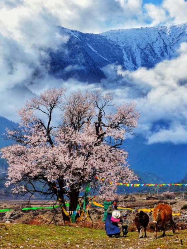
The 2025 official opening was on 22 March at Gala Village; 2026 is projected to follow a similar schedule, with the opening likely around 21 March. Lower-elevation venues bloom first and draw the largest crowds, so visitors arriving in mid-to-late April should head for Basum Lake or Bomi rather than the valley floor villages. Most venue entrances are free, with select scenic areas charging about $7–14 (¥50–100). For photographers, early-morning light at Su-song village catches the peach trees against the canyon wall to good effect—the light arrives low and warm before 9 am in late March.
🛂 Entry Rules & Travel Regulations: Understand the essential permit requirements and guided tour restrictions in Can You Visit Tibet.
How to Get to Linzhi
Four practical routes reach Nyingchi, each with distinct trade-offs on time, cost, and the experience itself. The table below compares them.
Flights and train tickets are bookable on Trip.com and Klook with foreign credit cards. A practical note on G318: independent self-drive is not permitted on the Tibetan side of the highway. All foreign visitors must travel Tibet in a licensed tour group with an arranged vehicle and guide—the permit checkpoint system enforces this at road blocks, train stations, and airline check-in counters.
Travel Essentials for Foreign Visitors
Three practical areas require attention before departure: permits, health considerations, and accommodation.
Permits, Money, and Language
All foreign visitors to the Tibet Autonomous Region require a Tibet Travel Permit (TTP), arranged through a registered Tibet travel agency. The permit costs roughly $30–60 (¥200–420) per person and is checked at airline check-in, train stations, and road checkpoints throughout the region. Accompanying a licensed guide and tour vehicle is mandatory in most areas—independent travel is not permitted. Cash backup is advisable: domestic mobile payment platforms require a mainland bank account and a mainland phone number, neither of which most foreign visitors hold. Mandarin is the working language in transport and hotels; English-speaking guides are standard on group tours arranged through agencies, but rare on independent ground. Most major scenic areas display basic English signage.
- Tibet Travel Permit: Arranged by agency; $30–60 (¥200–420); mandatory
- Tour vehicle: Included in agency package; required on Tibetan side of G318
- Payment: Carry cash; domestic mobile payment not accessible to most foreigners
- Language: English guides available on group tours; basic English signage at major sites
Altitude, Health, and Safety
Nyingchi town at roughly 2,990 m sits 600 m below Lhasa, and most visitors report mild or no symptoms here. At higher points—Basum Lake (3,500 m) and Sejila Pass (4,500 m)—the elevation makes itself felt. The standard advice holds: climb gradually, avoid strenuous activity on the first day, stay hydrated, and report any persistent headache or nausea to the guide. Travel insurance covering high-altitude trekking is essential; standard policies often exclude activities above 4,000 m, so check the policy wording. Road closures on G318 and the Lhasa–Nyingchi rail line can occur during heavy summer rain (June–August) and winter snow (December–February). The nearest major medical facility with English-speaking staff is Nyingchi People's Hospital, in the city centre.
- Acclimatisation: Spend 2–3 nights in Nyingchi before ascending to higher elevations
- Insurance: High-altitude trekking cover required; confirm policy exclusions
- Seasonal closures: G318 and some mountain roads may close in heavy rain or snow
- Medical facility: Nyingchi People's Hospital (city centre; English-speaking staff)
Where to Stay and What to Eat
Nyingchi town offers the widest range of accommodation. Mid-range hotels run about $50–90 (¥350–650) per night, with a handful of upscale options at roughly $130–200 (¥950–1,400). Lulang village has Tibetan-style lodges at around $40–70 (¥280–500). For an overnight near the canyon, Su-song village has basic Tibetan-run guesthouses at about $25–45 (¥180–320). All of these are bookable on Trip.com and Klook with foreign cards. Food in the region centres on yak meat, tsampa (roasted barley flour), butter tea, and Sichuan-influenced noodle dishes. Vegetarian options outside tourist-oriented hotels in Nyingchi town are limited.
- Nyingchi town: $50–90 (¥350–650) mid-range; $130–200 (¥950–1,400) upscale
- Lulang: $40–70 (¥280–500) Tibetan lodges
- Su-song village: $25–45 (¥180–320) basic guesthouses
- Local food: Yak, tsampa, butter tea, Sichuan noodles; limited vegetarian options
Frequently Asked Questions
Q: How do you get from Lhasa to Linzhi?
The fastest and most popular option is the Lhasa–Nyingchi Railway, which takes 4–5 hours and costs roughly $25–40 (¥180–280) in second class. A private transfer runs about 6 hours at $140–220 (¥1,000–1,600). A public bus takes roughly 7 hours at a lower fare. All options are included in the guided tour package.
Q: What is the best month to visit Linzhi?
For trekking, April through June and September through October offer the most stable weather. For the peach blossom festival specifically, mid-March through mid-April is the target window, with peak bloom shifting by venue elevation.
Q: Can you fly directly into Linzhi from mainland China?
Yes. Nyingchi Mainling Airport (LZY) has direct flights from Chengdu, Lhasa, and Chongqing, with seasonal service from Guangzhou and Shanghai. The flight from Chengdu takes roughly two hours.
Q: Is Linzhi safer for altitude sickness than Lhasa?
Generally yes. Nyingchi town sits roughly 600 metres lower than Lhasa (about 2,990 m versus 3,650 m), and most visitors experience milder or no symptoms. Gradual ascent to Sejila Pass (4,500 m) and Basum Lake (3,500 m) from the town base is still recommended.
Q: How many days do you need in Linzhi?
Four to six days covers the main scenic areas: the Yarlung Tsangpo Grand Canyon, Basum Lake, and Lulang Forest. Seven to ten days allows for a multi-day Grand Canyon rim trek and a detour east to Ranwu Lake and Midui Glacier.