Highest Mountains in China
China holds ten of the world's fourteen peaks above 8,000 metres, more than any other country. The highest is Mount Everest, shared with Nepal on the southern border. Nine more stand along the Himalaya and Karakoram ranges in Tibet, Xinjiang, and the far west. For foreign visitors, the practical question is not just which mountains rank highest but which ones you can actually stand beneath without joining a serious expedition. This guide ranks all ten, explains climbing difficulty, and covers the four snow mountains that non-mountaineers can visit with a standard tour or a cable car.
🏔️ China Mountain Overview: Explore the diverse geography, sacred peaks, and alpine landscapes across the country in our comprehensive guide to Mountains in China.
Quick Facts
🔝 Top Peak Profile: Read in-depth facts and geological details about the country's ultimate rooftop in our guide to the Highest Mountain Peak in China.
Where China's Tallest Peaks Are Located
The ten 8,000-metre-plus peaks on or inside China fall into two ranges. The Himalaya runs along Tibet's southern border with Nepal, holding Everest, Lhotse, Makalu, Cho Oyu, and Shishapangma. The Karakoram sits further west, straddling the China–Pakistan border in Xinjiang and containing K2, Gasherbrum I, Broad Peak, and Gasherbrum II. Kangchenjunga occupies a transitional position on the Sikkim–Tibet–Nepal tri-point.
The geological reason is the same for both ranges. The Indian tectonic plate continues to push northward into the Eurasian plate, and the compression lifted the Himalaya and Karakoram to their current heights. As a result, almost every peak above 8,000 metres in these ranges touches Chinese territory.
⛰️ Giant Mountain Range: Discover the massive geographic scale and alpine regions across the country in our feature on China's Largest Mountain.
The 10 Highest Mountains in China Ranked by Elevation
All ten peaks exceed 8,000 metres, and nine of them lie on an international border. Shishapangma is the sole exception, standing entirely within Tibet. The rankings below use the latest standard elevations, with Everest's 2020 joint China–Nepal measurement replacing older figures.
Mount Everest (Qomolangma) – World's Highest
Mount Everest (Chinese Highest Mountain)
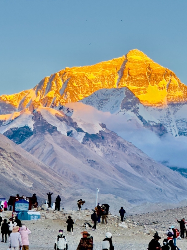
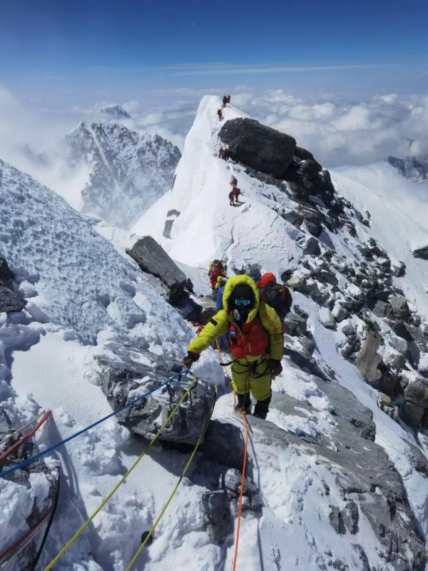
The Mount Everest straddles the border between Tibet and Nepal, known as Qomolangma on the Chinese side and Sagarmatha in Nepal. The current official elevation is 8,848.86 metres, measured jointly by China and Nepal in December 2020. Older sources may still cite 8,848 metres or 8,850 metres. Edmund Hillary and Tenzing Norgay made the first confirmed ascent from the Nepal side in 1953. The first ascent from the Tibetan north ridge came in 1960, by Wang Fuzhou, Gonpo, and Qu Yinhua. The North Base Camp on the Tibetan side sits at approximately 5,200 metres and is reachable by 4WD from the Friendship Highway.
🏔️ Crown Jewel of Tibet: Dive into the detailed history, elevation measurements, and climbing records of the Chinese Highest Mountain.
K2 (Qogir Feng) – The Savage Mountain
K2 (Qogir Feng)
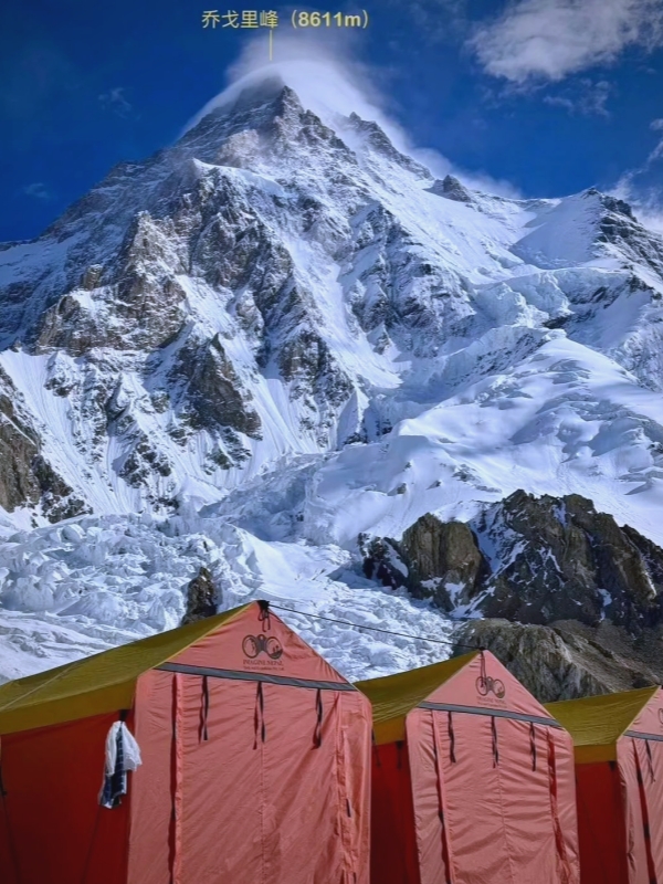
The K2 stands at 8,611 metres on the China–Pakistan border in Xinjiang's Taxkorgan region. Its Chinese name is Qogir Feng, meaning "Chogori" in Balti, or "mountain of mountains." The name K2 comes from the 1856 Great Trigonometrical Survey, which catalogued it as Karakoram 2. The peak carries the nickname "Savage Mountain," partly due to a historically high fatality rate that once approached 25–30 percent before modern expedition standards improved. The first ascent was made in 1954 by Italians Achille Compagnoni and Lino Lacedelli. The Chinese-side base camp requires a multi-day 4WD journey from Kashgar and sees very few foreign visitors.
Kangchenjunga – Five Treasures of Snow
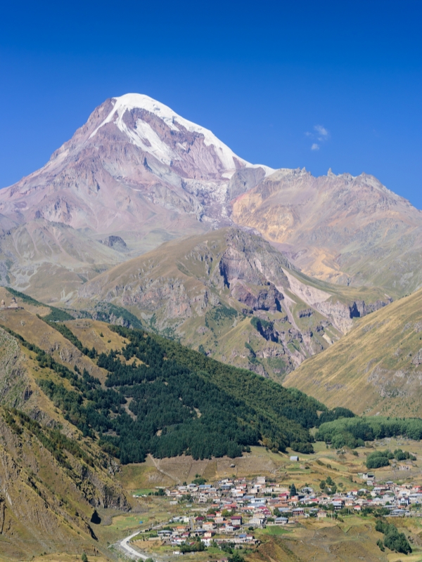
Kangchenjunga
The Kangchenjunga rises to 8,586 metres at the tri-point of India (Sikkim), Nepal, and Tibet. The name translates from Nepali as "Five Treasures of Snow," representing gold, silver, gems, grain, and holy books. The peak is considered sacred, and climbing teams traditionally stop short of the true summit out of respect. A British team led by Joe Brown and George Band made the first ascent in 1955. The Chinese side lies along the remote Sikkim–Tibet border and does not offer routine tourist access.
Shishapangma – Tibet's Only 8,000 m Peak
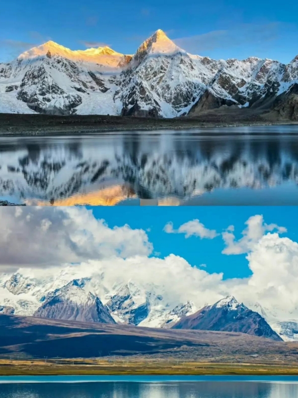
Shishapangma
Shishapangma reaches 8,027 metres in Tibet's Langtang Himal, making it the lowest of the eight-thousanders but the only one entirely within Chinese territory. It is also called Gosainthan. The first ascent in 1964 was achieved by a Chinese-led expedition, marking the first time an all-Chinese team confirmed a summit of an 8,000-metre peak. The mountain is considered one of the more accessible eight-thousanders technically, though altitude and weather remain extreme. Commercial expeditions sometimes use it as a stepping stone before attempting higher peaks.
Snow Mountains Foreign Visitors Can Reach
For visitors without mountaineering experience, China's high-altitude landscape is more accessible than the eight-thousanders suggest. Several large snow mountains offer cable cars, viewpoints, and organised base-camp tours that require no technical climbing skills.
- Mount Everest Base Camp (Tibet): Permit-only organised trip, entrance fee about $26 (¥180) for the Everest Nature Reserve.
- Jade Dragon Snow Mountain (Yunnan): Easiest access near Lijiang, entrance about $28 (¥198) plus roughly $21 (¥150) for the main cable car.
- Siguniang Mountain (Sichuan): Four "sisters" near Chengdu, combined entrance and shuttle about $12 (¥85).
- Muztagh Ata (Xinjiang): Organised tour from Kashgar, climbing permits range about $1,400–1,800 (¥10,000–13,000) on top of logistics costs.
Mount Everest Base Camp (Tibet)
The Tibet side of Everest is accessed via the Friendship Highway from Lhasa, continuing to Rongbuk Monastery and the North Base Camp area at roughly 5,200 metres. Foreigners must travel on an organised tour; independent travel in Tibet is not permitted. The Tibet Travel Permit is arranged by a registered tour operator and requires 10–15 working days to process.
- Permit requirement: Tibet Travel Permit arranged by registered operator; independent travel not allowed.
- Entrance fee: About $26 (¥180) for Everest Nature Reserve.
- Current access note: Post-2019 environmental cleanup restrictions have limited or suspended non-climbing tourist access to the North Base Camp area in some seasons. Confirm current status with your tour operator before booking.
Jade Dragon Snow Mountain (Yunnan)
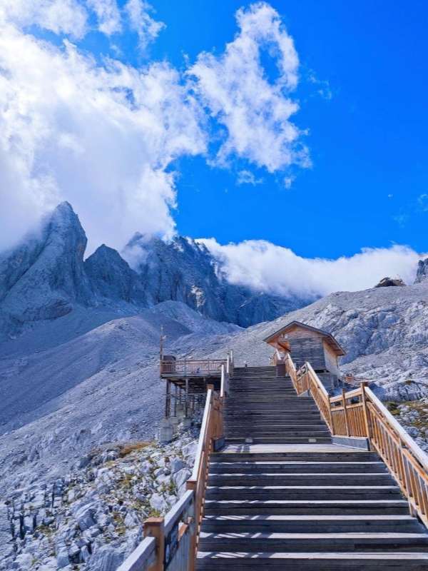
Jade Dragon Snow Mountain (Yunnan)
Jade Dragon Snow Mountain sits just outside Lijiang and is the most accessible high snow mountain in China for foreign visitors. No special permit is required. The main cable car, called Yunyan Ping, reaches 4,506 metres, with views toward the 5,596-metre summit, which is closed to climbing.
- Access: Near Lijiang; no special permit for foreigners.
- Ticket breakdown: Entrance about $28 (¥198); main cable car about $21 (¥150); optional Impression Lijiang outdoor show about $35–42 (¥248–298).
- Altitude tip: Temperatures at the cable-car top drop below freezing even in summer. Pack a windproof layer.
❄️ Yunnan Alpine Gem: Plan your cable car ride, glacier park trip, and ticket booking with our complete guide to Jade Dragon Snow Mountain.
Siguniang Mountain (Sichuan)
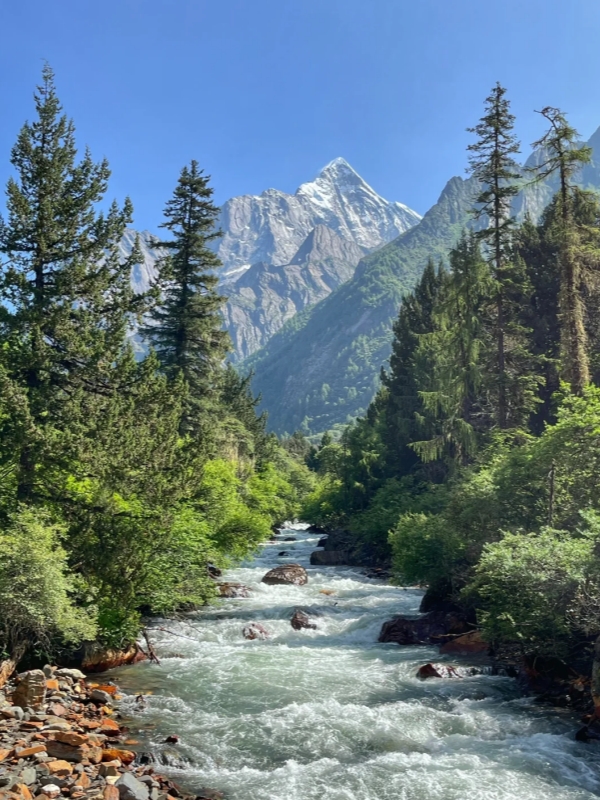
Siguniang Mountain (Sichuan)
Siguniang, meaning "Four Sisters Mountain," is a group of peaks near Chengdu with the highest summit reaching approximately 6,250 metres. The mountain draws both trekkers and climbers. Three valleys are open to visitors: Shuangqiao Valley for sightseeing buses, Changping Valley for trekking, and Haizi Valley for alpine camping and technical climbing routes.
- Location and permits: Near Chengdu; no special permit required for foreigners.
- Valley options: Three distinct areas covering sightseeing, trekking, and camping.
- Ticket and access: Combined entrance and shuttle about $12 (¥85); reachable by public bus or private car from Chengdu in a single day.
Muztagh Ata (Xinjiang)
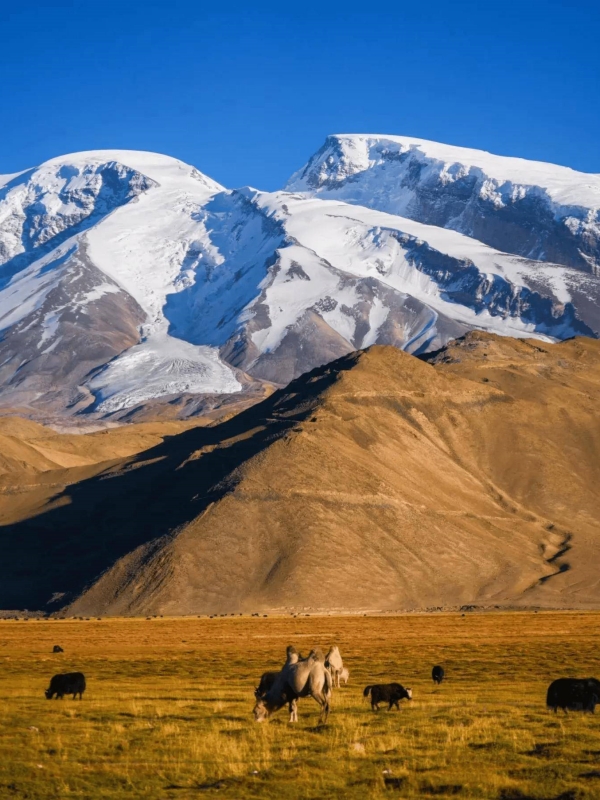
Muztagh Ata (Xinjiang)
Muztagh Ata rises to 7,546 metres in the Pamir range near Kashgar, Xinjiang. Its normal route is non-technical snow and ice, making it reachable by fit trekkers with a guide rather than professional alpinists. This has earned it the label "trekker's eight-thousander." Foreigners must travel with a registered tour operator, and the overall expedition typically runs 12–18 days including acclimatisation.
- Location and character: Near Kashgar, Xinjiang; non-technical normal route suitable for fit trekkers.
- Costs: Climbing permits about $1,400–1,800 (¥10,000–13,000); full guided expedition with logistics and yaks roughly $7,000–12,000.
- Foreigner access and time: Registered tour operator required; allow 12–18 days round trip from Kashgar.
Climbing Difficulty for China's 8,000 m Mountains
No single universal grading applies to the eight-thousanders, but international expedition operators broadly group them into four tiers based on technical demand, logistics, and danger. Climbers typically work up through the easier peaks before attempting the hardest.
- Easiest tier: Cho Oyu (8,188 m) and Shishapangma (8,027 m) are the standard first eight-thousanders for fit, experienced climbers. Commercial guided expeditions typically run three to six weeks and cost roughly $25,000–35,000 per climber.
- Intermediate tier: Gasherbrum II (8,035 m) and Broad Peak (8,051 m) are technically moderate but geographically remote, requiring long overland approaches from Pakistan or China.
- Hard tier: Lhotse (8,516 m) and Makalu (8,485 m) on the China–Nepal border demand high technical skill and acclimatisation depth.
- Extreme tier: K2 and Kangchenjunga are the deadliest and most technically demanding. K2 has been summited fewer than 500 times across all nationalities combined.
After 2019, Tibet closed the Everest North Ridge climbing route to most foreign teams for environmental cleanup. Access is now granted only to registered expeditions meeting strict waste-removal and safety-equivalence standards.
Practical Planning for High-Altitude Trips
All four accessible snow mountains sit well above 3,000 metres, and altitude, permits, and season matter more than physical fitness. Preparation before departure reduces the risk of serious altitude illness.
Permits and Visas
The Tibet Travel Permit (入藏函) is required for Everest Base Camp and other Tibet-side peaks. It must be arranged by a registered tour operator and takes 10–15 working days to process. Xinjiang peaks such as K2 and Muztagh Ata also require foreign visitors to travel with a registered operator, plus an Alien's Travel Permit for border zones near K2. Jade Dragon Snow Mountain in Yunnan and Siguniang in Sichuan require no special permits beyond a standard Chinese visa. Carry your passport in person at every checkpoint; phone-based e-permits are not accepted for Tibet-side peaks.
Best Season to Visit
April–May and September–October are the two main windows for China's high mountains, offering clear skies, stable weather, and passable roads. June–August brings monsoon conditions to the Tibet side, causing muddy roads on the Friendship Highway and leech activity at Siguniang. December–February is bitterly cold, and many high passes close entirely. The Everest climbing window narrows to April–May only.
Altitude Sickness Prevention
Every snow mountain in this article sits above 3,500 metres, with Jade Dragon's cable-car top at 4,506 metres and the Everest Base Camp area at 5,200 metres. Plan at least two nights at intermediate altitude before ascending — Lhasa at 3,650 metres, Lijiang at 2,400 metres, or Chengdu at 500 metres followed by a first night in Rilong. Hydrate well, avoid alcohol for the first 48 hours, and ascend gradually. Persistent headache, vomiting, or confusion are warning signs requiring immediate descent. Diamox (acetazolamide) is available in Chinese pharmacies without prescription, but confirm personal dosing with a travel doctor before departure.
Frequently Asked Questions
Q: How tall is Mount Everest exactly?
The current official elevation is 8,848.86 metres, jointly announced by China and Nepal in December 2020 after a joint survey. Older sources still cite 8,848 metres (1954 India survey) or 8,850 metres (1999 US survey).
Q: Can tourists climb K2 from the China side?
Not in any ordinary tourist sense. The Chinese side of K2 is in remote Xinjiang's Taxkorgan area, requiring a multi-day overland 4WD expedition from Kashgar with a registered tour operator. Summiting K2 remains one of the hardest objectives in mountaineering.
Q: When is the best time to visit China's high mountains?
April–May and September–October work for almost all snow mountains and Tibet-side Everest viewpoints. The Everest climbing season narrows further to April–May only.
Q: Which Chinese snow mountains can non-climbers actually visit?
Jade Dragon Snow Mountain in Yunnan offers a cable car to 4,506 metres with no climbing required. Siguniang Mountain in Sichuan has valleys and short treks open to all fitness levels. The Everest Base Camp area in Tibet is accessible via organised tour. None of these require technical climbing skills.
Q: How many 8,000 m peaks are in China?
Ten of the world's fourteen 8,000-metre peaks stand on or inside China's borders. Nine lie on an international border (six shared with Nepal, four with Pakistan, one with India and Nepal). Only Shishapangma at 8,027 metres sits entirely within Tibet.
Q: Is altitude sickness a real concern at these mountains?
Yes. Every mountain in this article sits above 3,500 metres, and the Everest Base Camp area reaches 5,200 metres. Most visitors need at least two nights of acclimatisation at intermediate altitude before ascending further. Persistent headache, vomiting, or confusion require immediate descent.