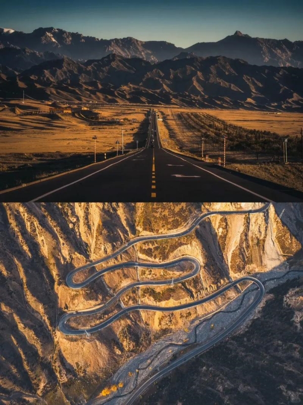
Duku Highway in Xinjiang
Built between 1974 and 1983, the Duku Highway stands as one of China's greatest engineering marvels. During construction, 168 soldiers heroically sacrificed their lives. Today, this legendary road connects Dushanzi in northern Xinjiang to Kuqa in the south, traversing the majestic Tianshan Mountains at elevations reaching 3,700 meters. The highway opens only from June to early October each year, making careful trip planning essential for travelers seeking this once-in-a-lifetime experience.
Duku Highway Essential Information
| Category | Details |
|---|---|
| 🛣️ Official Name | Duku Highway (独库公路) - China National Highway 217 (G217) |
| 📍 Route | Dushanzi (Northern Xinjiang) to Kuqa (Southern Xinjiang) |
| 📏 Total Length | 561 kilometers through Tianshan Mountains |
| ⛰️ Elevation Range | From 500m to 3,700m (Haxilegen Pass) back down to 1,000m |
| ⚠️ Important Restrictions | Open only June-October; Foreign tourists require permits and approved drivers; Vehicles over 7 seats prohibited |
| 🏞️ Scenic Highlights | Desert canyons, alpine forests, grasslands, glacial valleys, snow peaks, wetlands |
| 👥 Local Culture | Kazakh nomadic communities, Uyghur heritage, traditional yurts, ethnic cuisine |
Complete Route: Divided into Three Sections
Northern Section: Dushanzi to Nalati (250km)
-
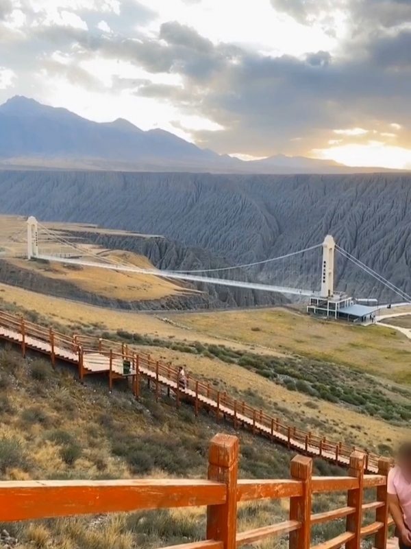

- Dushanzi Grand Canyon
-
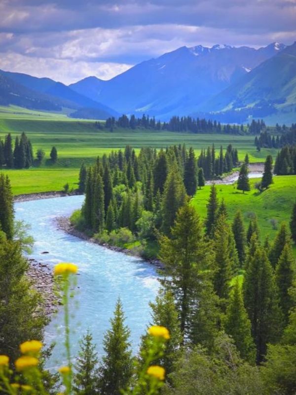
- Tangbula Grassland
-
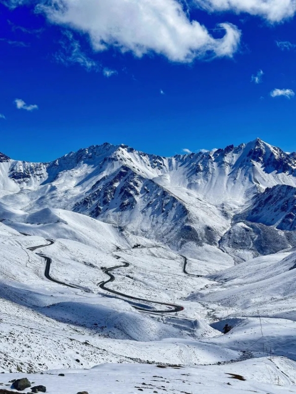
- Haxilegen Pass
Thrilling Ascent: From Desert to Sky
The northern section is the Duku Highway's most challenging and spectacular segment, connecting the Yili region's diverse attractions. From Dushanzi's desert, you'll ascend 3,200 meters over 250 kilometers.. Moreover, this section contains the highway's sharpest curves and steepest grades. However, the scenery is breathtaking: ancient canyons, pristine forests, and legendary Haxilegen Pass.
Core Attractions:
- Dushanzi Grand Canyon (28 km): A 200-400 meter deep canyon with red sandstone cliffs creating intense color contrasts. Best visited in evening (4-6 PM) when sunset illuminates the rocks.
- Tangbula Grassland (100 km): Local Kazakhs call it the "Hundred-Li Gallery" for constantly changing scenery. Allow 2-3 hours for photography stops.
- Haxilegen Pass (150 km): The highway's 3,700-meter highest point with year-round glacial coverage and 100-meter avalanche gallery offering panoramic views.
💡 Altitude Management: Don't spend more than one hour at Haxilegen Pass. Walk slowly and avoid running. Consider taking rhodiola capsules starting three days before departure.
🚗 Challenge Xinjiang’s Most Iconic Switchbacks: While the Duku Highway offers an unforgettable high-mountain drive through mountain passes and grasslands, road-trip enthusiasts heading further south into the Pamir Plateau shouldn't miss the famed 600+ hairpin turns of the Panlong Ancient Road.
Middle Section: Nalati to Bayinbulak (61 km)
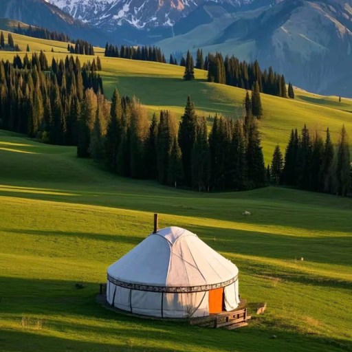
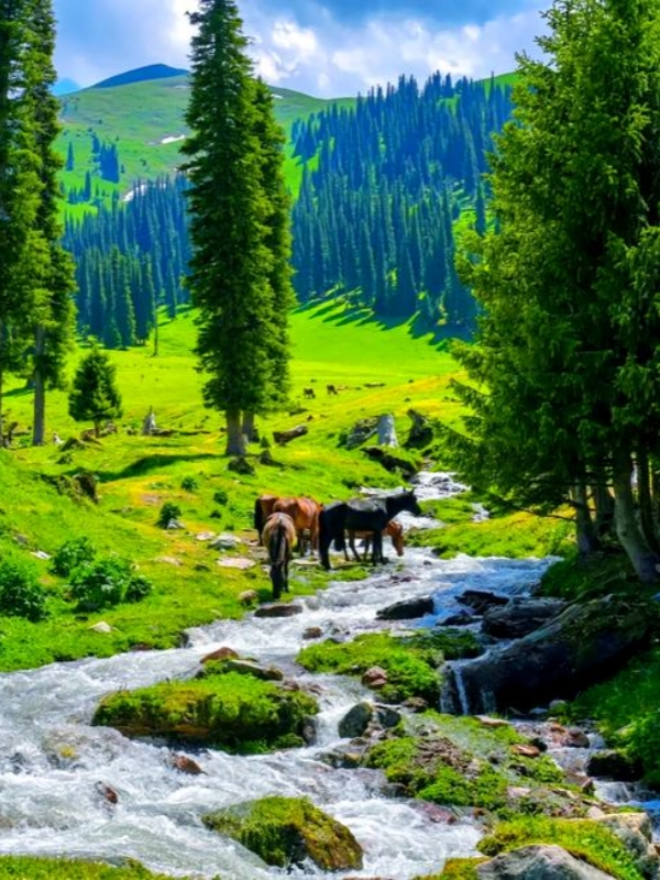
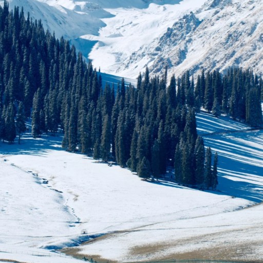
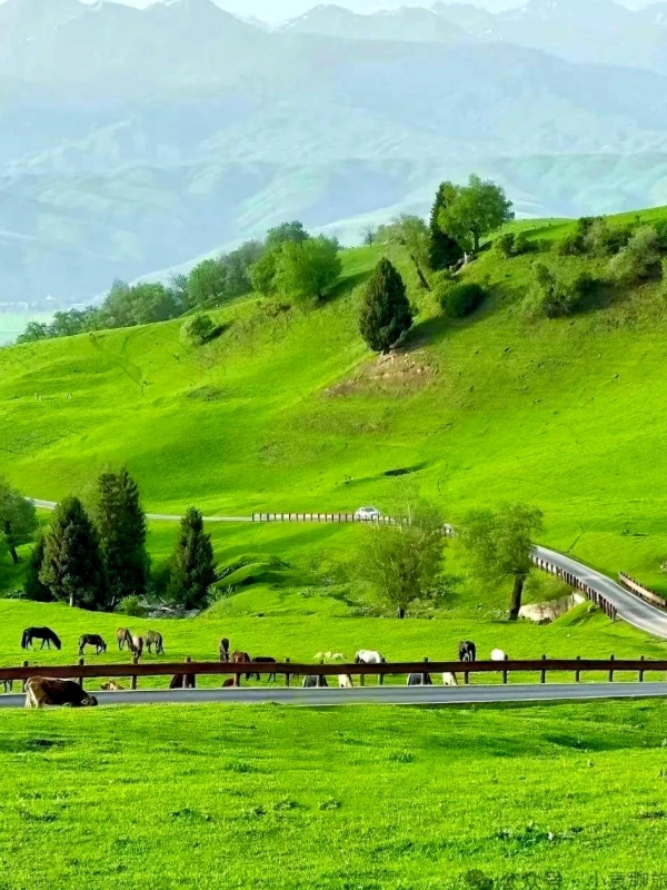
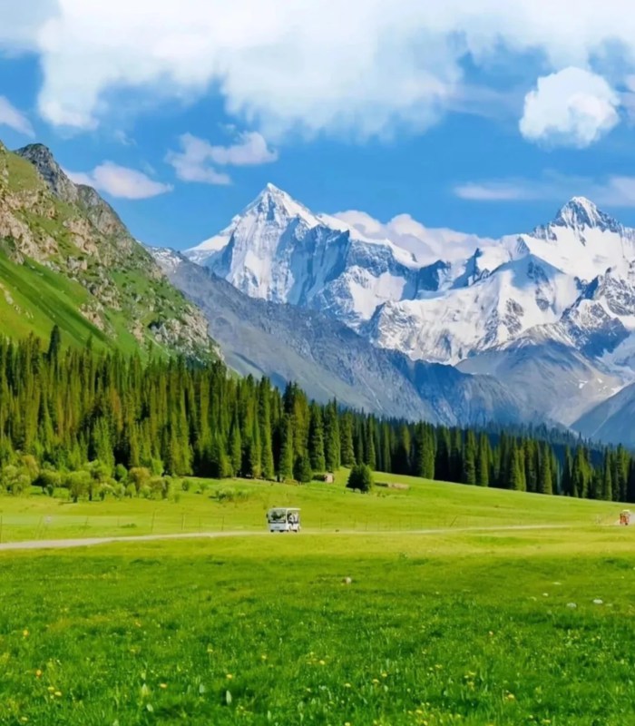
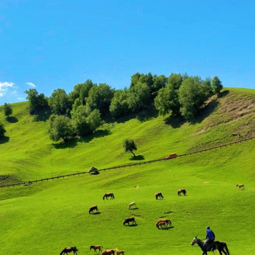
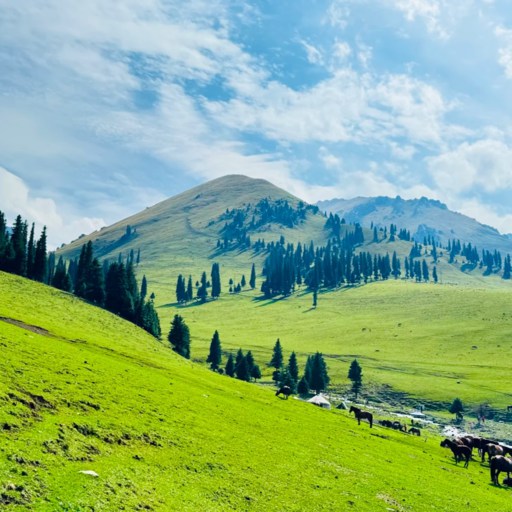

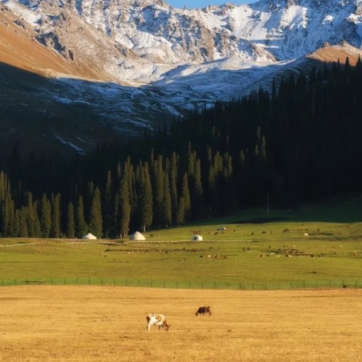
Pastoral Interlude: Grassland Serenity
After the northern section's intense trek, the middle segment offers delightful tranquility. This 61-kilometer stretch is relatively flat between 2,000-2,500 meters elevation. Moreover, it showcases China's most beautiful grassland scenery with river valleys and nomadic culture creating peaceful atmosphere.
Core Attractions:
Nalati Grassland (250 km): This "sky grassland" sits at 2,000 meters with distinct landscape layers: valley rivers, meadow slopes, and distant snow peaks.
Nalati Highlights:
- Valley trails (5 km hiking, 2-3 hours)
- Kazakh yurts offering overnight stays
- Horseback riding (100-200 yuan/hour)
- Wildlife viewing including eagles and marmots
Magical moments occur between 7-9 AM when mist rises from valleys creating ethereal atmosphere. Herders begin daily work while wildflowers glisten under morning dew.
💡 Overnight Recommendation: Spending one night at Nalati significantly enhances your experience. However, accommodations book quickly during July-August, so reserve in advance.
Southern Section: Bayinbulak to Kuqa (250km)
-
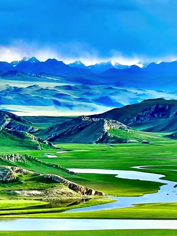
- Bayinbulak Grassland
-
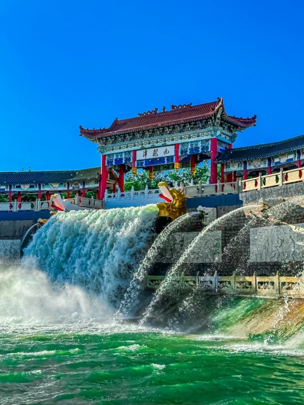
- Dragon Pools
-
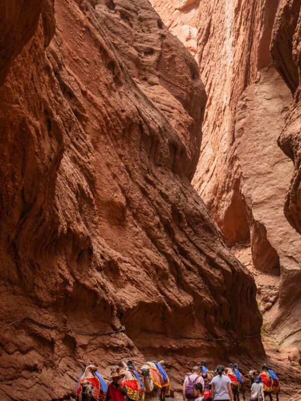
- Tianshan Grand Cayon
Dramatic Descent: From Wetlands to Desert
The southern section showcases the Duku Highway's most stunning terrain transitions. From Bayinbulak's lush wetlands at 2,500 meters, it descends to Kuqa's arid desert at 1,000 meters. Moreover, this 250-kilometer segment condenses millions of years of geological history into a visual feast.
Core Attractions:
- Bayinbulak Grassland (311 km): UNESCO World Heritage wetland where Kaidu River forms the famous "Nine Bends and Eighteen Turns" landscape. Swan Lake hosts thousands of swans (May-September). Best sunset viewing from observation platform.
- Dragon Pools (450 km): Two alpine lakes at 2,400 meters displaying different colors—deep emerald and light turquoise—due to varying mineral content. Local Kazakh families sell fresh milk tea (10 yuan) and nang bread (5 yuan).
- Tianshan Mysterious Grand Canyon (530 km): This 5.5-kilometer red sandstone canyon features peculiar formations carved by wind and water erosion. Highlights include One Line Sky, Echo Wall, and dramatic light-shadow play.
⚠️ Summer Heat Warning: The canyon has no shade with July-August temperatures reaching 40°C. Visit before 9 AM or after 6 PM. Carry at least 2 liters of water per person.
How to Visit the Duku Highway: Planning Your Journey
Can Foreign Tourists Drive the Duku Highway? (Important Information)
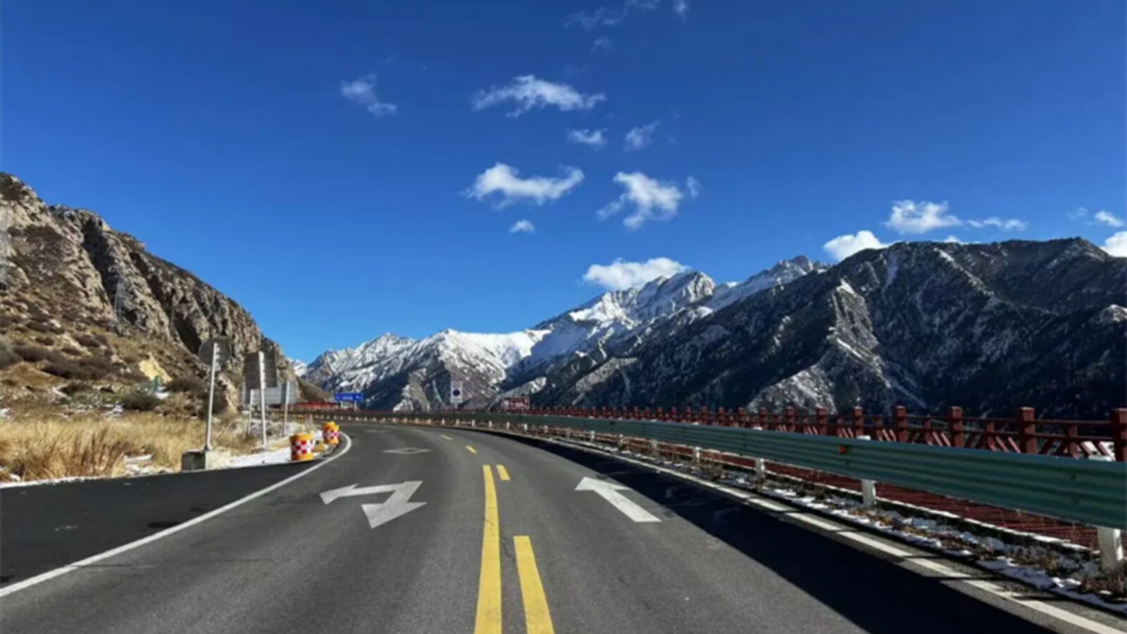
Duku Highway
Important Restrictions: Know Before You Go
Xinjiang implements special regulations significantly impacting Duku Highway travel. Most importantly, foreign citizens are prohibited from independent self-driving throughout Xinjiang. Moreover, certain checkpoints completely prohibit foreigner passage without proper permits.
Foreign tourists must travel through licensed travel agencies handling required permits and providing qualified drivers or guides. Permit processing takes 2-4 weeks, and only registered agencies have authorization. You cannot apply independently.
Legal Options:
- Private Car with Driver (Most Recommended): 3,000-5,000 yuan for three days including professional driver, vehicle, fuel, and permits. Best for couples or small groups wanting flexible timing.
- Small Group Tours: 2,500-4,000 yuan per person for 3 days including transportation, most meals, accommodation, and tickets. Best for solo travelers or budget-conscious visitors.
- Private Guide Plus Driver: 5,000-8,000 yuan for three days with exclusive guide and customized itinerary. Best for deep cultural experiences.
Required Documents: Valid passport (6+ months validity), Chinese visa (L or M), travel permit (processed by agency), hotel confirmations, and detailed itinerary.
💡 Booking Timeline: Contact agencies at least 4-6 weeks before departure. July-August trips need 8-10 weeks advance booking.
Recommended Itinerary: 3-Day Schedule
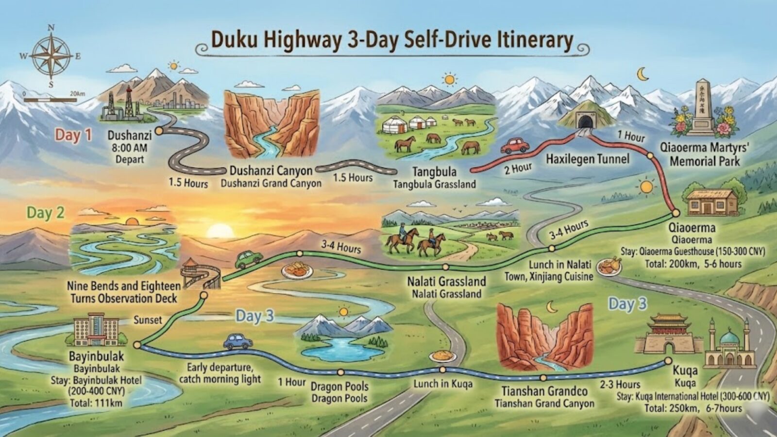
3-Day Schedule in Duku Highway
Optimal Route: Balancing Time with Experience
Three days is ideal for exploring the Duku Highway, allowing leisurely sightseeing without rushing. Moreover, you naturally adjust to altitude changes while visiting all major attractions. However, extra days at Nalati or Bayinbulak greatly enhance your experience.
Day-by-Day Plan:
Day 1: Dushanzi → Qiaoerma (200km, 5-6 hours): Depart 8 AM, visit Dushanzi Grand Canyon (1.5 hours), tour Tangbula Grassland (2 hours), stop at Haxilegen Pass (1 hour), visit Heroes' Memorial, overnight at Qiaoerma guesthouse (150-300 yuan).
Next Day: Qiaoerma → Bayinbulak (111km via Nalati): Explore Nalati valley trails or horseback riding (3-4 hours), lunch in town sampling Xinjiang food, continue to Bayinbulak, watch sunset at Nine Bends observation platform, overnight at Bayinbulak hotel (200-400 yuan).
Day 3: Bayinbulak → Kuqa (250km, 6-7 hours): Early departure catching morning light, stop at Dragon Pools (1 hour), lunch in Kuqa, explore Tianshan Grand Canyon (2-3 hours), overnight at Kuqa International Hotel (300-600 yuan).
Budget: Total per person (based on 2 people): ¥2,400-3,650 including car rental with driver (1,500-2,000), accommodation (350-700), meals (300-500), tickets (150-250), and miscellaneous (100-200).
💡 Flexible Scheduling: Weather may necessitate itinerary adjustments. Maintain scheduling flexibility and don't pack itinerary too tightly—spontaneous stops create the best memories.
Vehicle Restrictions and Road Conditions
Know Your Vehicle: Not All Vehicles Are Permitted
For safety reasons, the Duku Highway enforces strict vehicle regulations. Most importantly, only vehicles with 7 seats or fewer can traverse northern and southern sections. Moreover, the road's design isn't intended for large vehicles.
Allowed/Restricted Vehicles:
- Allowed: Small cars (7 seats or fewer), SUVs and crossovers (ground clearance ≥180mm recommended), four-wheel drive (not necessary but helpful), motorcycles (permitted but challenging).
- Restricted: Tour buses (prohibited on northern section steep grades), large trucks (banned except essential services), vehicles exceeding 7 seats, hazardous material transport (strictly prohibited).
The entire highway is asphalt-paved with varying segment quality. Northern section has steepest grades reaching 12%. Furthermore, continuous sharp curves demand constant driver vigilance. Nevertheless, ordinary sedans can pass under good weather conditions.
Critical Safety Tips: Maximum 40 km/h uphill, 30 km/h downhill. Use engine braking downhill—avoid brake pad overheating. Rest every 90-120 minutes. Keep tank above half—gas stations are 100-150 km apart. Check daily weather forecasts.
💡 Vehicle Preparation: Check tire tread depth (3mm minimum), brake pad thickness (50%+ remaining), spare tire condition, warning triangle, basic tools, first aid kit, tow rope, and flashlight.
Best Time to Visit: Opening Times, Peak Seasons, and Weather Guide
Operating Hours and Seasonal Closures
Limited-Time Access: Plan Your Trip Carefully
The Duku Highway opens only four months annually, typically from early June to early October. This results from extremely harsh winter weather conditions at high elevations. Moreover, snow accumulation at Haxilegen Pass reaches several meters. Therefore, from mid-October through late May the following year, this route becomes completely impassable.
The 2026 opening is expected around June 1st, though the exact date depends on spring snowmelt conditions. Similarly, the road typically closes around October 10th. However, sudden autumn snowstorms may cause early closure. Therefore, checking real-time road conditions before departure is essential.
Where to Check Road Status:
- Official Sources: Xinjiang Transportation Bureau hotline (0991-2865111)
- Real-Time Apps: Gaode Maps (高德地图) shows current road conditions
- Social Media: WeChat group "Duku Highway 2026" provides daily updates
- Hotel Staff: Accommodations along the route receive official closure notifications
⚠️ Important Planning Tip: To ensure smooth access, book during June through September. Moreover, avoid scheduling trips after September 25th, as early closures frequently occur in late September. Additionally, prepare a backup itinerary.
Monthly Weather and Landscape Guide
Timing Matters: Different Experiences Each Month
Choosing the right month significantly impacts your Duku Highway journey. While all four open months feature stunning scenery, each month offers distinct weather and landscape characteristics. Furthermore, tourist density varies by month.
Monthly Comparison
| Month | Temperature Range | Landscape Features | Tourist Density | Recommendation |
|---|---|---|---|---|
| June | 5-20°C | Snow mountains + new greenery | ⭐⭐ | ⭐⭐⭐⭐ |
| July-August | 10-28°C | Wildflowers + grasslands | ⭐⭐⭐⭐⭐ | ⭐⭐⭐⭐ |
| Sept-early Oct | 0-18°C | Golden autumn colors | ⭐⭐⭐ | ⭐⭐⭐⭐⭐ |
Monthly Details:
June - The Green Awakening:
- Landscape: High-altitude areas remain snow-covered while valleys turn green
- Weather: Cool temperatures (5-20°C) with occasional showers
- Crowds: Fewest tourists of the season
- Drawback: Some viewpoints may be difficult to access due to remaining snow
July-August - Peak Season Splendor:
- Landscape: Nalati Grassland blooms magnificently with lush wildflowers
- Weather: Warmest period at 10-28°C, though high-altitude passes remain cold
- Crowds: Expect severe weekend traffic congestion
- Drawback: Accommodation prices increase 30-50% during this period
September to Early October - Golden Autumn:
- Landscape: Birch forests turn golden, creating perfect Instagram moments
- Weather: Cool to cold (0-18°C) with significant temperature variations
- Crowds: Moderate, but surges during China's National Day holiday (October 1-7)
- Drawback: Risk of sudden early closure after September 25th
What to Bring for Variable Weather
Layered Clothing: Handling Extreme Temperature Differences
The Duku Highway's massive elevation changes create unique packing challenges. Indeed, you need summer clothing for valleys and winter gear for high-altitude passes. Moreover, weather can shift from clear to stormy within minutes. Therefore, flexible layered clothing is crucial.
Essential Clothing Layers:
- Base Layer: Moisture-wicking thermal underwear (suitable even for summer at 3,700 meters)
- Mid Layer: Fleece jacket or down vest for warmth
- Outer Layer: Waterproof shell jacket to resist rain and wind
- Accessories: Sun hat, warm hat, sunglasses (UV protection is critical at high altitudes)
Other Essential Items:
- Sun Protection: SPF 50+ sunscreen, lip balm with SPF, UV-protective sunglasses
- Medications: Altitude sickness medicine (acetazolamide), motion sickness medicine, basic first aid supplies
- Electronics: Power bank (at least 10,000mAh), spare camera batteries (cold temperatures rapidly drain batteries)
- Comfort Items: Wet wipes (bathroom facilities are limited), hand sanitizer, tissues
💡 Temperature Reality: Even in July, temperatures at Haxilegen Pass (3,700 meters) drop to 5-10°C, while valley temperatures reach 30°C. Therefore, you may need to add or remove clothing multiple times daily. Keep your backpack in an easily accessible location.
Duku Highway: Frequently Asked Questions
Q: How long does it take to drive the complete Duku Highway?
Driving the complete Duku Highway typically requires 2-3 days with proper sightseeing stops. Non-stop driving takes 8-10 hours, though rushing isn't recommended. The dramatic landscapes deserve appreciation time. Most travelers split the Duku Highway into three segments, allowing altitude adjustment and maximizing photography opportunities along this spectacular mountain corridor.
Q: Is the Duku Highway dangerous to drive?
The Duku Highway presents moderate to high driving difficulty with continuous sharp curves, steep 12% grades, and cliff-side sections. Altitude reaching 3,700 meters affects alertness. However, well-maintained asphalt and experienced drivers navigate successfully. Hiring professional drivers for the Duku Highway ensures safety while enjoying spectacular scenery.
Q: What's the best month to visit the Duku Highway?
September to early October offers optimal Duku Highway visiting conditions with spectacular golden autumn landscapes and decreased crowds. Weather remains stable with comfortable temperatures. However, closure risk exists after September 25th. Alternatively, late June through July showcases lush greenery across the Duku Highway's diverse terrain.
Q: Can I visit the Duku Highway in winter?
No, the Duku Highway closes completely from mid-October through late May. Heavy snowfall at Haxilegen Pass accumulates several meters, making passage impossible. Temperatures plummet to -40°C. Attempting Duku Highway entry during winter closure is both dangerous and illegal. The route reopens only after complete snow clearing in June.
Q: Do I need a permit to visit the Duku Highway as a foreigner?
Yes, foreign nationals require travel permits arranged through licensed agencies to visit the Duku Highway. Independent self-driving by foreigners is prohibited throughout Xinjiang. You cannot apply independently—only registered agencies process Duku Highway permits. The process takes 2-4 weeks, requiring advance planning for legal access.
Q: Are there ATMs and mobile payment options along the Duku Highway?
Mobile payments like Alipay and WeChat Pay work in major Duku Highway towns including Nalati, Bayinbulak, and Kuqa. However, smaller stops require cash only. ATMs exist in larger towns. Foreign credit cards have limited acceptance. Carrying ¥500-1,000 cash remains essential for vendors and services along the Duku Highway route.
Q: What kind of vehicle is best for the Duku Highway?
SUVs or crossovers with ground clearance ≥180mm prove ideal for the Duku Highway's varied conditions. Standard sedans complete the route successfully under normal weather. Four-wheel drive isn't necessary. Most critical for the Duku Highway are reliable brakes for steep descents, good tire tread, and sufficient engine power for sustained climbing.
Q: Is there English signage on the Duku Highway?
English signage remains very limited throughout the Duku Highway with most signs displaying Chinese only. GPS navigation apps function reliably with offline maps despite Chinese interfaces. Hiring English-speaking drivers or guides is highly recommended for foreign Duku Highway travelers. Download translation apps before departure for enhanced communication.
Q: Can I camp along the Duku Highway?
Wild camping is technically prohibited in protected areas along the Duku Highway, though occasionally tolerated in designated spots with permissions. Best potential camping areas include Tangbula Grassland sections. However, facilities are nonexistent and weather turns severe unexpectedly. Staying in established Duku Highway town accommodations is safer and more comfortable.
Q: How does the Duku Highway compare to Highway 318?
The Duku Highway concentrates more diverse scenery than Highway 318 within significantly shorter distance. Highway 318 spans 2,000+ kilometers over 7-10 days, while the Duku Highway presents similarly spectacular but more varied landscapes—deserts, forests, grasslands, snow mountains—in just 561 kilometers over 2-3 days, suiting travelers with limited time better.