Panlong Ancient Road
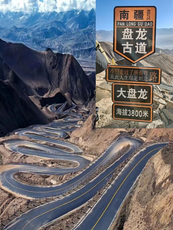
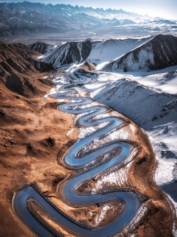
The Panlong Ancient Road climbs through the western Kunlun in Xinjiang, throwing 639 S-bends across roughly 36 km on the way from Taxkorgan town east to Wacha Township. Within that single one-way run, drivers rise ~1,200 m and top out at a 4,216 m summit. On clear afternoons meanwhile, the Pamir ridgeline and Muztagata peak frame the entire route.
The road itself opened in 2019 as a poverty-alleviation connector, but the surrounding Taxkorgan corridor traces much older Silk Road paths — which is where the "ancient" in the name actually comes from. Foreign visitors need a free border-area permit issued in Kashgar before they can drive it, and the season is short: late April through late October, while winter snow seals the route.
Quick Facts
Where the Panlong Ancient Road Sits
Panlong Ancient Road
Around 4,200 km west of Beijing and roughly 290 km by road southwest of Kashgar city, the Panlong Ancient Road sits inside Taxkorgan Tajik Autonomous County in Kashgar Prefecture, Xinjiang. The one-way route links Taxkorgan town — the western gateway and overnight base for most drivers — to Wacha Township in the east. Local coordinates sit near 37.78°N, 75.23°E, with the road threading the transition between the western Kunlun range and the Pamir Plateau.
Geography and Coordinates
The road climbs east-southeast out of Taxkorgan town along provincial route Z710, before peeling off into the bend sequence and dropping into Wacha. Total climb is from ~3,000 m on the western flats to 4,216 m at the summit marker. The nearest international airport is Kashgar Laining International Airport, about 290 km northeast by road; the nearest rail terminal is Kashgar Railway Station. In turn, the wider corridor forms part of the approach to the Khunjerab Pass and the China–Pakistan Friendship Highway.
The Pamir Plateau Setting
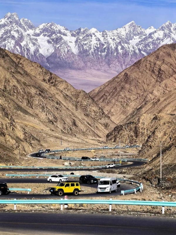
At 4,216 m at the crest, the road sits well above the tree line, and the landscape is bare high-desert mountain — gold and grey scree slopes cut by deep ravines, with the Kunlun ridgeline and Muztagata (7,546 m) visible to the north on clear mornings. The route runs through the cultural homeland of the Tajik (Saricol) people, and the county itself borders Afghanistan, Pakistan, and Tajikistan, which is why a border-area permit is required at every checkpost.
🛣️ Xinjiang's Other Legendary Highway: If you love the dramatic twists and sharp mountain bends of the Panlong Ancient Road and want to experience another bucket-list driving route that cuts right through the heart of Xinjiang's spectacular Tianshan mountains, check out our ultimate guide to the Duku Highway.
Why "Ancient" and Why It Draws Drivers
Panlong Ancient Road
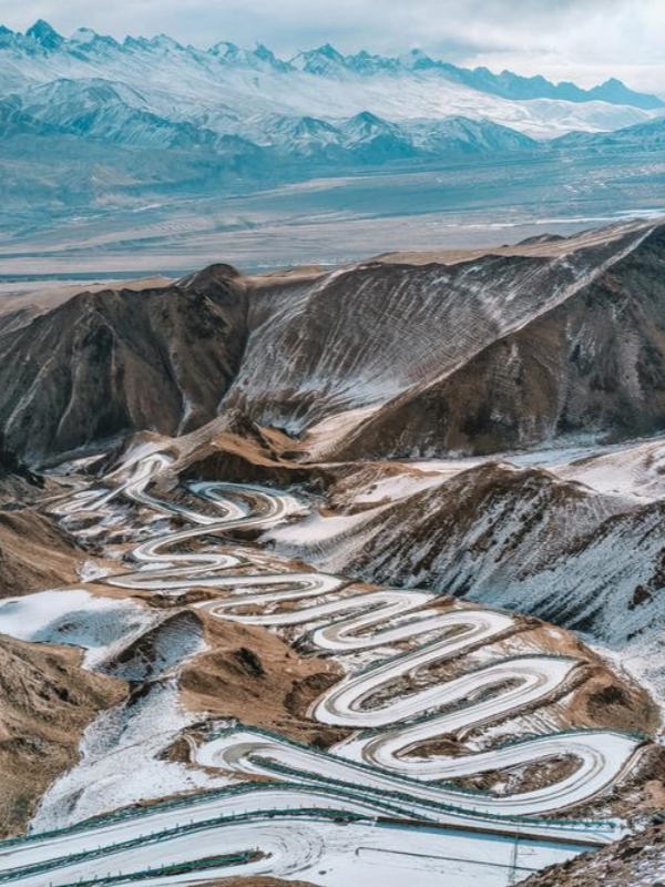
"Panlong" translates as "coiling dragon" — a description of the road's serpentine shape from above, not a clue to its age. In fact, the route opened in July 2019 as a poverty-alleviation road linking Taxkorgan town to Wacha Township, while the "ancient" label reflects the older Silk Road and Tajik heritage of the surrounding Taxkorgan region through which the road now runs.
The Name "Panlong" and the "Ancient" Question
The name means "coiling dragon," given for the S-bend pattern visible from above on satellite and drone imagery. The road itself is less than a decade old, and the "ancient" qualifier sits oddly on a 2019 ribbon of asphalt. The most reasonable reading is that the label belongs to the Silk Road corridor of the Taxkorgan / Pamir region — the Stone City and Tajik village heritage the new road now cuts through — rather than to the surface under the tyres.
The 639-Bend Draw
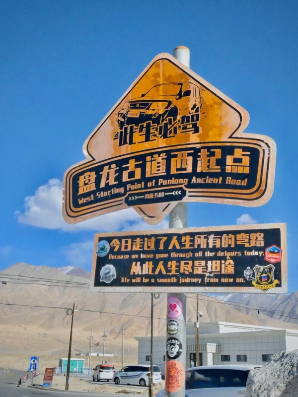
639 S-bends over ~36 km works out at about 20 bends per kilometre, mostly tight 180° and 270° hairpins climbing ~1,200 m. Meanwhile, the 4,216 m summit marker and the bare ridgeline give every bend a clean sightline, which is why drone and telephoto frames of the route read like calligraphy from above. The viral entrance sign reading "Today we have traversed every winding path" has become a pilgrimage photo stop, and most traffic now runs on that viral reputation — serpentine geometry paired with Tajik village culture on either side.
Access Rules, Vehicle Limits, and Seasons
Panlong Ancient Road
The Panlong Ancient Road runs under strict access rules, and the table below summarises the vehicle, schedule, and behavioural limits; the seasonal notes follow.
One-Way Access, Hours, and Speed Limit
Direction is strictly west to east — Taxkorgan to Wacha — and reverse travel is prohibited. Entry is barred after 19:00 even in peak summer, while the speed cap holds at 20–30 km/h throughout. Overtaking on bends is not allowed, and stopping is only permitted at signed viewing platforms; vehicles parked on the verge or shoulder will be towed.
Seasonal Windows and Weather
The road is open roughly late April through late October, and it is closed or impassable from November to March under heavy snow. May and June bring snowmelt, green meadows, and apricot blossoms with daytime temperatures around 5–15°C. July and August are the peak of the season with the clearest summit views, although heavy afternoon rain can trigger landslides. September and October trade green for gold against snow peaks, with 20°C temperature swings between sun and shade.
☀️ Navigating High-Altitude Climates: Because this high-elevation pass cuts through the rugged Pamir Plateau, conditions can shift rapidly from bright sunshine to sudden snowstorms even in the summer months. To plan your driving window safely, be sure to check our breakdown of the region's seasonal conditions in our guide to Xinjiang Weather.
The Four Stages of the Drive
Panlong Ancient Road
The Panlong Ancient Road splits naturally into four stages. Each one changes character — from flat provincial highway through dense hairpin clusters to a final descent past the summit marker.
Stage 1 — Taxkorgan to the Western Entrance
The run-out from Taxkorgan town covers ~24 km in around 25 minutes along provincial route Z710. The asphalt is well maintained and climbs gently through the valley. Refuel fully in town — there are no petrol stations along the bend sequence itself, only the 92 / 95 / 98 octane pumps back in Taxkorgan.
Stage 2 — Western Entrance to the Longji Mountain Boardwalk
About 20 km and roughly 45 minutes of continuous uphill brings drivers into the bend sequence proper. Bend density climbs sharply, and the viral "Today we have traversed every winding path" entrance sign sits here. The Longji Mountain boardwalk opens the first clean drone vantage over the serpentine layout.
Stage 3 — Longji Mountain to Xiao Panlong Viewpoint
This is the densest stretch at ~6 km in roughly 16 minutes. Consecutive 180° hairpins stack back to back along the ridge, while the Xiao Panlong and Huilongguan viewing platforms sit on the right-hand side. Afternoon light works best for telephoto shots of the bends.
Stage 4 — Xiao Panlong to the Terminus at Wacha
The final ~10 km, around 21 minutes, descends from the 4,216 m summit marker, with Muztagata (7,546 m) holding the horizon to the north. The terminus sign echoes the entrance sign, and arrival at Wacha Township completes the one-way route.
Practicalities for Foreign Drivers
Foreign drivers need paperwork sorted before reaching Taxkorgan and a budget sized for the short driving season.
Border Permits and Documents
A passport and a valid Chinese visa are the baseline; on top of that, you need a border-area permit listing "Tashkurgan County" or "Tourism throughout Xinjiang" — free, issued in Kashgar, and valid 7–10 days. Checkposts will not pass vehicles without it, and the same permit covers Taxkorgan town. An international driving permit is required for any self-drive.
Vehicle Choice and Refuelling
- Recommended rig: a 4WD SUV such as a Toyota Land Cruiser Prado or Tank 300.
- Carry: snow chains, full-size spare, oxygen canisters, and a thermos.
- Refuel: full top-up in Taxkorgan (92 / 95 / 98 octane) — no service stations on the road itself.
- Pure EVs: not advised, given no charging points and cold drain at altitude.
Where to Eat and Sleep
Taxkorgan town has Taxkorgan Guest House (oxygen-supplemented rooms), Pamir Hotel, and Mufeng International at $30–115/night (¥200–800). Wacha offers Tajik homestays at ~$22/person/night (¥150), usually including three meals. The local signature food is yak hotpot at $11–17/person (¥80–120); pack water and snacks — there is no food on the road itself.
Budget Reference
- Chartered 4WD with driver: ~$170/day (¥1,200)
- Self-drive SUV rental: ~$57/day (¥400)
- Fuel (Kashgar↔Taxkorgan round trip): ~$28 (¥200)
- Taxkorgan hotel: $30–60/night (¥200–400)
- Wacha homestay: ~$22/night (¥150)
- Yak hotpot per person: $11–17 (¥80–120)
- Road fee: free; Stone City ~$7 (¥50); Karakul Lake ~$7 (¥50)
In short, a 2-person self-drive group typically runs $80–140/person/day, while a 4-person chartered group runs $95–170/person/day.
Safety, Altitude, and Photography
The road's altitude and weather deserve more attention than the bends themselves.
Altitude Sickness and Driving Safety
The 3,000 → 4,216 m climb carries real altitude-sickness risk. Start Rhodiola or Gaoyuan'an 1–2 days before, and descend immediately at any sign of severe headache, dizziness, or palpitations — portable oxygen canisters sell for about $2 (¥15) at Kashgar pharmacies. On the road, hold 20–30 km/h, never overtake on a bend, yield to livestock, switch off the engine as needed, and stop only at signed platforms.
Weather in a Single Day
"Four seasons in a single day" is not a marketing line here. Dawn sits around 0°C with mist, midday climbs to 20°C under intense UV, afternoon hailstorms are possible in July–August, and dusk drops to ~5°C. Dress in removable layers with water- and slip-resistant footwear, and expect landslides in peak rainy season.
Photography Spots and Times
Must-shoot stops: the viral entrance sign, the Longji Mountain boardwalk, the Xiao Panlong platform, the Huilongguan platform, the 4,216 m summit marker, and the terminus sign paired with Muztagata behind. Golden hour runs one hour after sunrise and one hour before sunset, while Wacha's lack of light pollution makes it a strong Milky Way location after dark. Drones are allowed but require prior notification.
Frequently Asked Questions
Q: Where exactly is the Panlong Ancient Road?
Wacha Township, Taxkorgan Tajik Autonomous County, Kashgar Prefecture, Xinjiang, on the Pamir Plateau. The road runs ~36 km one-way from Taxkorgan town to Wacha Township. Taxkorgan town is the western gateway, ~290 km southwest of Kashgar city by road, with coordinates near 37.78°N, 75.23°E.
Q: Do foreign visitors need a border permit?
Yes. You need a passport with a valid Chinese visa, plus a free border-area permit listing "Tashkurgan County" or "Tourism throughout Xinjiang". Permits are valid 7–10 days and issued in Kashgar. Checkposts will not pass vehicles without one; the same permit also covers Taxkorgan town itself and the road.
Q: Can foreigners drive themselves on the Panlong Ancient Road?
Yes — with a visa, the border permit, and a valid driving licence (an international driving permit is recommended). The road accepts ≤7-seat small passenger vehicles only (≤5500×2000×2400 mm, wheelbase <3200 mm). A 4WD SUV is strongly recommended; pure EVs are not advised due to no charging at altitude.
Q: When is the Panlong Ancient Road open?
Roughly late April to late October; the road is closed or impassable from November to March under heavy snow. Daily hours run 10:00–19:00, with entry barred after 19:00. The most reliable windows are May–June (green, blossom) and September–October (gold, snow peaks).
Q: Is the Panlong Ancient Road dangerous?
639 hairpins over ~36 km with ~1,200 m of climb is real work, but it is manageable at the 20–30 km/h cap with no overtaking on bends and engine braking on descents. The main risks are altitude sickness at the 4,216 m peak and sudden weather changes — descend immediately on severe altitude symptoms.
Q: How much does it cost to drive the Panlong Ancient Road?
The road itself is free. Main costs: chartered 4WD ~$170/day (¥1,200), self-drive SUV rental ~$57/day (¥400), Taxkorgan hotel $30–115/night (¥200–800), Wacha homestay ~$22/person/night (¥150), yak hotpot $11–17 (¥80–120). Add ~$28 (¥200) fuel for the round trip. Budget $80–140/person/day for 2 sharing a self-drive, or $95–170/person/day for 4 in a chartered 4WD.
Q: How many bends does the Panlong Ancient Road actually have?
Officially 639 S-bends across ~36 km one-way, averaging about 20 bends per kilometre. Some published listings cite ~30 km in length rather than 36 km, but the 639-bend count itself is consistent across sources. All bends run west to east; reverse travel is not permitted at any time of year.