Hangzhou City Map
Hangzhou sits roughly 170 km southwest of Shanghai along the Qiantang River, capital of Zhejiang province in eastern China. The Hangzhou city map covers about 16,850 square kilometres, holds around 12.5 million residents, and stitches together 10 urban districts, a 12-line metro system, and the UNESCO-listed West Lake basin at its centre. For first-time visitors, an English-language city map of Hangzhou is the fastest way to orient yourself around the lake, pick the right metro line for your hotel, and understand which district groups the major sights. This guide layers those three map elements — districts, metro, and West Lake — with the practical details you need on the ground.
Quick Facts
West Lake and Top Attractions
Hangzhou City Map
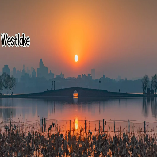
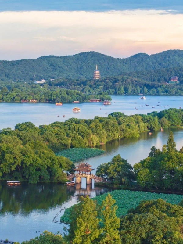
West Lake is a 6.4 km² UNESCO World Heritage site sitting in Xihu District, the western anchor of any Hangzhou city map. The lake and its surrounding hills, causeways, temples, and tea fields formed the Southern Song capital from 1127 to 1279, and the street grid of that era still shapes the modern city centre. Seven landmarks anchor the lake map for first-time visitors.
- Su Causeway and Bai Causeway: The two west–east embankments that cross the lake; Su Causeway is the longer, tree-lined walk; Bai Causeway is the smaller northern embankment.
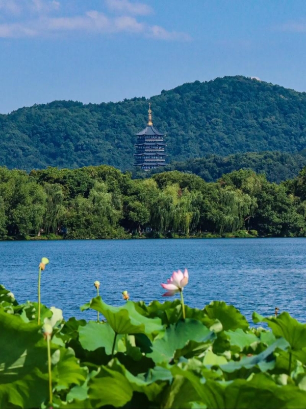
- Leifeng Pagoda: On the southern shore; a five-story tower rebuilt in 2002 on the original Liang dynasty foundation.
- Three Pools Mirroring the Moon: The island group to the west; the most photographed view on the lake, especially at dusk.
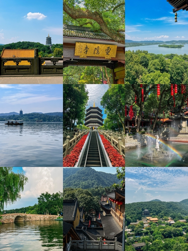
- Lingyin Temple and Fei Lai Feng: On the northern hills; Lingyin is one of the oldest Buddhist temples in China; Fei Lai Feng is a grotto filled with 5th-century rock carvings.
- Longjing Tea Village: Southwest of the lake; terraced tea fields producing the famous West Lake Longjing green tea.
- China National Tea Museum: Near Longjing; the national museum dedicated to Chinese tea history and production.
- Hefang Ancient Street: South of the lake in Shangcheng District; a restored Song-era shopping street with traditional architecture and local snacks.
Around the Lake

Hangzhou City Map
Four walkable clusters cover the lake perimeter and its immediate hills. Each cluster is reachable by metro with a short walk, or by the public bike network.
- Hubin and Eastern Lakeshore: The pedestrian promenade along the lake's east bank; Wulin Square lies just east on Line 1.
- Southern Shore: Leifeng Pagoda, the China National Silk Museum, and the Su Causeway entrance all cluster here.
- Northern Hills: Baochu Pagoda sits on a hill north of the lake; a steep climb leads to views over the water and city.
- Western Causeway and Three Pools: The most photographed stretch; ferries run from the south shore to the islands.
Beyond West Lake
Hangzhou City Map
Four major sights sit outside the lake perimeter but within a short ride. Each makes an easy half-day trip from the waterfront.
- Lingyin Temple complex: About 5 km west of the lake; the Fei Lai Feng grottoes are part of the same temple grounds.
- Hefang Ancient Street: In Shangcheng District south of the lake; restored Song-era market street.
- Six Harmonies Pagoda (Liuhe Pagoda): On the Qiantang River in Binjiang District; a 60-metre octagonal tower dating from the 10th century.
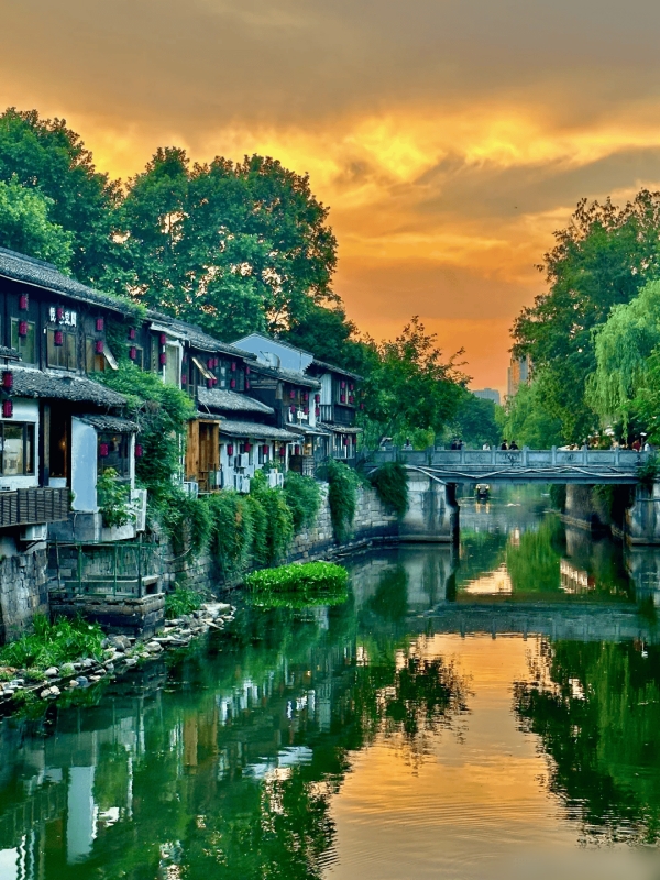
- Grand Canal of China: The UNESCO-listed waterway runs through Gongshu District; canal-side walks and boat tours start at Gongchen Bridge.
🌸 Plan Your Seasonal Visit: Understanding Hangzhou's city layout makes it easy to explore when peach blossoms, blooming gardens, and fresh Longjing tea harvesting bring the lake basin to life. Discover top seasonal itineraries in our guide to Spring Tours in Hangzhou.
Hangzhou City Districts
The 10 districts on the Hangzhou city map follow a logical geographic pattern. The urban core sits west of the Qiantang River, with the lake as its western anchor. East of the river lies Xiaoshan and Qiantang. Outer districts fan north, west, and southwest into mountain terrain. For most visitors, the four core districts contain every major sight worth visiting.
Core Urban Districts
The four core districts contain almost every major attraction on the Hangzhou city map. Shangcheng holds Wulin Square and the lakeside Hubin promenade. Gongshu runs along the Grand Canal corridor north of downtown. Xihu is the West Lake district itself, named for the lake at its centre. Binjiang sits across the Qiantang River and blends tech offices with residential towers. Lines 1, 2, 3, 4, 5, 7, and 19 link all four districts to each other and to the main transport hubs.
- Shangcheng: Downtown south of West Lake; Hubin pedestrian strip and Wulin Square; Hefang Ancient Street nearby.
- Gongshu: North of the Grand Canal; canal-side walking areas and historic waterway views.
- Xihu: Holds West Lake; Su Causeway and Bai Causeway; Lingyin Temple and Fei Lai Feng on the northern hills.
- Binjiang: South bank of the Qiantang River; tech and financial hub; Six Harmonies Pagoda on the waterfront.
Outer Districts and Suburbs
Six outer divisions extend from the urban core into mountain, river, and farmland territory. These areas connect to the metro network via Lines 1, 9, 16, and 19.
- Xiaoshan: Southeast; Xiaoshan International Airport and Hangzhou East Railway Station; Line 19 terminus.
- Yuhang: Northwest; tech and innovation zone; Line 1 and Line 16 connect this district to downtown.
- Linping: North; major rail interchange for Lines 1 and 9.
- Qiantang: East of downtown; newer residential and commercial district.
- Lin'an: Far west; mountain and forest reserves; Line 16 reaches into this district.
- Fuyang: Southwest; river valleys and paper-making towns.
🛶 Explore Hangzhou's Urban Waterways: Beyond the central West Lake district on your map, the city is also home to a massive natural park featuring peaceful reed canals and ancient water villages. Plan your route with our guide to Xixi Wetland.
Hangzhou Metro Lines
Hangzhou City Map
The Hangzhou metro now runs 12 lines that converge on the West Lake and downtown core. The newest addition, Line 19, runs straight from Xiaoshan International Airport to Hangzhou East Railway Station in around 45 minutes. All lines use distance-based fares.
Metro Lines at a Glance
Five facts to keep in mind when planning trips on the Hangzhou metro map. Most West Lake sights fall within 1–2 km of Longxiangqiao, Ding'an Road, or Huanglong Cave stations. Lines 1 and 5 run east–west across the city and connect Hangzhou East Railway Station to the downtown core. Line 19 runs directly from Xiaoshan Airport to the city centre in about 45 minutes. Line 16 reaches Lin'an mountain district to the west. Lines 7, 8, and 9 serve the newer east-bank residential zones.
- West Lake access: Longxiangqiao, Ding'an Road, and Huanglong Cave stations put most lake attractions within walking distance.
- East–west routes: Lines 1 and 5 are the main cross-city arteries; both pass through Hangzhou East Railway Station.
- Airport line: Line 19 connects Xiaoshan International Airport directly to Hangzhou East Railway Station in about 45 minutes.
- West corridor: Line 16 runs from Lin'an District into downtown, reaching mountain areas west of the urban core.
- East bank: Lines 7, 8, and 9 cover the residential and commercial zones east of the Qiantang River.
Key Transfer Stations
Four major interchange stations link the most useful lines for visitors. Checking which of these four is nearest your hotel gives you the fastest route to almost every attraction in the city.
- West Lake Cultural Square: Lines 1 and 3; close to the eastern gate of West Lake.
- People's Square: Lines 2 and 5; the downtown civic hub with good bus connections.
- Ding'an Road: Lines 1 and 4; central cross-axis for moving between north and south.
- Hangzhou East Railway Station: Lines 1, 4, and 19; the main HSR node and the city's largest transport interchange.
Getting Around Hangzhou
The city's transport options cover every distance and budget. The metro runs roughly 06:00–23:00 with fares of ¥2–9 ($0.28–1.30) by distance. Public buses cost ¥2 ($0.28) flat. Taxis flag at ¥11 ($1.50) for the first 3 km, then ¥2.5/km. Didi is the easiest on-demand option. Hangzhou Public Bike has over 4,000 stations. Water buses link canal piers to lake piers.
Metro and Bus
The metro is the fastest option for cross-district travel, particularly Lines 1, 2, 4, and 5 covering the downtown core. Buses run from roughly 05:30 to 22:30 and reach suburbs not yet on a metro line. An English-language metro map is available on the official Hangzhou Metro operator site.
- Best lines: Lines 1, 2, 4, and 5 for downtown coverage; Line 19 for airport access.
- Bus hours: Roughly 05:30–22:30; flat fare ¥2 ($0.28).
- English map: Available on the Hangzhou Metro operator site and in this guide's metro section.
Taxi and Ride-Hailing
Hangzhou taxis are blue or yellow and use a meter. The flag-fall is ¥11 ($1.50) for the first 3 km, then ¥2.5/km. Didi works reliably across the city and is the default choice after 22:00 when the metro closes. An airport transfer by Didi from Xiaoshan International Airport to West Lake typically costs ¥100–130 ($14–18) depending on traffic.
- Flag-fall: ¥11 ($1.50) for the first 3 km; ¥2.5/km after.
- Didi: Works well across the city; easiest after metro hours.
- Airport fare: About ¥100–130 ($14–18) from Xiaoshan Airport to West Lake.
Bikes and Water Bus
Hangzhou Public Bike has over 4,000 stations across the city. The first hour is free with a deposit; Alipay users can unlock bikes through the app without a separate deposit. Canal water-bus routes connect Gongshu Grand Canal piers to West Lake piers. The lake loop cycling route is roughly 13 km and flat, a popular choice at sunset.
- Public Bike: Over 4,000 stations; first hour free; Alipay unlocks without extra deposit.
- Water bus: Routes link Grand Canal piers in Gongshu to West Lake piers.
- Lake loop: Roughly 13 km; flat terrain; popular at sunset.
Frequently Asked Questions
Q: Where is Hangzhou located in China?
Hangzhou is the capital of Zhejiang province in eastern China. It sits roughly 170 km southwest of Shanghai along the Qiantang River, at the southern end of the Grand Canal. The city is a major rail hub on the Beijing–Shanghai high-speed line; the HSR ride from Shanghai Hongqiao takes about one hour.
Q: How many districts does Hangzhou have?
Hangzhou has 10 urban districts: Shangcheng, Gongshu, Xihu, Binjiang, Xiaoshan, Yuhang, Linping, Qiantang, Lin'an, and Fuyang. Beyond these, there is one county-level city (Jiande) and two counties (Tonglu and Chun'an). For visitors, the most relevant districts are Xihu, Shangcheng, Gongshu, and Binjiang.
Q: What is the best way to navigate Hangzhou?
The metro is the fastest option for cross-district trips and airport access. Walking works best around West Lake. Didi handles late-night returns and door-to-door trips. Buses reach outer suburbs not yet served by metro.
Q: Where exactly is West Lake on the city map?
West Lake sits in the western part of downtown Hangzhou, within Xihu District. The lake covers 6.4 km² and is bounded by hills on three sides. It became a UNESCO World Heritage site in 2011. The nearest metro stops are Longxiangqiao, Ding'an Road, and Huanglong Cave.
Q: Is there an English-language Hangzhou metro map?
Yes. The official Hangzhou Metro operator publishes a bilingual network map on its website. The line colours and transfer station names are also laid out in the Hangzhou Metro Lines section of this guide.
Q: How far is Hangzhou from Shanghai?
Hangzhou is about 170 km from Shanghai by road. The fastest option is the high-speed rail, which takes 45–60 minutes from Shanghai Hongqiao to Hangzhou East Railway Station. Second-class HSR tickets cost around $11 (¥73); departures run frequently throughout the day.
Q: What is the best area to stay for first-time visitors?
The Hubin and Wulin Square area in Shangcheng District offers the best transit access, served by Lines 1 and 2. For walkable West Lake access, choose a hotel near Longxiangqiao or Ding'an Road stations. Visitors with short stays or early HSR departures may prefer staying near Hangzhou East Railway Station.
Q: Are there Google Maps views of Hangzhou?
Google Maps covers Hangzhou, though live transit information and Street View depth are limited inside mainland China. Baidu Maps and Amap (Gaode) offer more detailed local coverage. Apple Maps works as a fallback and is a common choice among international visitors in the city.