Dunhuang China Map
A Dunhuang China Map shows an oasis town wedged into Gansu's far northwest, pressed against the Gobi to the north and the dunes of Mingsha Mountain to the south. The Hexi Corridor's ~1,000 km ribbon of oases once carried the overland Silk Road between the Qilian Mountains and the Gobi, and Dunhuang sits at its western mouth — the last reliable water before the desert crossing into Xinjiang.
For example, inside a 25 km radius of the city you can stand inside a UNESCO grotto, ride a camel across singing dunes, and watch the sun set over a crescent-shaped spring. The same Dunhuang China map also tracks two Han-era frontier passes, a beacon ruin, and a museum holding a fragment of the oldest surviving star chart. Two days is the realistic minimum.
Quick Facts
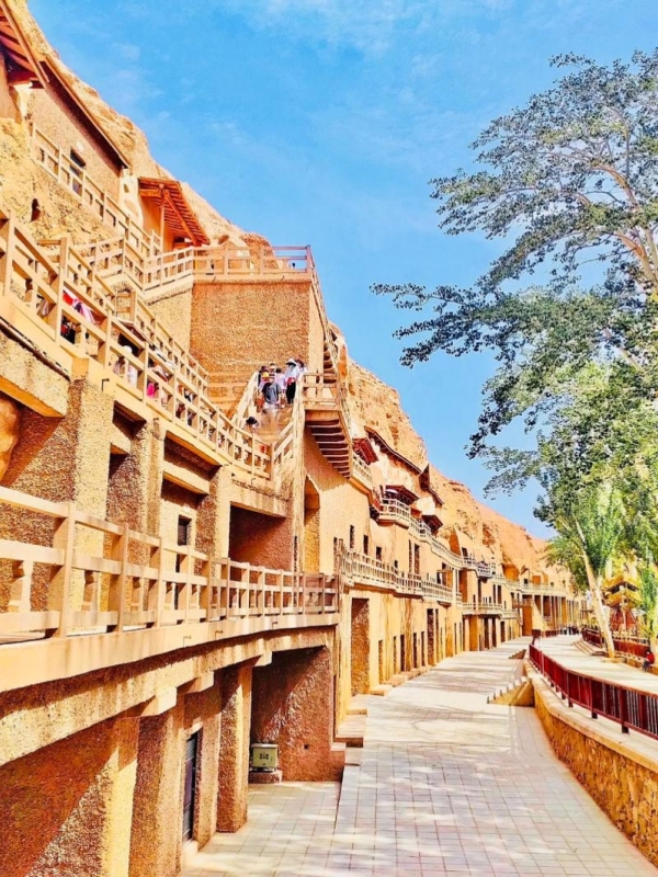
The Mogao Grottoes anchor any dunhuang china map — 492 caves with ~45,000 m² of murals and about 2,000 painted sculptures running along the Dachuan River cliff (UNESCO, 1987). From that single site the rest of the map radiates outward: singing dunes to the south, Han-era frontier passes to the west and southwest, and beacon ruins to the north.
Where Dunhuang Sits on the Map of China
Dunhuang, Gansu, China
A dunhuang china map puts the city at the far northwest tip of Gansu Province, where the Mongolian Gobi meets the Tarim Basin and where the Chinese state's old frontier once ran. The Hexi Corridor runs roughly southeast from here for about a thousand kilometers, threading oases between the Qilian Mountains to the south and the Mazong–Longshou range to the north.
Gansu itself is a long, narrow province; Dunhuang is its westernmost county-level city, before the line crosses into the Xinjiang Uyghur Autonomous Region. Meanwhile, the corridor is the only reliable east–west route across the arid belt of northwest China — which is why caravans, beacon towers, frontier passes, and ultimately Buddhist cave complexes all clustered along this single axis.
Coordinates 40.14°N, 94.66°E put the city several degrees of latitude above the Tropic of Cancer, plainly west of Lanzhou, and inside the Gobi margin. Within a 100 km radius of the city sit four marquee anchors: Mogao Caves to the southeast, the Western Thousand Buddha Caves to the west, Mingsha Mountain and Crescent Lake to the south, and Yumen Pass to the northwest. Yangguan Pass sits a similar distance to the southwest, and the map breaks each one down in the next section.
Dunhuang is administered as a county-level city under Jiuquan prefecture — that administrative frame matters more on a Chinese-language gazetteer than on Google Maps. For the distances foreign travelers usually ask about, here is how the city sits relative to its neighbors.
Key Cities & Their Distances from Dunhuang
🏛️ A Legacy of National Heritages: Dunhuang’s remote desert wonders represent just one spectacular chapter of the country’s vast architectural and cultural heritage. Discover more must-visit landmarks across the country in our master list of China Historical Sites.
Map of Dunhuang's Key Attractions
Dunhuang's tourist map hangs on two axes. The south axis runs city → Mingsha Mountain → Mogao Caves; the west axis tracks the old Silk Road from the Western Buddha Caves out to Yumen and Yangguan Passes. Together they keep any dunhuang china map readable in a single day.
Mogao Caves and the Western Buddha Caves
Mogao Caves
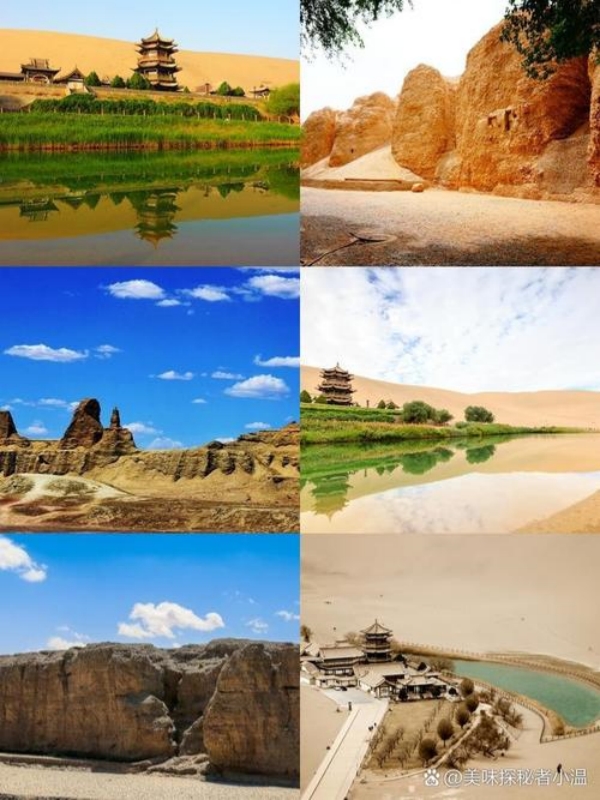
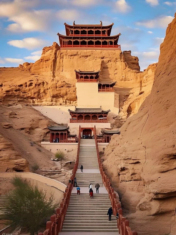
The Mogao Grottoes sit on the east bank of the Dachuan River, ~25 km southeast of the city. UNESCO inscribed them in 1987 under criteria (i)(ii)(iii)(iv)(v)(vi), with construction starting in 366 AD; the site now holds 492 caves, ~45,000 m² of murals, and roughly 2,000 painted sculptures. Entry is by timed ticket through the Digital Exhibition Center, with an English-language guide assigned to each group.
Fifteen km west of the city, at the foot of Dangjia Nanshan, the smaller Western Thousand Buddha Caves serve as a quieter fallback when Mogao's timed slots sell out.
Mingsha Mountain and Crescent Lake
Crescent Lake
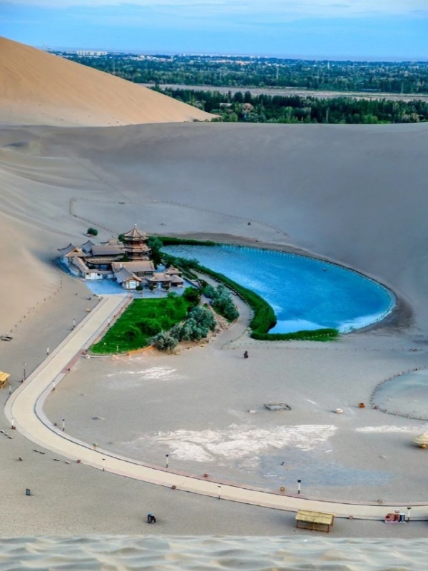
Mingsha Mountain and Crescent Lake sit ~5–6 km south of the old town, signed from the White Tiger Pagoda roundabout, and share a single ticket ($22–29 / ¥150–200 via Klook or Trip.com). Hours run roughly 06:00–19:30 in summer and 07:00–19:00 in winter. Camel rides cost $25–35 (¥180–240) for a 30–45 min loop, and dune buggy plus sand-sliding sit at $7–14 (¥50–100). Bring a face mask — fine sand lifts off the crest on windy afternoons.
Silk Road Passes and Frontier Sites
Yumen Pass
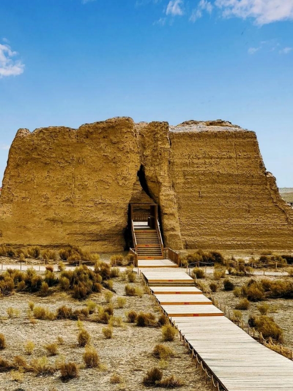
Yumen Pass (Jade Gate, 玉门关) sits ~80 km northwest at ~40.30°N, 93.85°E, the Han-era gateway to the Western Regions. Yangguan Pass (阳关) lies ~70 km southwest. Both sell combined tickets at $11–14 (¥75–100) on Klook or Trip.com, and the Han Great Wall beacon ruin north of the modern city is usually viewed en route to Yumen.
As a result, no public transit serves the passes — a rental car or a pre-booked Klook day-tour ($70–110 / ¥500–800, half-day) is the practical choice on a dunhuang china map.
City Landmarks
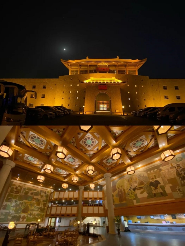
Dunhuang Museum
Dunhuang Museum sits inside the city and is free with ID, though English-language panels are uneven. The smaller Dunhuang County Museum holds the tattered Dunhuang Star Map fragment from the Library Cave — the oldest surviving star chart on paper. The White Tiger Pagoda stands as an open ground in the city center, and Dunhuang Old Street lights up Apr–Oct as a night-market strip for street food and souvenirs.
🐫 Explore the Desert Ruins: To fully experience these ancient frontier passes, beacon towers, and UNESCO grottos scattered across the oasis map, plan your daily itineraries using our comprehensive Dunhuang China Historical Sites Travel Guide.
Dunhuang on the Ancient Silk Road Map
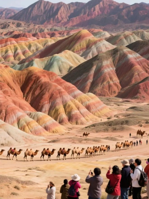
Dunhuang, Gansu, China
On the ancient Silk Road map Dunhuang appears as a single fork point. The Hexi Corridor enters from the east and, near the city, splits into two routes: a Northern Route along the foot of the Tian Shan via Hami, Turpan, and Urumqi, and a Southern Route skirting the Kunlun through Miran and Khotan toward Kashgar. Han Great Wall beacon ruins north of the modern city mark how early this fork mattered — the Han state secured these routes and seeded the earliest Mogao grottoes.
The Library Cave hoard, rediscovered in 1900, grew directly out of that east–west exchange. Caravans loaded silk, lacquerware, and porcelain for the west; they brought back jade, glass, horses, and Buddhist sutras that funded the cave murals and the patronage behind them. The same Mingsha Mountain–Mogao–Yumen Pass axis that guided those caravans still reads cleanly on any modern dunhuang china map, on Baidu or Google satellite view, and on the dunhuang map ancient china that every Silk Road historian has redrawn since.
🐫 Trace the Silk Road Journey: While Dunhuang served as the vital Western gateway before the treacherous desert crossing, this legendary trade network actually began thousands of kilometers to the east. Reconstruct the full historic route starting from its ancient capital origin in Xi'an China Silk Road.
How to Get to Dunhuang
Three realistic entry modes serve Dunhuang. The fastest is air to Dunhuang Mogao International Airport (DNH), 13 km east of town. The classic overland route is the Lan-Xin (Lanzhou–Xinjiang) railway, which terminates here for many eastbound services. Road along G3011 connects east to Jiayuguan (~370 km) and west toward the Xinjiang border, while DiDi ride-hailing, taxis, and pre-booked minibuses cover the spread-out sites once you arrive.
Flying to Dunhuang Mogao Airport
DNH sits ~13 km east of the city. Direct flights link Dunhuang to Beijing, Shanghai-Pudong, Xi'an, Lanzhou, Chengdu, and seasonally to Guangzhou. Trip.com handles booking in USD with a normal e-ticket, and an airport-to-city official taxi runs $7–10 (¥50–70); DiDi ride-hailing matches.
Trains and the Lan-Xin Railway
Dunhuang Railway Station is a stop on the main Lanzhou–Urumqi Lan-Xin line. The Lanzhou → Dunhuang overnight sleeper takes 12–14 hours, with hard sleeper at $38–45 (¥260–320) and soft sleeper at $56–63 (¥400–450). Daytime D-train services from Lanzhou and Jiayuguan shorten the trip. Foreign travelers book via 12306 (passport required) or Trip.com, which emails a pickup code for international-card users.
Road, Bus and Local Transport
G3011 eastbound reaches Jiayuguan in ~5 hours (~370 km); westbound, G215 heads into Xinjiang. Long-distance buses from Lanzhou are slow and infrequent, so most foreign visitors arrive by air or train. Inside Dunhuang, DiDi and taxis cover Mogao (25 km), Mingsha (5 km), and Western Buddha Caves (15 km). Reaching Yumen Pass (~80 km) or Yangguan Pass (~70 km) needs a rental car or a pre-booked Klook day-tour ($70–110 / ¥500–800, half-day).
Frequently Asked Questions
Q: Where is Dunhuang located on the map of China?
Dunhuang sits at Gansu's far northwest tip, ~1,100 km west of Lanzhou and ~1,050 km east of Urumqi. City coordinates are about 40.14°N, 94.66°E — at the Hexi Corridor's western mouth.
Q: Which province and region does Dunhuang belong to?
Gansu Province (甘肃省), administered as a county-level city under Jiuquan Prefecture. It is Gansu's westernmost county-level unit, sitting just beside the Xinjiang Uyghur Autonomous Region.
Q: Can I use Google Maps to find Mogao Caves and Mingsha Mountain?
Google Maps loads slowly or incompletely inside mainland China, even over a VPN. Baidu Maps and Amap (Gaode) pinpoint Mogao Caves and Mingsha Mountain cleanly, and Apple Maps handles browsing a dunhuang china map well from abroad.
Q: Where is Mingsha Mountain on a Dunhuang city map?
Mingsha Mountain sits ~5–6 km due south of the old town, signed from the White Tiger Pagoda roundabout. Crescent Lake lies inside the same ticketed site, so the two are listed together on most maps.
Q: How did Dunhuang sit on the ancient Silk Road map?
At the western end of the Hexi Corridor, the east–west road forked. One branch ran north along the Tian Shan via Hami and Turpan; the other skirted the Kunlun through Miran and Khotan toward Kashgar. The Han dynasty built Yumen and Yangguan Passes to guard exactly that fork.
Q: How far is Dunhuang from Beijing, Shanghai and Lanzhou?
Beijing is ~3 hours direct by air, round-trip about $280–420 (¥2,000–3,000). From Shanghai expect a connection via Lanzhou or Xi'an. Lanzhou is ~1,100 km by road or rail, and the overnight sleeper takes about 14 hours, with hard sleeper around $38–45 (¥260–320).
Q: Which map app works best for foreign visitors in Dunhuang?
Apple Maps handles orientation and stays usable for foreigners in China. Amap (Gaode) is the strongest pick for live Chinese-language navigation once you cross into the country. Pre-download Baidu offline tiles as a backup — phone data gets patchy around the dunes.
Q: Can several Dunhuang sights be visited in one day from the city?
A half-day covers Mogao or Mingsha plus the museum. A full day adds the Western Thousand Buddha Caves and one frontier pass (Yumen or Yangguan). For both passes plus Mogao and Mingsha together, plan a comfortable two days.