Luoyang, Henan, China
Luoyang on a map sits in western Henan Province at roughly 34.62°N, 112.45°E — about 130 km west of Zhengzhou and 350 km east of Xi'an. The city straddles the Luo River, a southern tributary that empties into the Yellow River about 30–40 km north of town. For more than two thousand years it served as the imperial seat of multiple dynasties and now ranks among China's Four Great Ancient Capitals alongside Beijing, Xi'an, and Nanjing.
This guide covers three things: where Luoyang falls on a modern map of China, how its position compares with Anyang and Chang'an on the map of ancient capitals, and how to reach the city by air or high-speed rail from major gateways.
Quick Facts
Luoyang's Location on a Map of China
Luoyang lies in west-central Henan Province, roughly 130 km west of the provincial capital Zhengzhou and about 700 km southwest of Beijing as the crow flies. It sits on the Luo River, a southern tributary flowing into the Yellow River 30–40 km north of the city center. The Qinling–Funiu mountains rise to the south, separating the Guanzhong basin — home to Xi'an — from the North China Plain to the east.
On a national map, the city falls near the same latitude as Xinyang in southern Henan and Shaoxing in Zhejiang. Its inland position keeps it firmly continental — no coast, no major river port, and a climate swinging between dry, cold winters and hot, humid summers. Elevation at the city center sits around 150 m.
Position Within Henan and Central China
Luoyang, China
Henan Province borders Shaanxi to the west, Shanxi to the north across the Yellow River, Shandong to the northeast, Anhui to the southeast, and Hubei to the south. Within Henan, Luoyang's immediate neighbors are Sanmenxia to the west, Jiyuan to the southeast, and Zhengzhou to the east. The city is often grouped with Zhengzhou and Kaifeng as the "Central Plains" tourism triangle — three ancient capitals within a 200 km radius.
On a national scale, Luoyang sits inside the central economic belt that links Beijing, Zhengzhou, Wuhan, and Changsha. It also marks the eastern edge of the Loess Plateau and the western approach to the Funiu Mountains. This geography has shaped the city's strategic value for more than two millennia.
Luoyang's Urban Layout at a Glance
Luoyang, China
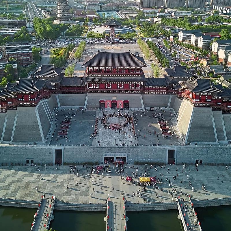
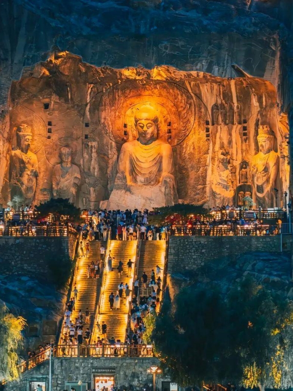
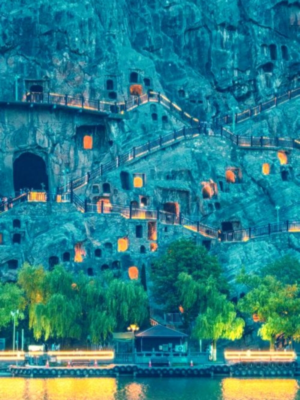
The city straddles the Luo River. Older districts — Xigong, Jianxi, and the Old Town — sit on the north bank. The Luolong New District, seat of the municipal government and main HSR station, occupies the south bank. Longmen Grottoes lie about 12 km south of center, where the Yi meets the Luo. White Horse Temple sits 12 km east.
Two metro lines cover most major visitor nodes. Line 1, opened in 2021, runs east–west across both banks. Line 2, also 2021, crosses it north–south. The Old Town, Luolong, and the eastern museum district are all reachable within 30 minutes by metro or taxi.
Luoyang Among China's Ancient Capitals
Luoyang is one of the Four Great Ancient Capitals of China, an official designation carried by the State Administration of Cultural Heritage. The other three are Beijing, Xi'an (Chang'an), and Nanjing. Over more than a millennium, Luoyang served as the imperial seat of the Eastern Zhou, Eastern Han, Cao Wei, Western Jin, Northern Wei, Sui (as eastern capital), and Tang (as Dongdu, the "Eastern Capital"), plus several of the Five Dynasties.
Its location mattered. The city commanded the Luo–Yellow river confluence, sat where the western mountain passes — Hangu and Tongguan — opened onto the North China Plain, and could project force east toward Kaifeng and south toward the Yangtze. On ancient maps of the Central Plains, Luoyang appears roughly midway between Anyang to the northeast and Chang'an to the west, a position that made it the perennial "second capital" of successive dynasties.
Anyang and Luoyang on the Map of Early China
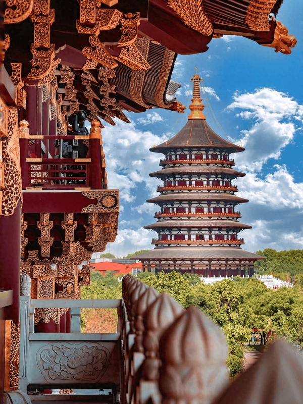
Luoyang, China
Anyang, capital of the late Shang dynasty (c. 1300–1046 BC), lies about 200 km northeast of Luoyang in northern Henan. On a map of Bronze Age China, Luoyang had not yet become a capital, but the Luo River site was already settled. Within a few centuries it inherited Shang-era oracle-bone traditions when the Eastern Zhou court moved east from Haojing in 770 BC.
The two cities anchor the Central Plains north–south axis that defined early Chinese history. Anyang marks the Shang apex. Luoyang marks the start of a new political geography that would last, in one form or another, until the fall of the Northern Song in 1127.
Chang'an and Luoyang Under the Tang Dynasty
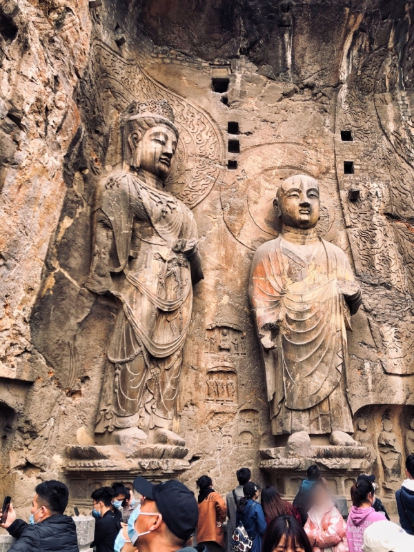
Luoyang, China
Under the Tang (618–907), Chang'an — modern Xi'an, roughly 350 km west of Luoyang on a map — was the main capital. Luoyang held the title of Dongdu, the "Eastern Capital." The Tang court, the administration of Empress Wu Zetian, and major grain-tax convoys all rotated through Luoyang during the dynasty.
A direct imperial road, sometimes called the Luoyang–Chang'an corridor, connected the two cities via Tongguan Pass. On Tang-era maps the two capitals appear as twin hubs of a single political system, with Luoyang controlling the eastern plains and the Grand Canal's eastern terminus at the city's New Port, or Xinde.
🏛️ Exploring the Ancient Capital: If you want to walk through the modern-day landmarks that keep this incredible Tang Dynasty history alive—from the colossal ancient city walls to the world-famous Terracotta Warriors—discover the ultimate itinerary in our guide to the best Things to Do in Xi'an.
Distance from Major Chinese Cities
Luoyang sits inside a broad triangle formed by Beijing, Shanghai, and Xi'an. For foreign travelers, however, the nearest major air-and-rail hub is Zhengzhou, about 130 km east — not Xi'an. The table below gives straight-line and high-speed-rail route distances to the gateway cities most visitors actually fly into. Times and fares for the rail segments are covered in the next section.
How to Reach Luoyang by Air and Rail
Luoyang Beijiao Airport (LYA) handles a small set of domestic routes. Most international visitors instead connect through Zhengzhou Xinzheng International (ZHA), about 130 km east and roughly 1.5 hours away by high-speed rail. The city's main rail gateway is Luoyang Longmen Station on the Longhai HSR line, served by direct G-trains to Zhengzhou, Xi'an, Beijing West, Shanghai Hongqiao, and Lanzhou. Conventional-speed trains still stop at Luoyang Station in the Old Town.
The fare table below covers prices bookable through Trip.com or Klook — the channels foreign visitors can actually use.
From Luoyang Longmen Station, a taxi into the Luolong New District takes about 25–30 minutes for roughly $5–8 (¥35–55). Last-bus times and exact platform numbers are not listed here — confirm on site before traveling.
Frequently Asked Questions
Q: Where exactly is Luoyang on a map of China?
Western Henan Province, roughly 34.62°N / 112.45°E, on the Luo River just south of its confluence with the Yellow River. The city lies about 130 km west of Zhengzhou and 350 km east of Xi'an. Most international visitors land at Zhengzhou Xinzheng, 130 km east.
Q: What province is Luoyang in?
Henan Province, in its western half. Henan is the most populous province in China and lies in the Central Plains between the Yellow River and the Huai River. It borders Shaanxi, Shanxi, Shandong, Anhui, and Hubei. Luoyang's nearest neighbors include Sanmenxia, Jiyuan, and Zhengzhou.
Q: How far is Luoyang from Beijing by high-speed rail?
About 700 km by HSR route. Direct G-trains from Beijing West to Luoyang Longmen take around 4 hours and cost roughly $60–80 (¥430–550). Book through Trip.com or Klook. From Luoyang Longmen Station, a taxi into Luolong New District runs about 25–30 minutes for $5–8 (¥35–55).
Q: How far is Luoyang from Xi'an?
Roughly 350 km straight-line, about 430 km by HSR. Direct G-trains on the Longhai line take about 1.5 hours and cost roughly $25–30 (¥180–220). Xi'an and Luoyang were twin Tang capitals — Chang'an to the west, Dongdu to the east.
Q: Where was Anyang relative to Luoyang on ancient maps?
Anyang lies about 200 km northeast of Luoyang, in northern Henan. Anyang was the late Shang dynasty capital (c. 1300–1046 BC). Luoyang inherited the Central Plains' centrality centuries later, when the Eastern Zhou court moved east from Haojing in 770 BC.
Q: What was Luoyang's role during the Tang dynasty?
Luoyang served as the Tang Eastern Capital, Dongdu, paired with the main capital Chang'an about 350 km to the west. The court, Empress Wu Zetian's administration, and major grain shipments rotated through Luoyang. The Grand Canal's eastern terminus also sat inside the city.
Q: Which airport should I fly into for Luoyang?
Most international visitors fly into Zhengzhou Xinzheng International (ZHA), about 130 km east of Luoyang. From there, an HSR transfer takes about 1 hour, while a taxi runs roughly 2 hours. Luoyang Beijiao (LYA) handles only a small set of domestic routes.
Q: Is Luoyang near the Yellow River?
Yes — the Yellow River runs about 30–40 km north of the city center, and the Luo River that flows through Luoyang joins it just upstream. The Longmen Grottoes are carved into cliffs on the Yi River near its confluence with the Luo, a few kilometers south.