Most people visiting Shenzhen spend their time in Futian or Nanshan and never make it east. That's a shame, because Wutong Mountain — the city's highest peak at 943.7 meters — is sitting right there, free to enter, with five hiking trails and a summit view that stretches all the way to Hong Kong on a clear day. It's one of those places locals visit nearly every weekend that somehow barely shows up in foreign travel guides. This is what you need to know before you go.
Quick Facts about Shenzhen Wutong Mountain
| Wutong Mountain Details | |
|---|---|
| 📍 Location | Luohu, Yantian & Longgang districts, eastern Shenzhen |
| 🏔️ Elevation | 943.7 m — "First Peak of Pengcheng" (鹏城第一峰) |
| 🎫 Admission | Free (Xianhu Garden requires ticket ~¥10–30) |
| ⏰ Opening Hours | 07:00–19:00 daily; last entry 17:00 |
| 🗻 Three Peaks | Big Wutong (943.7 m) · Doufutou · Small Wutong (TV Tower) |
| 🥾 Trail Options | 5 official trails + wild stream routes |
| 🚇 Metro Access | Line 2/8: 4 stations cover all main entrances |
| 🌸 Best Season | Mar–May (azaleas) · Sep–Nov (clearest views) |
| ⏱️ Time Needed | 3–4 hrs single trail · 5–7 hrs full Big + Small Wutong |
| 💧 Water on Trail | ¥3 (base) → ¥6 (mid) → ¥9 (summit); buy extra before |
| 💳 Payment | Alipay & WeChat Pay; RMB cash at small stalls |
| 📞 Emergency | Management: 0755-25708918 · Police: 110 |
| 🗺️ Navigation | Amap (高德地图) — best trail coverage, has English |
| 🐗 Wildlife | Asian wild boar occasionally spotted near streams |
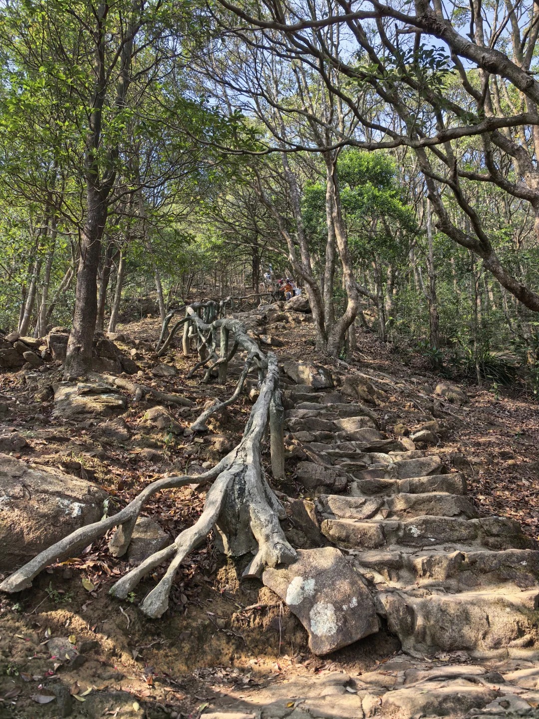
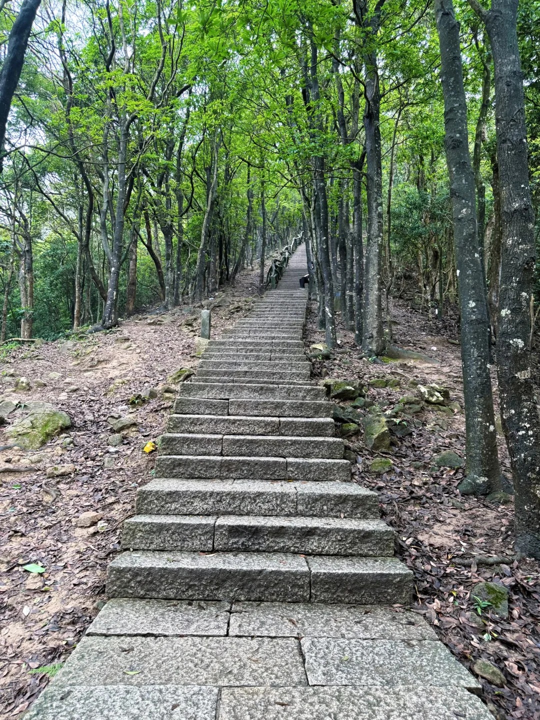
5 Trails Up Shenzhen Wutong Mountain — Pick Your Level and Go
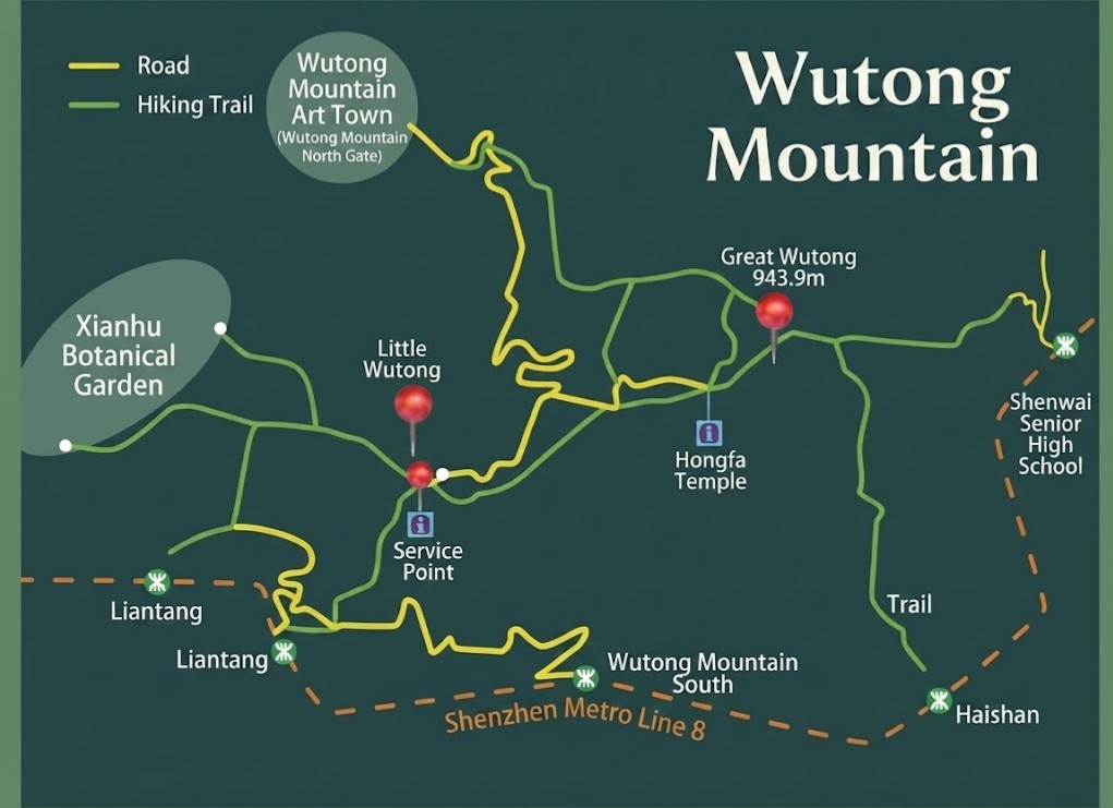
Wutong Mountain Map
The North Gate Classic — Haohanpo Hero Slope and the Most Popular Route on the Mountain
The North Gate Classic
- Start: North Gate (梧桐山北门) — walk from Shenwai Senior Campus Station, Line 2/8
- Distance: ~7.8 km one way
- Duration: 3–4 hrs up
- Difficulty: ★★★☆☆
- Best for: First-timers wanting the full experience with trail facilities along the way
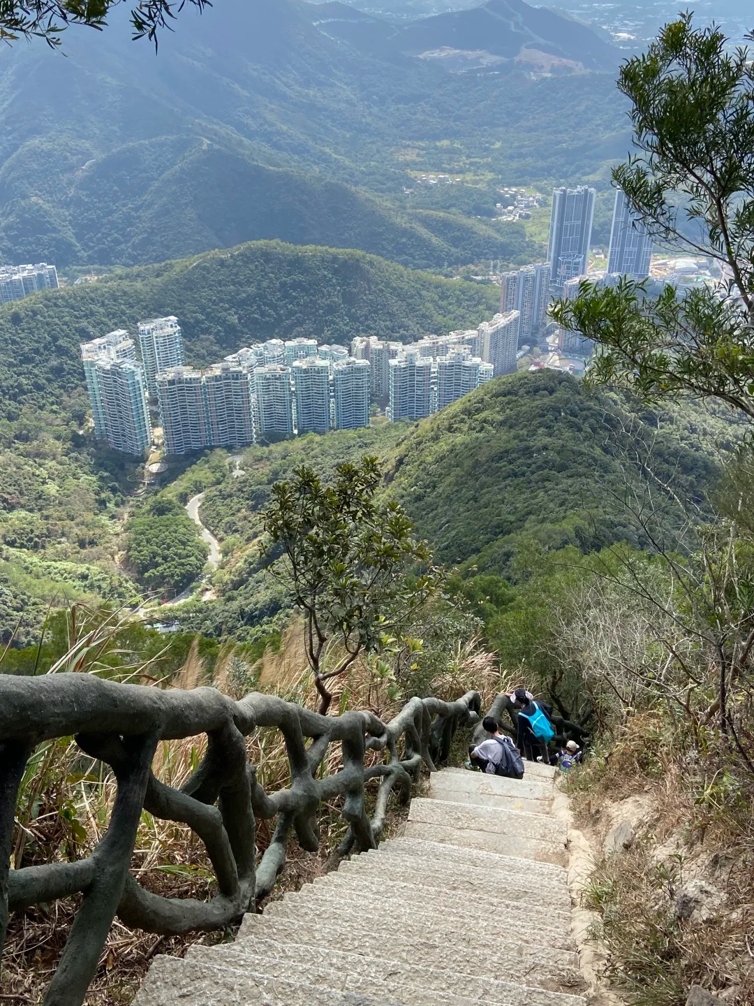
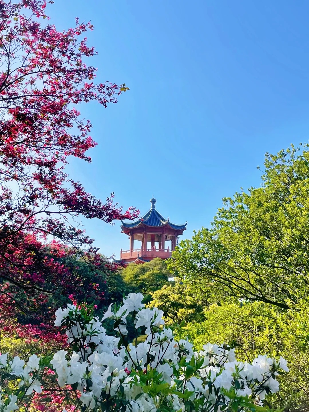
Haohanpo Hero Slope (好汉坡) is what this trail is known for — roughly 1,100 steps at nearly 70°. Most people stop at the bottom to take it in before committing. Haohanpo Square sits midway up with a convenience store, toilets, and benches — the last proper rest stop before the summit. Don't descend the same way; it's hard on the knees. In spring, the North Gate road is flanked by red, white, and purple azaleas on both sides. North Gate is the only entrance with a parking lot (~300 spaces); on weekends, before 8am is when you want to arrive.
Dengyun Trail — Shadiest Path Up, Perfect for Hot Days and First-Timers
Dengyun Trail
- Start: Liantang Station (Line 2/8), or from inside Xianhu Botanical Garden
- Distance: ~8–9 km
- Duration: 4–5 hrs
- Difficulty: ★★☆☆☆
- Best for: Summer hikers, families with kids, anyone who burns easily
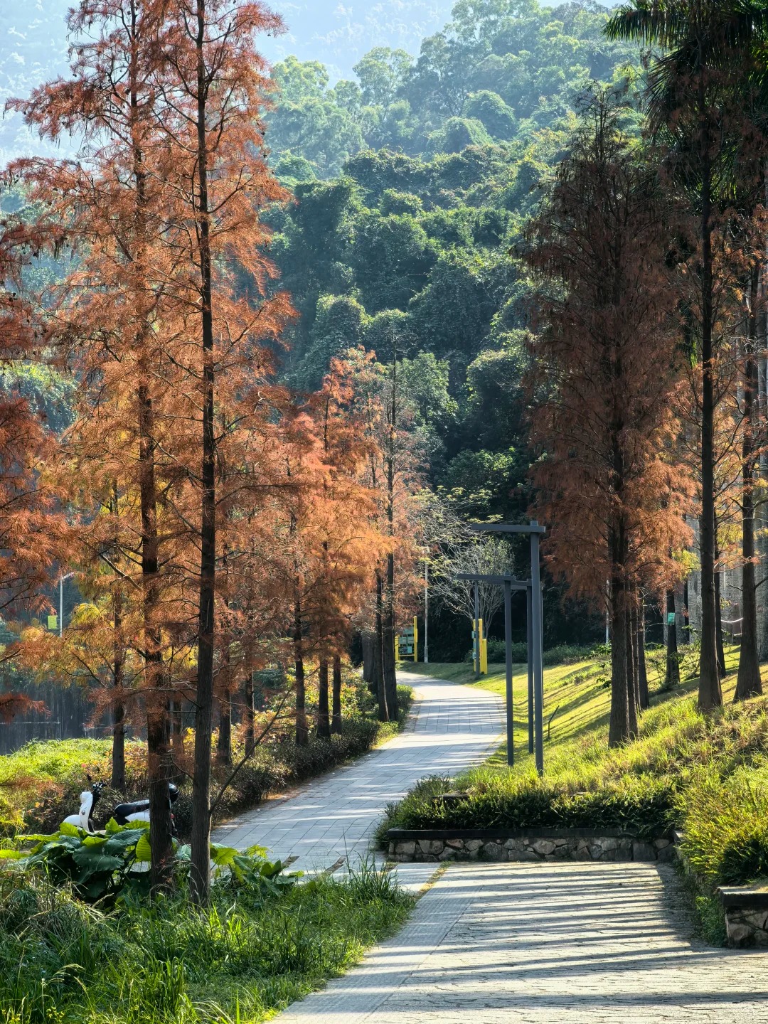
Opened in December 2003, Dengyun Trail has dense tree cover from bottom to top — it's the shadiest official route on the mountain and makes a genuine difference on a humid Shenzhen afternoon. It feels more like a forest walk than a stair climb. Along the way, Shenzhen Reservoir comes into view, and you'll catch glimpses of Hongfa Temple in the distance. Starting from Xianhu Botanical Garden (separate ticket required) lets you loop back through the garden afterward — a natural and satisfying end to the day.
Lingyun Trail — the Steepest Climb on Wutong Mountain and Not for Everyone
Lingyun Trail
- Start: Liantang / Xiantong Sports Park — Lingyun Trail (凌云道) entrance
- Distance: ~1.37 km trail section; ~2–3 km total with approach
- Duration: 2–3 hrs
- Difficulty: ★★★★★
- Best for: Experienced hikers only
凌云 roughly means "reaching the clouds," and the gradient earns that name — max incline around 70°, all stone steps, with sections where you're gripping the railing to pull yourself up. Views toward Hong Kong and Shenzhen Reservoir open up as you gain elevation. Chinese hiking guides are explicit: elderly visitors, children, and those with weaker knees should not descend via this route. Quite a few people find that out the hard way. Don't let it be you.
Bitong Road — the Sea View Route and a Local Favourite for the Descent
Bitong Road
- Start: Haishan Station (海山站), Line 2/8 → 3-min walk to entrance near Yantian District Hospital bus stop
- Distance: ~4.2 km
- Duration: 2.5–3.5 hrs up
- Difficulty: ★★★★☆
- Best for: Sea view chasers; locals doing a North Gate–Bitong through-route
Bitong Road has the best sea views of any trail here. From roughly the midpoint onward, Yantian Port and the South China Sea stay in frame all the way to the summit. In summer, streams run alongside parts of the trail — people stop to cool their feet, which sounds small but genuinely helps. Many locals do "North Gate up, Bitong down" as a one-way traverse. No parking at this entrance, and no shade either — sunscreen is not optional on this one.
Xiutong Trail — Shenzhen Wutong Mountain's Shortest Route When Time Is Tight
Xiutong Trail
- Start: Shenwai Senior Campus Station (深外高中站), Line 2/8, Exit C → behind Shenzhen Foreign Languages School High School
- Distance: ~2.6 km (Xiutong section) + short Bitong Road connection to summit
- Duration: ~1.5–2 hrs
- Difficulty: ★★★☆☆
- Best for: Half-day visitors, repeat hikers, runners
The newest of the five routes, and the most efficiently designed. The path is wide, well-signposted, and has multiple observation decks — each worth a stop for Yantian Port views. One Trip.com user put it simply: "convenient transportation and beautiful scenery." It won't give you the full Wutong Mountain experience, but if you have a morning free and want to stand on Shenzhen's highest point, this gets you there fastest. No parking nearby — take Bus M444/M465 to Banshanbansea Terminal, or use the metro.
What Waits at the Top — Summit Highlights and the Surprises Nobody Writes About
The "Pengcheng First Peak" Stone, Tianchi Lake, and the 360° View
The Pengcheng First Peak Stone
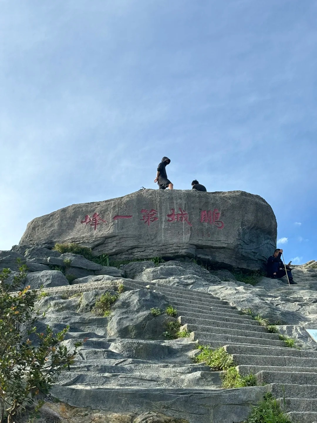
The summit of Big Wutong (大梧桐) has two things worth tracking down once you get there.
The first is the "Pengcheng First Peak" stone marker (鹏城第一峰) — a large engraved rock that shows up in virtually every summit photo taken on this mountain. It's the obvious spot for a group shot. On weekdays you walk straight up to it; on weekends there's a queue. Worth timing accordingly.
About 20–30 minutes past Haohanpo Square, you'll reach Tianchi (天池), a small mountain pond near the top. It's not dramatic in size, but the water reflects the surrounding trees and ridgeline, and it's genuinely quiet up there. Good place to stop before the final push.
The view from the top splits in two directions:
- West (city side): Shenzhen's CBD skyline sits below the cloudline — recognisable towers, dense and grey, fading into haze
- East (sea side): Dapeng Bay opens up in blue-green, with cargo ships queued outside Yantian Port looking almost too small to be real
- North (on clear days): The ridgeline of Hong Kong's New Territories is visible — autumn and winter give the best visibility
Summit Surprises — Live Music, a Phone Network Switch, and the Occasional Wild Boar

Summit Surprises
The summit on a weekend is not a quiet place. Locals bring instruments — erhu, guitar, occasionally a bluetooth speaker for impromptu dancing. One TripAdvisor reviewer noted plainly: "on the weekend you will probably encounter a band on the mountain top." It's unexpected, but it works.
Two other things worth knowing that most guides skip entirely:
- Phone network: Along the Ten-Mile Azalea Trail (十里杜鹃), close to the Hong Kong border, your phone may switch to a Hong Kong carrier automatically. Some people get a "Welcome to Hong Kong" text mid-hike. It's a quirk, not a problem — but it catches people off guard.
- Wildlife: Wild boar have been spotted on descent trails near stream sections. The HikeNTrail group encountered one on the way down and noted it showed no interest in them. Keep distance, don't feed them, keep moving — that's the practical advice.
The Best Time to Hike Wutong Mountain — Season by Season
March to May — the Ten-Mile Azalea Trail Turns the Hillside Three Colors
March to May
The Ten-Mile Azalea Trail (十里杜鹃) runs roughly 5 km between Big Wutong, Doufutou, and Small Wutong. Late March through early May is when it peaks — red, white, and purple azaleas alternating along both sides of the path. The North Gate road gets the same treatment in spring, which makes even the approach worth photographing.
A few practical notes for this season:
- Peak timing: April is the high point; late March and early May are quieter with flowers still showing
- Best light: 9–11am for photography, when the angle is right and the colours read well
- Crowds: Weekends in flower season are genuinely packed — arriving before 8am or going on a weekday makes a real difference
September to November — Clear Skies and the Sea Views Locals Actually Wait For
September to November
After typhoon season ends, the air clears noticeably. This is when the summit views are at their best — Hong Kong's New Territories ridge comes into sharp focus, and on good days you can pick out distant islands. Temperatures sit around 20–28°C, which means far less sweat and a much more manageable climb than summer.
One caveat: September and October can still catch the tail end of a typhoon system. Check the forecast the night before, not the morning of.
Sunrise Hikes — What Time to Leave and Which Gate to Use
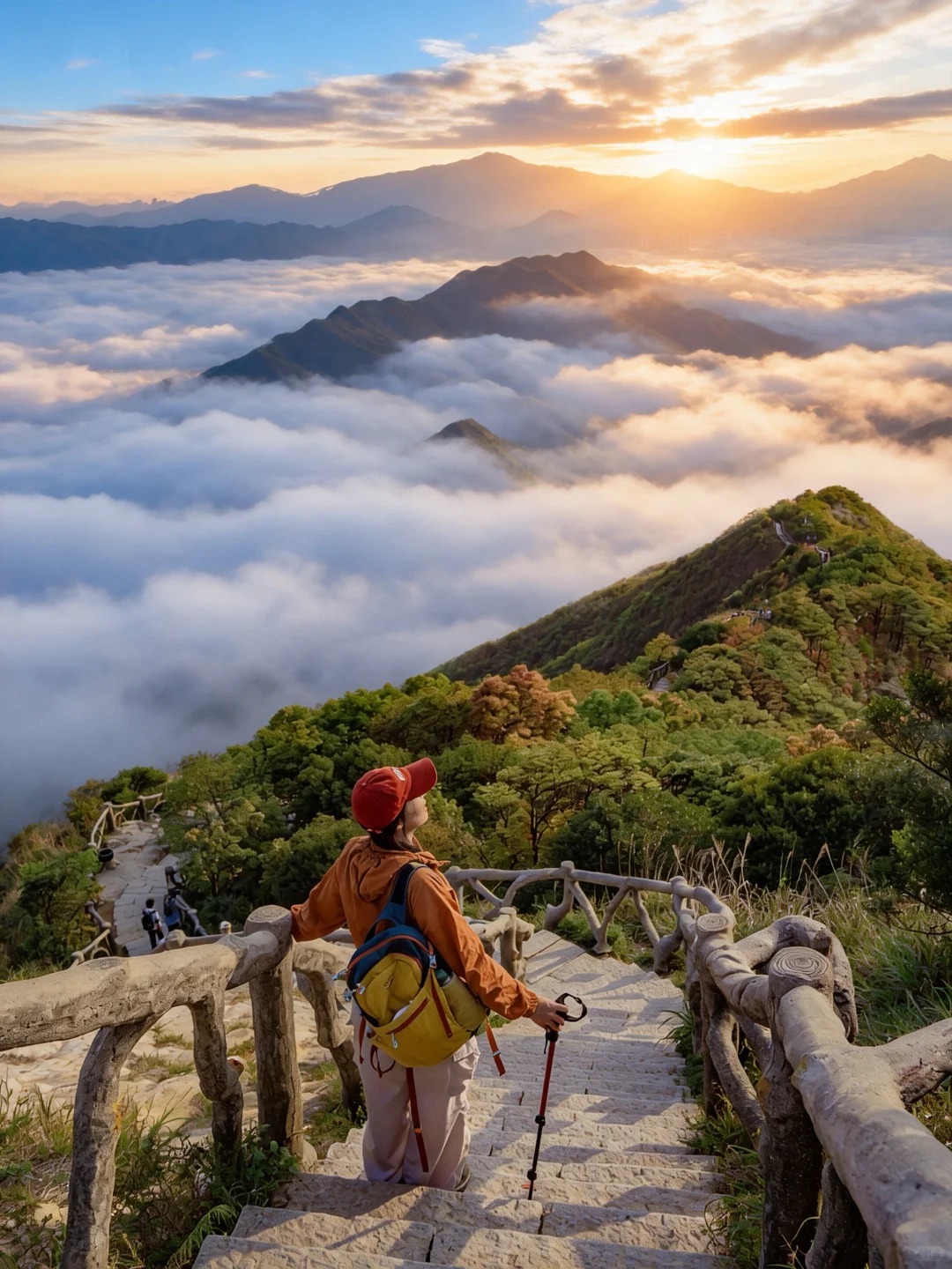
Sunrise Hikes
TripAdvisor reviewers consistently flag Wutong Mountain as one of Shenzhen's best spots for sunrise — and the elevation backs that up at 943.7 meters. The standard route is North Gate → Haohanpo → Big Wutong.
Timing by season:
- Summer (May–Aug): Leave North Gate by 4:30am; sunrise around 5:45–6:00am; ~3 hrs to summit
- Winter (Nov–Feb): Depart around 5:00am; sunrise around 6:45–7:00am
⚠️ Official park hours are 07:00–19:00 — sunrise hikers are technically entering before opening. If you go, bring a strong torch, go with at least one other person, and pack a windproof layer. The summit temperature drops and the wind picks up well before dawn.
How to Get to Wutong Mountain — by Metro from Shenzhen or on a Day Trip from Hong Kong
By Metro from Shenzhen — Line 2/8 Covers All Four Entrances
Wutong Mountain South
Line 2/8 (the orange line) is the easiest way in, and it serves all four main trailheads. Decide which trail you're doing first, then pick the corresponding station.
- South Gate (南门 / Lingxun & Lingyun trails): Line 2/8 → Wutong Mountain South Station (梧桐山南站), Exit D → ~10-min walk to entrance
- North Gate (北门 / Classic route & Xiutong Trail): Line 2/8 → Shenwai Senior Campus Station (深外高中站), Exit C → walk past the school to the gate
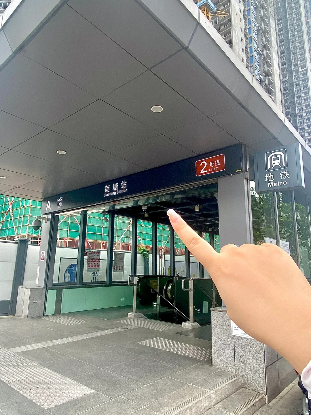
- Liantang entrance (莲塘 / Dengyun & Lingyun trails): Line 2/8 → Liantang Station (莲塘站) → short walk or Bus 211 to the trailhead
- Bitong Road entrance (碧桐道): Line 2/8 → Haishan Station (海山站) → ~3-min walk to the entrance near Yantian District Hospital bus stop
By bus, Route 211 runs to the Wutong Mountain terminal near the North Gate. Bus M445 serves the market area. If you're coming from Huangbeiling, M445 from Exit D is a common option.
Driving is not recommended unless you're going to the North Gate specifically — it's the only entrance with a parking lot (around 300 spaces), and it fills up fast on weekends.
Day Trip from Hong Kong — Full Border Crossing and Metro Guide Step by Step
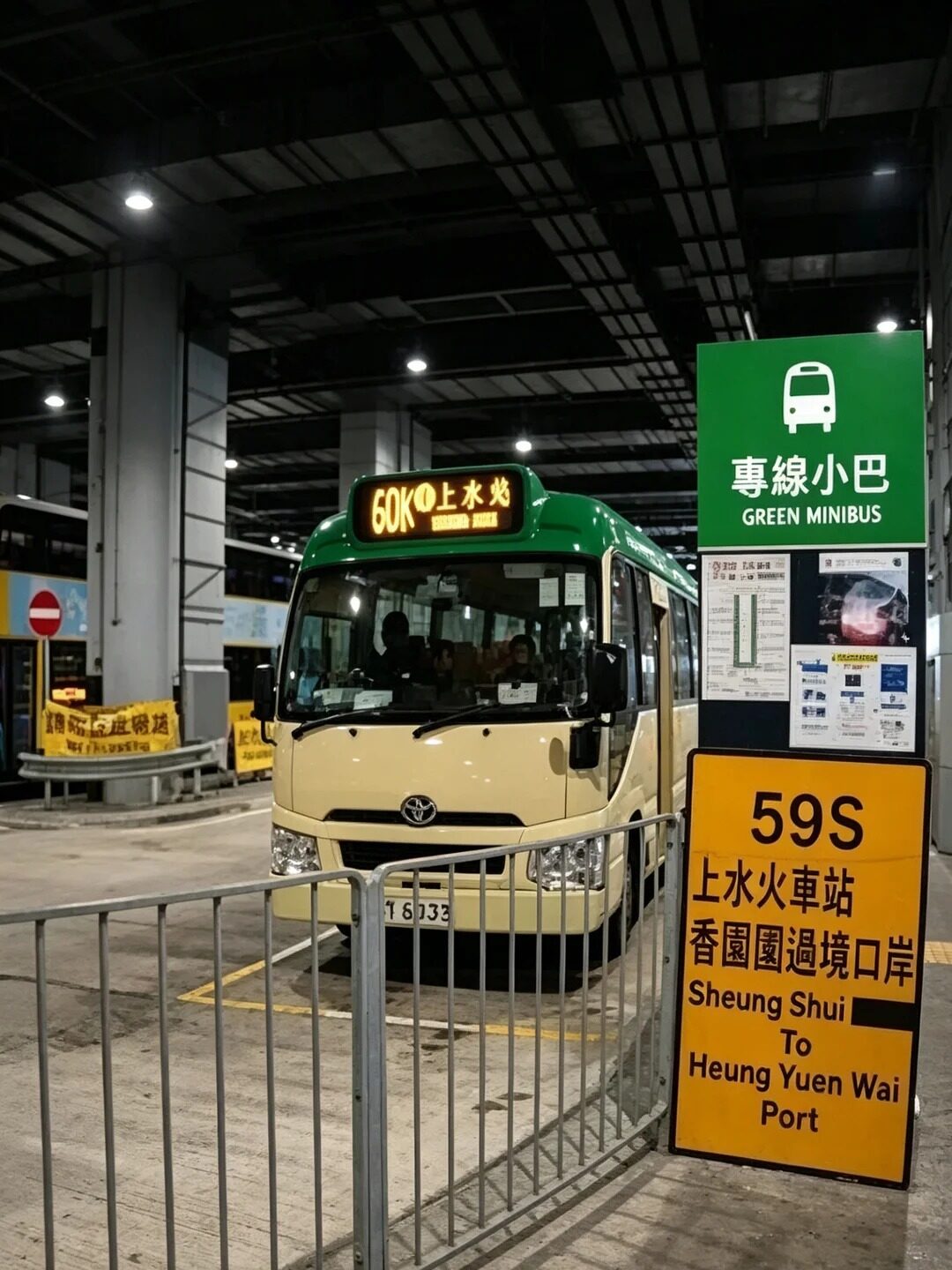
Heung Yuen Wai
Wutong Mountain is a popular weekend trip for Hong Kong residents — on Saturday mornings at the trailhead, you'll regularly hear Cantonese alongside Mandarin. The whole round trip from Hong Kong is doable in a day, and the logistics are more straightforward than most people expect.
Two border crossing options:
Option 1 — Liantang / Heung Yuen Wai (莲塘口岸) — recommended for South Gate:
- Hong Kong side: MTR East Rail Line → Lo Wu Station or Sheung Shui → connect to Liantang boundary crossing (bus or ~20-min walk from Sheung Shui)
- Cross into Shenzhen → Liantang Metro Station → Line 2/8 east → Wutong Mountain South Station
- Best for: hikers targeting Dengyun or Lingyun trails
Option 2 — Lo Wu (罗湖口岸) — simplest overall:
- Hong Kong side: MTR East Rail Line → Lo Wu Station (end of line) → walk across the border
- Shenzhen side: Luohu Station → Line 2 eastbound → Wutong Mountain South Station (梧桐山南站)
- Best for: first-timers who want the most direct route with fewest transfers
Before you go, sort these out:
- Documents: Valid passport and Chinese visa (or Home Return Permit for HK/Macau residents)
- Payment: Set up Alipay (支付宝) or WeChat Pay (微信支付) before crossing — both accept international Visa/Mastercard when linked in advance. Test it before you leave Hong Kong. Small trailhead stalls sometimes take RMB cash, so carrying ¥50–100 is sensible backup.
- Navigation: Download Amap (高德地图) — it has English mode and shows all Wutong Mountain trail overlays clearly. Google Maps works but trail detail is limited.
From central Hong Kong (say, Mong Kok), allow roughly 2 to 2.5 hours to reach the trailhead including border formalities. Earlier crossings on weekends move faster — the queues at Lo Wu after 9am on Saturdays can add 30–45 minutes.
What to Pack and What Things Cost on the Trail
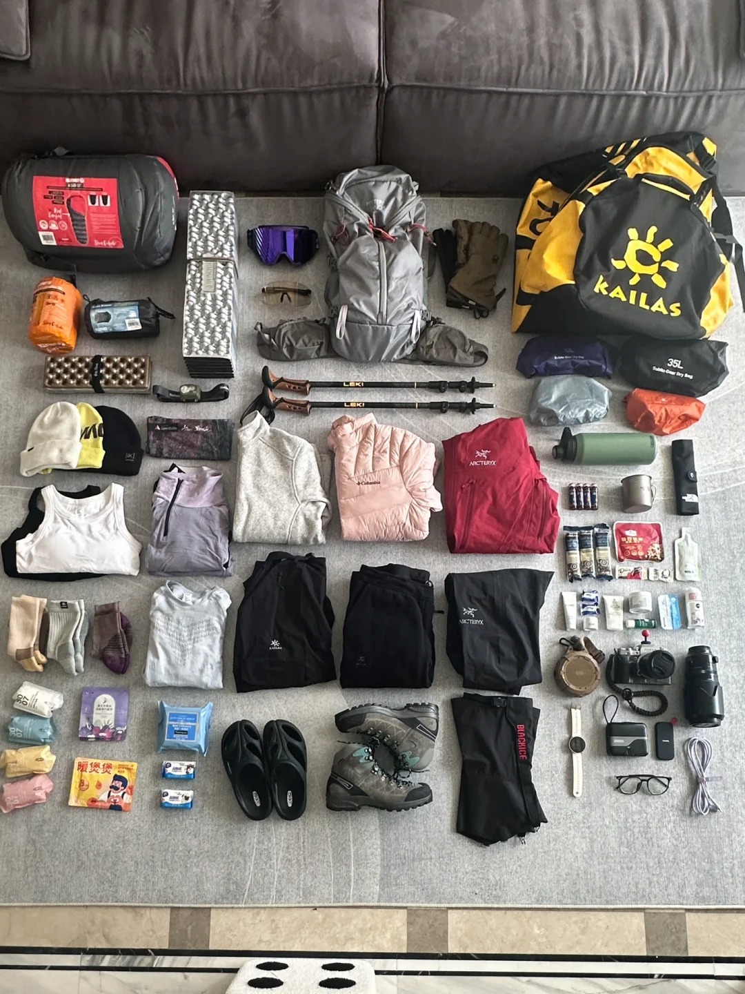
What to Pack
Gear Checklist for Wutong Mountain
Nothing on this list is unusual, but a few items matter more here than on easier hikes. Flip-flops on Lingyun Trail or Haohanpo is genuinely dangerous — both have steep, uneven stone steps that need grip.
- 👟 Footwear: Hiking shoes or trail runners with ankle support — not sandals, not flat sneakers
- 💧 Water: Bring at least 1.5–2L from the bottom (prices on the mountain are 3–4x higher)
- 👕 Clothing: Lightweight moisture-wicking top + a windproof layer — the summit gets cold and breezy even in summer
- 🧴 Sun protection: Sunscreen, hat, sunglasses — UV exposure on open sections is strong
- 🔋 Power bank: Shared charging units are available on trail (¥4.5/30 min), but bringing your own is cheaper
- 🥢 Trekking poles: Optional going up, genuinely useful on the descent — available to buy on the mountain if needed
- 🧥 Rain jacket: Shenzhen weather shifts fast, especially in spring and summer
- 🍫 Snacks: Nuts, chocolate, bread, energy bars — something that travels well
- 💵 RMB cash: Small stalls don't always accept Alipay or WeChat
- 🩹 Basic first aid: Plasters and antiseptic wipes take up almost no space
Water Prices on the Mountain and How to Pay for Everything
Buy your water at the bottom. Prices increase steadily as you climb:
| Location | Price (500ml Nongfu Spring) |
|---|---|
| Convenience store at base | ¥2 |
| Trailhead vendors | ¥3 |
| Mid-mountain stalls | ¥6 |
| Near the summit | ¥9 |
Stocking up at the base saves you ¥10–20, which is a decent meal at a noodle shop afterward. The stalls on the mountain also sell cut fruit (watermelon, oranges), energy bars, and 辣条 (spicy gluten strips) — a Chinese snack that's worth trying if you haven't.
For payment:
- Alipay / WeChat Pay: Most widely accepted, including at vending machines and mid-mountain shops. Both apps support international Visa and Mastercard — link your card before the trip and test it
- RMB cash: Still accepted at smaller stalls; carry ¥50–100 in small notes as backup
- Shared power banks: Available at Haohanpo Square and a few other rest stops at ¥4.5 per 30 minutes
Where to Eat After the Hike
Restaurants Near the North Gate
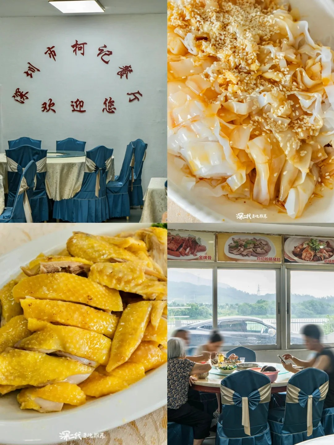
Ke Ji Restaurant
Both options here are within walking distance of the North Gate — useful when your legs are already done for the day.
- Ke Ji Restaurant (柯记餐厅): The go-to spot for post-hike locals. Known for Cantonese white-cut chicken (白切鸡) — poached simply, served at room temperature, dipped in ginger-scallion oil. It's one of the clearest expressions of Cantonese cooking — no heavy sauce, just the quality of the ingredient. Straightforward and satisfying after a long climb.
- Fanghua Xuan Hakka Restaurant (芳华轩客家菜): Hakka cuisine is one of the three major culinary traditions of Guangdong, and this place does it well. Stuffed tofu (酿豆腐) and salt-baked chicken (盐焗鸡) are the dishes to order. Prices are reasonable and portions are generous.
Restaurants Near the South Gate and Yantian
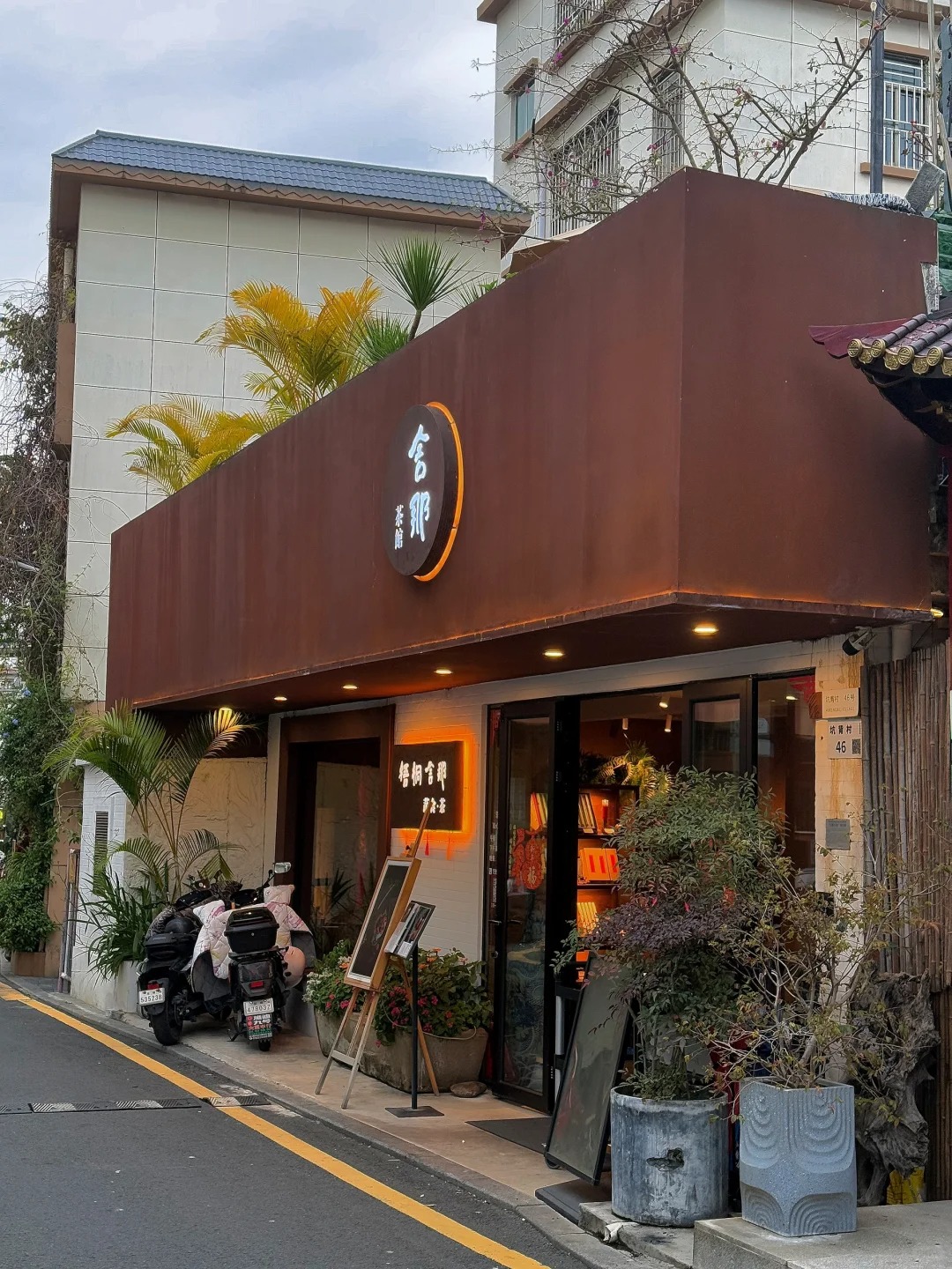
Wutong She Na Vegetarian
- Desheng Restaurant (德胜酒楼): Classic Cantonese dim sum near the South Gate. Works well for a late breakfast or early lunch before the hike, or a sit-down meal after. Note that dim sum service typically ends by 14:00 — if you're finishing the trail in the afternoon, you may have missed the window.
- Wutong She Na Vegetarian (梧桐舍那·蔬食·茶): A vegetarian restaurant and teahouse with garden seating. Quieter atmosphere, slower pace — a genuinely good option for anyone who wants to decompress after the climb rather than rush to the next thing. The only spot on this list that works for non-meat eaters.
If you've come down via Bitong Road or Xiutong Trail into the Yantian area, there are seafood restaurants along the coast worth trying. Pairing that with a walk along the Yantian Coastal Boardwalk before dinner is a reasonable way to end the day.
FAQ about Wutong Mountain Shenzhen
Q: Is Wutong Mountain in Shenzhen free to visit?
Yes, entry to Wutong Mountain Scenic Area is free. There are no gate fees for any of the five main trails. The one exception is Xianhu Botanical Garden (仙湖植物园), which requires a separate ticket — around ¥10–30 depending on the season. If you're starting the Dengyun Trail from inside the botanical garden, factor that in. Parking at the North Gate costs extra, but taking the metro avoids that entirely.
Q: How long does it take to hike to the top of Wutong Mountain?
It depends heavily on which trail you take and how fit you are. The Xiutong Trail is the shortest at around 1.5–2 hours to the summit. The North Gate Classic via Haohanpo takes 3–4 hours. If you're doing the full traverse — Big Wutong, Doufutou, and Small Wutong — allow 5–7 hours total, plus descent time. Most people underestimate how long the descent takes, especially on steeper routes like Lingyun or Haohanpo.
Q: Which trail is best for beginner hikers on Wutong Mountain?
The Dengyun Trail is the most beginner-friendly option. It has a gentler gradient than most other routes, full tree cover for shade, and good signage throughout. The North Gate Classic is also manageable for beginners, though Haohanpo Hero Slope will test people who aren't used to sustained climbs. Avoid Lingyun Trail as a first experience — the 70° incline sections are steep enough to put people off hiking altogether.
Q: How does Wutong Mountain compare to hiking in Hong Kong?
In terms of elevation, Wutong Mountain at 943.7 meters is slightly lower than Hong Kong's Tai Mo Shan (957 meters), but the character of the hike is different. Wutong has more steps and paved sections, which makes it feel more structured. The views combine both city skyline and sea — something most Hong Kong trails don't offer simultaneously. For Hong Kong hikers looking for a change of scenery without flying anywhere, it's a solid half-day option.
Q: Can you see Hong Kong from the top of Wutong Mountain?
On a clear day, yes — the ridgeline of Hong Kong's New Territories is visible from the summit. Autumn and winter give the best visibility, after the humid summer haze clears. One detail worth knowing: if you're walking the Ten-Mile Azalea Trail section near the Hong Kong border, your phone may automatically switch to a Hong Kong carrier network. Some people receive a "Welcome to Hong Kong" message mid-hike. It's harmless, just unexpected.
Q: When are the azalea flowers in bloom on Wutong Mountain?
The main bloom period runs from late March through early May, with April being the peak. The Ten-Mile Azalea Trail (十里杜鹃) between Big Wutong, Doufutou, and Small Wutong is the main stretch — red, white, and purple flowers running about 5 km. The North Gate approach road also gets covered in spring. Weekends during peak bloom are very crowded. Going on a weekday, or arriving before 8am on weekends, makes a real difference.
Q: How do I get to Wutong Mountain from Hong Kong?
The simplest route: MTR East Rail Line to Lo Wu Station → walk across the border → Luohu Metro Station → Line 2 eastbound → Wutong Mountain South Station. For the North Gate, transfer to Line 8 toward Shenwai Senior Campus Station. Total journey from central Hong Kong is around 2–2.5 hours including border crossing. Set up Alipay or WeChat Pay before you leave Hong Kong — you'll need it for the metro and anything on the mountain.
Q: Is there food and water available on Wutong Mountain?
Yes, but prices increase as you go up. A 500ml bottle of water costs around ¥2 at a convenience store at the base, ¥6 mid-mountain, and ¥9 near the summit. Stalls also sell cut fruit, energy bars, and snacks along the way. The practical advice is to bring enough water from the bottom and treat anything bought on the mountain as emergency backup rather than your main supply. Alipay and WeChat Pay work at most stalls; some smaller vendors prefer cash.
Q: Is Wutong Mountain safe for solo hikers?
The five official trails are well-maintained and regularly used — solo hiking on these is generally fine during daylight hours. The wild stream routes near Taishan Stream are a different matter; those should be done with at least one other person and require some experience. Night hiking is officially prohibited, and for good reason — trails are unlit and conditions change fast. If something goes wrong, the Wutong Mountain Management line is 0755-25708918, available 24 hours.
Q: Can I combine Wutong Mountain with Xianhu Botanical Garden in one day?
Yes, and it works well. Hiking down Small Wutong via the Dengyun Trail leads directly into Xianhu Botanical Garden (仙湖植物园). From there you can explore the garden at a relaxed pace — it's large enough to spend 1.5–2 hours in — and Hongfa Temple (弘法寺), Shenzhen's largest Buddhist temple, sits within the grounds. Budget around ¥10–30 for the botanical garden entrance. The combination of mountain hike in the morning and garden visit in the afternoon makes for a full and varied day.