Mangshan Mountain
Deep in southern Hunan, far from the selfie crowds of Zhangjiajie, Mangshan Mountain holds one of China's best-kept natural secrets. This 198-square-kilometre national forest park sits at the Hunan–Guangdong border, cloaked in primeval subtropical forest and boasting a staggering 99.01% forest coverage rate — the highest of any area at the same latitude on Earth. Yet very few international travellers have even heard its name.
This guide covers everything you need to plan a confident, rewarding trip to Mangshan Mountain. From the world's rarest snake to a barrier-free elevator that whisks you above the clouds, you'll discover why this hidden gem consistently outperforms its own reputation. Whether you're a first-time visitor deciding between the East and West Gate, or a wildlife photographer chasing that elusive pit viper sighting, read on — Mangshan Mountain is ready to surprise you.
What Is Mangshan Mountain? History, Location and Key Facts
From "Mang" to Mountain — The Story Behind the Name
Mangshan Mountain takes its name from the ancient Chinese word mang (莽), which refers to the lush, impenetrable vegetation — and, by local legend, to the pythons and vipers that have long inhabited these slopes.🐍
Located at the northern foot of the Nanling Mountain Range, the park straddles the border of Yizhang County, Chenzhou City, Hunan Province, and Shaoguan City, Guangdong Province. Its highest peak, Mengkengshi, rises to 1,902 metres above sea level.
The park was formally designated a National Nature Reserve in 1982. However, international awareness of Mangshan Mountain has lagged far behind its ecological significance. Scientists describe it as a "natural museum of flora and fauna on China's southern ridge" and a "Green Pearl at the same latitude." Moreover, the International Mountain Tourism Alliance (IMTA) officially selected Mangshan Mountain as one of the world's famous tourism mountains in 2024 — a recognition that finally puts it on the global map.
Mangshan Mountain at a Glance — Key Stats
Before diving deeper, here are the core numbers you need to know:
| Fact | Data |
|---|---|
| Total Area | 198.33 sq km |
| Forest Coverage Rate | 99.01% (highest at same latitude globally) |
| Highest Peak | Mengkengshi, 1,902 m |
| Plant Species | 1,700+ |
| Animal Species | ~300 |
| Nationally Protected Animals | 50+ species |
| Scenic Area Rating | National 4A-level |
| Location | Yizhang County, Chenzhou, Hunan |
These numbers, verified by the Hunan Provincial Government's official English portal (enghunan.gov.cn), tell a clear story: Mangshan Mountain is not a minor local attraction. It is one of the most biodiverse subtropical mountain ecosystems in all of China.
The Mangshan Pit Viper — Meet the Mountain's Most Famous Resident⭐
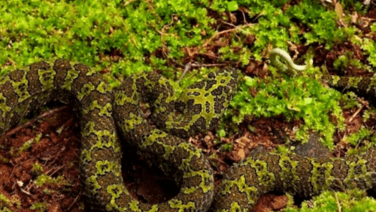
Mangshan Pit Viper
Mangshan Pit Viper Facts — Why the Whole World Is Watching
You might be wondering why a travel guide opens with a snake. Here is the honest answer: the Mangshan pit viper (Protobothrops mangshanensis) is the single most powerful reason international wildlife lovers search for this mountain. First described by scientists in 1990, this species is found nowhere else on Earth. Its entire known wild population lives exclusively in the Mangshan Mountain area.
The IUCN Red List classifies the Mangshan pit viper as Critically Endangered (CR) — one step away from extinction in the wild. Estimates suggest fewer than 500 individuals remain outside captivity. The snake can grow up to two metres in length, making it one of China's largest pit vipers. Its most distinctive feature is a bright white tail tip, which herpetologists believe functions as a lure for prey. For wildlife photographers and nature enthusiasts, spotting one in the wild is the ultimate Mangshan prize.
Viper Bite Risk for Tourists — The Honest SafetyAssessment
Here's a tip that will immediately ease your concerns: the Mangshan pit viper is extraordinarily shy. Unlike many venomous species, it actively avoids human contact and rarely strikes unless directly threatened or handled. Therefore, the realistic risk of a bite for a normal tourist walking on marked trails is extremely low.
That said, sensible precautions always apply in any mountain environment. Wear long trousers and closed-toe shoes, especially if you venture off the main boardwalks. Never reach under rocks or into dense undergrowth without looking first. Additionally, if you want a guaranteed encounter with this remarkable species, the Mangshan Museum in the park displays preserved specimens and conservation information. The snake's legendary status has, ironically, become one of the strongest protections for the ecosystem around it — because local authorities know that an intact forest is the only thing keeping this species alive.
West Gate vs East Gate — The Most Important Decision You'll Make⭐
Bottom line up front: Choose the West Gate (Wuzhi Peak) for barrier-free, cable-car-and-elevator convenience. Choose the East Gate (Tiantai Mountain – General Stockade) for rugged hiking and primeval forest immersion. The two areas connect via cable car, so a two-day visit can comfortably cover both.
| Comparison | West Gate (Wuzhi Peak) | East Gate (Tiantai Mountain) |
|---|---|---|
| Core Experience | Barrier-free sightseeing, sea of clouds, cable car + elevator | Primeval forest, steep peaks, waterfalls, hiking |
| Best For | Elderly visitors, families, leisure travellers | Hikers, photographers, adventure seekers |
| Key Facilities | Cable car, Motianling Elevator, smooth boardwalks, hoists | Glass plank road, waterfall trails, monkey valley |
| Recommended Time | 3–4 hours | 4–6 hours |
| Difficulty | ⭐Easy | ⭐⭐⭐Moderate |
West Gate (Wuzhi Peak Scenic Area) — Barrier-Free Mountain for Everyone
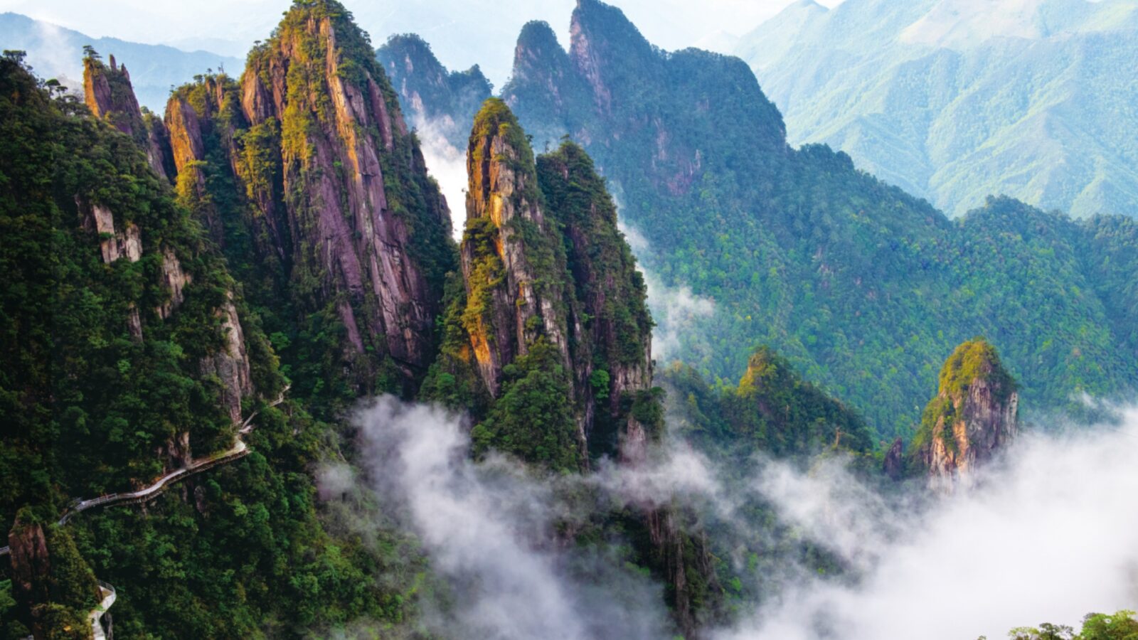
Wuzhi Peak
The West Gate of Mangshan Mountain is, by official recognition, the first mountain-type scenic area in China to achieve fully barrier-free access from base to summit. That means cable cars, an elevator, gentle paved boardwalks, escalators, and hoists — working together so that elderly visitors, young children, and people with limited mobility can all reach the 1,000-metre cloud layer without climbing a single steep step. This achievement, confirmed by the Hunan Provincial Government, is genuinely remarkable.
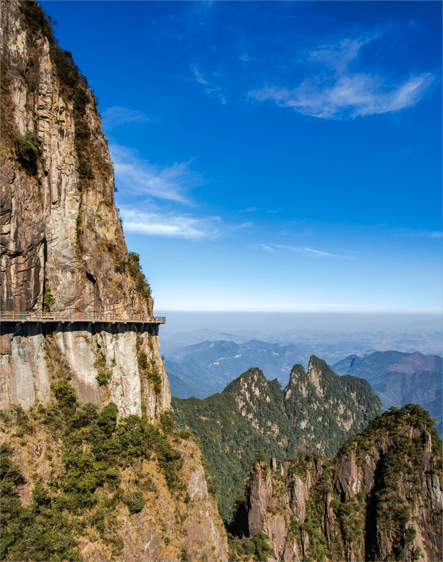
The West Gate centres on Wuzhi Peak (Five Finger Peak), a cluster of granite columns that rise dramatically above the forest canopy. From the summit area, the park's most iconic views unfold: a rolling sea of clouds that fills the valleys below, strange-shaped pine trees silhouetted against sunrise light, and the full panorama of southern Hunan stretching toward Guangdong. Moreover, the boardwalk network here is approximately 8 kilometres long — the world's longest suspended plank road — so there is plenty of ground to cover even without strenuous climbing.
The Motianling Elevator — Not the Bailong, But Just as Jaw-Dropping
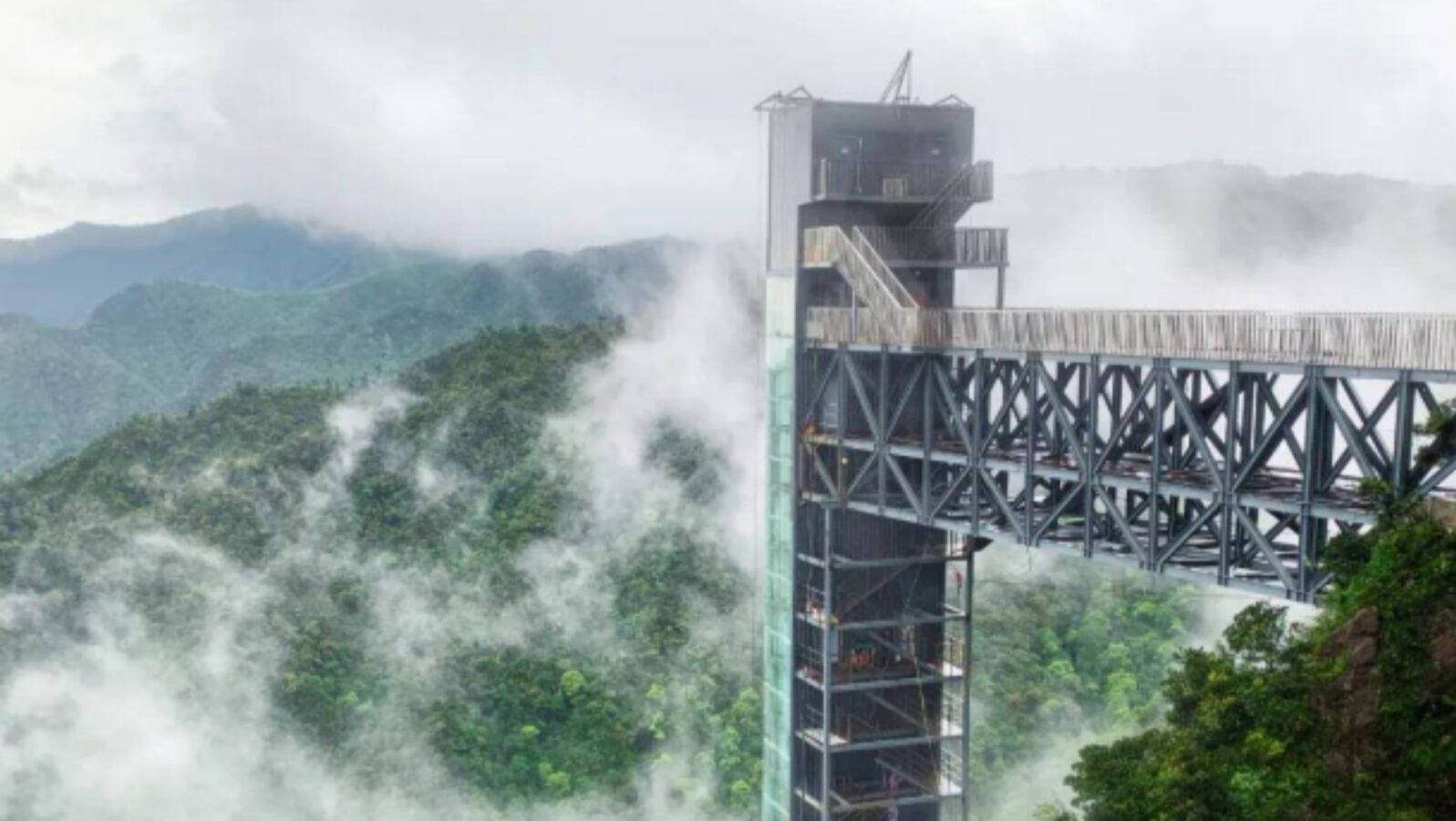
The Motianling Elevator
You may have heard of the Bailong Elevator in Zhangjiajie, which rises 335 metres up a sandstone cliff face. Mangshan Mountain's answer is the Motianling Elevator — and while it is a different beast, it is no less spectacular. Unlike the famous Bailong Elevator in Zhangjiajie, Mangshan's Motianling Elevator ascends vertically through 150 metres (equivalent to a 50-storey building) at a speed of 3 metres per second, delivering you to the summit in approximately 50 seconds.⚡
The cabin is fully glazed, providing an unobstructed view of the granite cliff face rushing past as you ascend. At the top, the doors open directly onto the cloud-level boardwalk. On clear mornings, you step out into a sea of white mist. On crisp winter days, you emerge into a world encased in rime ice. However, the elevator's real value is practical: it means that even visitors who cannot manage the cable car ascent have a second, even more dramatic, route to the summit experience.
East Gate (Tiantai Mountain – General Stockade) — For the Adventurous Traveller
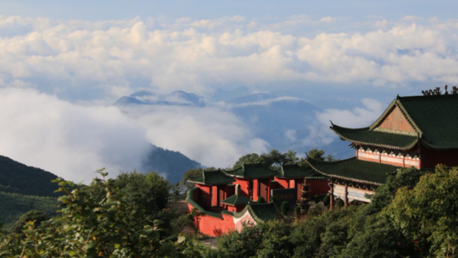
Tiantai Mountain
The East Gate tells a completely different story. Here, the landscape is wilder, the trails steeper, and the sense of genuine wilderness far more pronounced. Tiantai Mountain features dramatic granite peak formations weathered into shapes locals call the General Stone and the Celestial Platform. The virgin forest here is so dense that sunlight barely penetrates the canopy in summer.
Two highlights stand out. First, a three-stage waterfall with a total drop of 120 metres roars through a narrow canyon — during the rainy season, the negative ion concentration around the falls reaches 100,000 per cm³, earning it the title of "Natural Oxygen Bar." Second, a valley approximately 1.2 kilometres long is home to a colony of over 200 wild rhesus monkeys, where designated feeding areas allow for close, respectful interaction. For wildlife photographers in particular, the East Gate offers encounters that no boardwalk-and-elevator route can replicate.
Cable Car Experience — Riding Through Four Seasons in One Ascent
What the Cable Car JourneyActually Feels Like
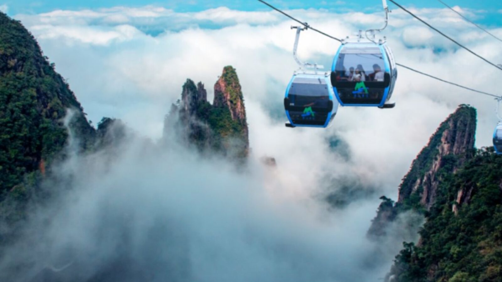
Cable Car
The Mangshan Mountain cable car is 1.7 kilometres long and uses fully transparent cabins that provide 360-degree views throughout the ascent. However, the most remarkable thing about the ride is not the distance — it is the visual transformation. At the base, the forest is lush and green year-round. As the cabin climbs, the vegetation gradually shifts. By the time you pass the 1,000-metre mark, everything changes:
- in winter, frost-covered branches sparkle white
- in autumn, red maples blaze against the granite peaks
- in summer, cloud banks roll through the cabin's line of sight like slow-motion waves
Along the route, the cable car passes directly above two historic structures:
• Tianta Temple
• Wanshou Pagoda
Both are perched on forested ridgelines. These sudden glimpses of ancient architecture against the raw mountain backdrop make for exceptional photography. For that reason, a window seat on the uphill side is worth arriving early to secure. The total ascent takes approximately 10–15 minutes, and many visitors say it is one of the most visually rewarding cable car experiences in all of Hunan.
Practical Cable Car Information — Tickets, Timing and Tips
- 🎫 Tickets:
The cable car is typically included in the main scenic area ticket, but confirm at the gate, as pricing structures occasionally change. - ⏰ Operating hours:
Generally 08:00–17:00; arrive early during peak seasons (October–November) to avoid queues of 60–90 minutes. - 📸 Best photography window:
Approximately 30 minutes after sunrise, when low-angle light hits the peak clusters and mist still fills the valleys. - 🧥 Temperature drop:
Expect a 6–8°C drop between the base and summit. Even in summer, a light jacket is advisable at the top.
Best Time to Visit Mangshan Mountain — A Season-by-Season Guide
Autumn's Golden Window — Sea of Clouds at Its Peak
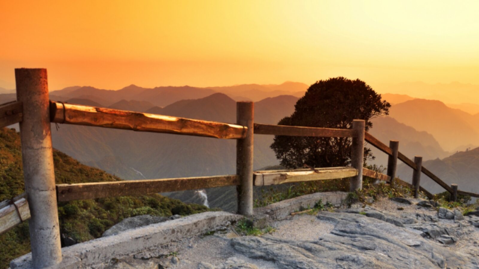
Autumn in Mangshan
October and November are widely regarded as Mangshan Mountain's finest months. 🍂 The summer humidity fades, the air sharpens, and the conditions for sea-of-clouds formation become nearly daily. The best viewing spot is the Wangyue Observation Platform near Wuzhi Peak. Clouds typically begin rolling in from the valleys around 11:00 AM, building to a full inversion by early afternoon. Combine this with the autumn colour change — maples and ginkgos turning amber and crimson across the slopes — and you have conditions that rival any alpine destination in China.
Here is a practical tip for timing your autumn visit: Go mid-week if possible. Weekends in October draw significant numbers of visitors from Guangzhou, Shenzhen, and Changsha, all within 3–5 hours by road or rail. A Tuesday or Wednesday arrival will give you the same scenery with dramatically fewer people sharing the view.
Winter Rime — Is It Worth Braving the Cold?
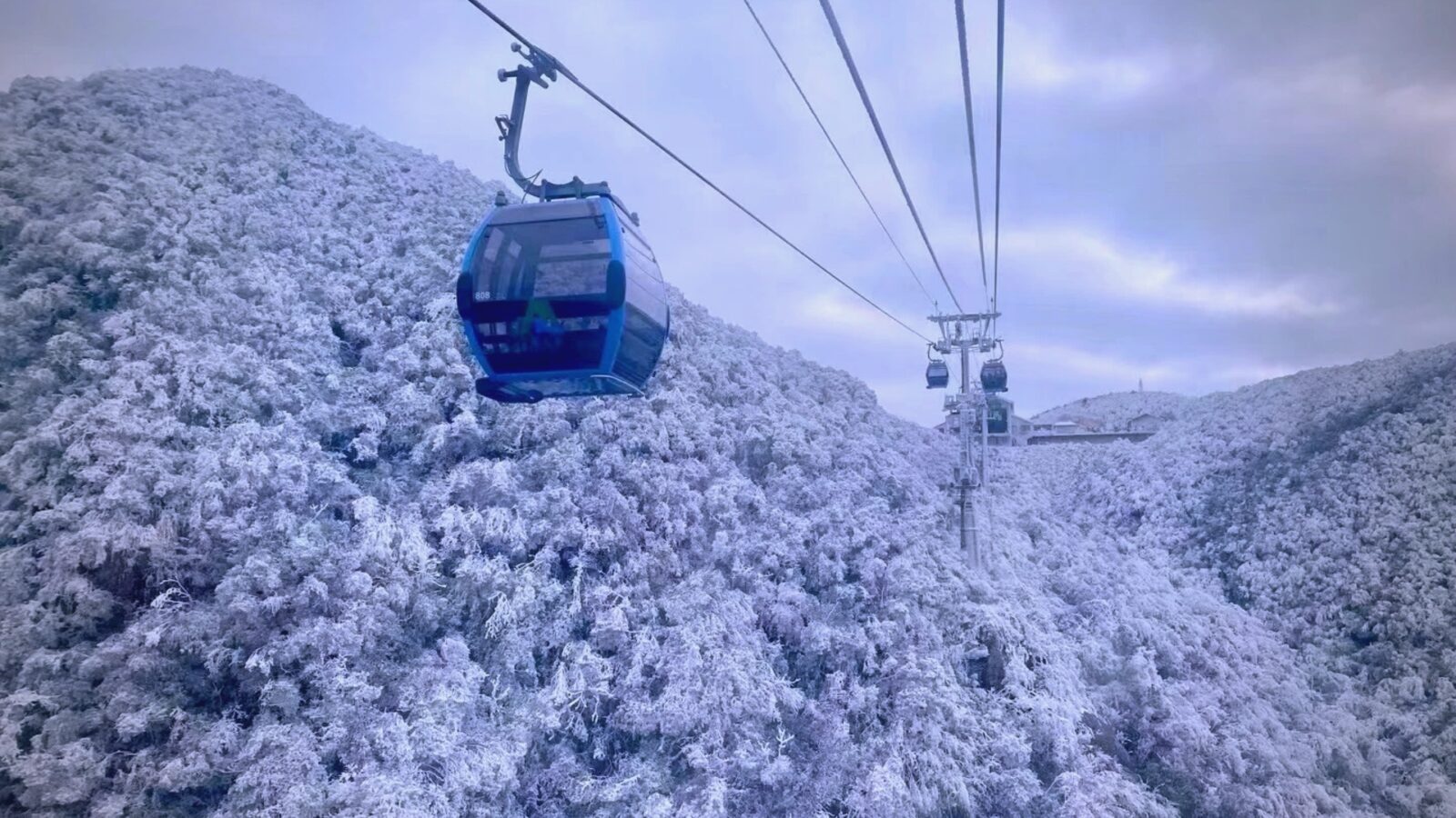
Winter in Mangshan
The short answer is yes — but only with proper preparation and good timing. Rime ice forms on Mangshan Mountain when temperatures drop below zero and fog settles overnight on the summit. The result is extraordinary: Every tree branch, every pine needle, every railing is encased in white crystal. When sunlight hits at dawn, the entire summit glows like a scene from a fantasy film.
The critical variable is temperature. Check the Chenzhou weather forecast at least a week ahead and look for nights below -2°C. The best conditions typically appear one to two days after snowfall, when fresh rime has formed but roads are passable. Importantly, the West Gate's cable car and elevator remain operational in most winter conditions, so elderly visitors and families are not excluded from this spectacle. However, dress in serious winter layers — the summit temperature can fall to -8°C even when the valley below sits at 5°C.
| Season | Best Months | Signature Experience | Practical Note |
|---|---|---|---|
| Spring | April – May | Azalea blooms, forest waterfalls | Weekdays best; rainy season begins late May |
| Summer | June – September | Natural air-conditioning (avg. 17.2°C) | Peak domestic tourism; book accommodation early |
| Autumn | October – November | Sea of clouds, red leaves | Best overall season; go mid-week |
| Winter | December – February | Rime ice, snow landscapes | Check forecast; layer heavily; West Gate accessible |
Getting to Mangshan Mountain — Transport, Routes and Accommodation
By High-Speed Rail — The Easiest Route from the Major Cities
Mangshan Mountain is more accessible than most travellers expect. The nearest high-speed rail hub is Chenzhou West Station (郴州西站), served by trains from Guangzhou South, Shenzhen North, and Changsha South. From Guangzhou or Shenzhen, the journey takes approximately 1.5–2 hours. From Changsha, expect around 2 hours.🚄From Chenzhou West Station, your options to reach the scenic area include:
- Customised tour bus: Departures available from Chenzhou West to Yizhang County and onward to Mangshan scenic area (approximately 2 hours total from the station).
- Private car or taxi: Approximately 1.5 hours from Chenzhou West directly to the scenic area gate.
- Self-arranged transport via Yizhang County seat: Bus to Yizhang, then connecting shuttle to the park entrance.
Self-Drive Routes — From Guangzhou, Shenzhen or Changsha
If you are driving, Mangshan Mountain sits at a convenient crossroads between three major cities:
- From Shenzhen: Approximately 3–4 hours via G107 and G4 expressway, passing through Shaoguan.
- From Guangzhou: Approximately 3.5–4.5 hours via G45 toward Chenzhou.
- From Changsha: Approximately 4–5 hours south via G4.
One important note: private vehicles are prohibited inside the scenic area. You must park at the designated car park near the entrance and board the official shuttle bus into the park. Plan 20–30 minutes for this transfer.
Where to Stay — Mountain Summit vs Valley Homestay
Your accommodation choice dramatically affects your experience. Two main options suit different travel styles:
- 🏔Mountain summit resort (e.g., Mangshan Forest Hot Spring Hotel): Staying on the mountain means you can walk to the sunrise viewpoint before other tourists arrive — typically the single best photographic moment of any Mangshan trip. Hot spring facilities here are built on the clifftop, with some pools positioned to overlook the sea of clouds.
- 🏡Valley homestay in Mangshan Town: More affordable, with easy access to local restaurants serving mountain vegetables and wild fungi. Ideal for multi-day stays combining hiking days with cultural exploration.
Yao Culture and Local Food — The Human Layer of Mangshan Mountain
The Yao People of Mangshan — Ancient Traditions in a Living Landscape
-
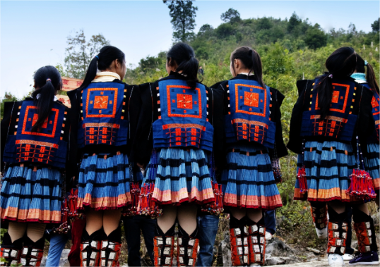

- The Yao People
-
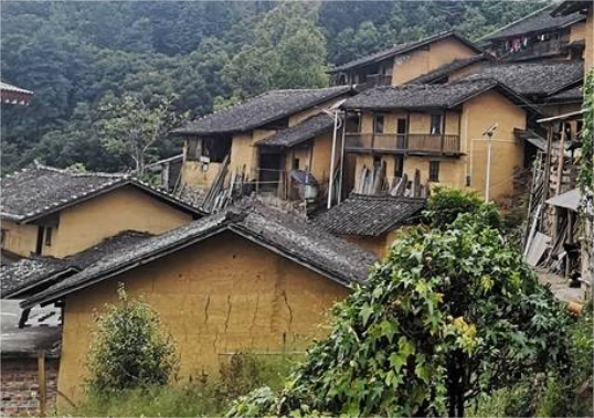
- The Yao settlements
-
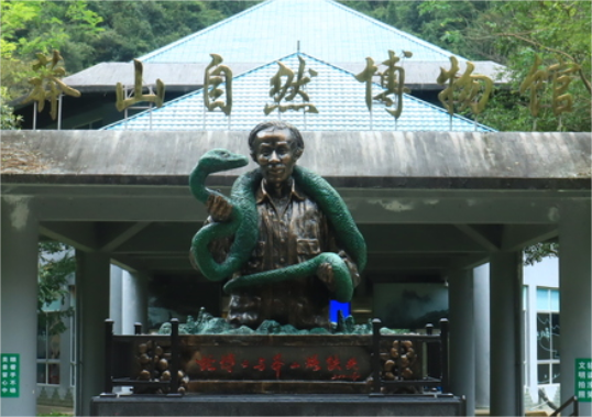
- The Mangshan Museum
Mangshan Mountain has been home to Yao ethnic communities for centuries. Unlike the more commercialised ethnic villages found near major tourist cities, the Yao settlements aroundMangshan retain a quieter, more authentic character. Traditional woven costumes, agricultural festivals tied to the mountain calendar, and craft practices passed down through generations are still visible in daily life — if you know where to look. 🎋
The Mangshan Museum, located within the scenic area, provides the most accessible introduction to both the local ecology and the Yao cultural heritage. It covers the mountain's geological formation, its rare species, and the history of Yao settlement in the Nanling range. For travellers doing a three-day itinerary, adding a guided visit to a nearby Yao village is a worthwhile extension that very few international visitors currently experience.
Local Food Worth Seeking Out — Mountain Vegetables, Fungi and Cloud Tea
-
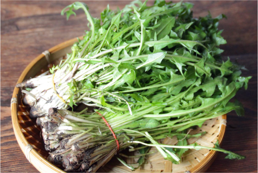

- Mountain vegetables
-
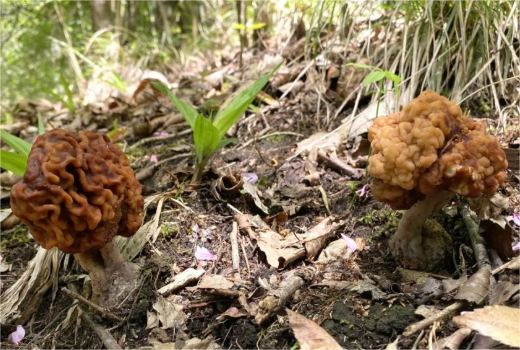
- Wild fungi
-
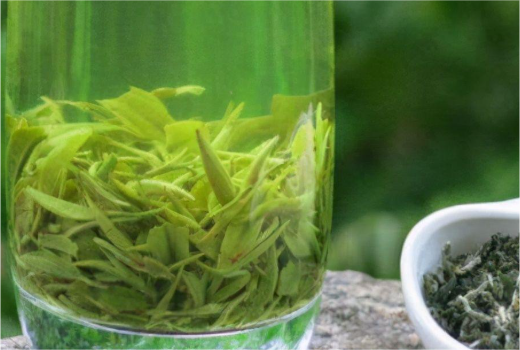
- Mangshan cloud tea
The food around Mangshan Mountain is a direct product of its extraordinary ecosystem. Three ingredients define the local table:
- 🌿Mountain vegetables (山野菜): Foraged greens stir-fried with garlic and chilli — simple, intense, and unlike anything in a city restaurant.
- 🍄Wild fungi: Varieties unavailable outside the region, served fresh in broths or with rice. Autumn is peak season.
- ☕Mangshan cloud tea (莽山云雾茶): Grown at altitude above 1,000 metres, this tea has a clean, floral character shaped by the same mist that creates the mountain's famous sea of clouds.
Farmhouse restaurants (农家乐) along the road into the scenic area are the best places to find these ingredients cooked without pretension. Prices are generally very reasonable — a full meal for two rarely exceeds ¥80–100.
FAQs: Mangshan Mountain Essentials
Q: What is the history of Mangshan Mountain and how did it get its name?
Mangshan Mountain takes its name from the ancient Chinese word for dense, impenetrable vegetation — and local tradition connecting the area to its famous reptilian inhabitants. The site was established as a National Nature Reserve in 1982, recognising its extraordinary biodiversity. Today, the park protects over 1,700 plant species and approximately 300 animal species within its 198-square-kilometre boundary in Yizhang County, Chenzhou, Hunan.
Q: Is it safe to visit Mangshan Mountain because of the vipers?
Yes — Mangshan Mountain is safe for normal tourist visits. The Mangshan pit viper is critically endangered, extremely shy, and very rarely encountered on maintained trails. Your practical risk is minimal if you wear closed-toe shoes and long trousers, stick to marked paths, and avoid reaching into undergrowth. Hundreds of thousands of visitors explore Mangshan Mountain each year without incident.
The West Gate (Wuzhi Peak / 五指峰) focuses on barrier-free sightseeing with cable cars, the Motianling Elevator, and smooth boardwalks — ideal for families, elderly visitors, and those who want spectacular views with minimal physical exertion. The East Gate (Tiantai Mountain / 将军寨) features rugged hiking trails, primeval forest, a 120-metre waterfall, and a wild monkey valley— better suited to active travellers and photographers.
Q: When is the best time to see the sea of clouds at Mangshan Mountain?
The optimal window is October to November. During these months, sea-of-clouds conditions form almost daily, typically developing from around 11:00 AM at the Wangyue Observation Platform near Wuzhi Peak. Autumn also brings red and golden foliage, creating a layered visual effect that many photographers describe as Mangshan Mountain at its absolute best.
Q: What does the Mangshan Mountain map layout look like?
The park divides into two main zones connected by cable car. The West Gate (Wuzhi Peak) area sits on the western side and contains the cable car terminal, Motianling Elevator, and the main sea-of-clouds viewpoints. The East Gate (Tiantai Mountain) occupies the eastern section and contains the waterfall canyon, monkey valley, and deeper forest trails. The two zones are approximately 30–40 minutes apart by cable car.
Q: Can I see the Mangshan pit viper in the wild during my visit?
Wild encounters are rare — and that rarity is actually a sign of good ecological health. The Mangshan pit viper avoids human activity, and its critically endangered status means the park strictly protects its habitat. However, the Mangshan Museum displays detailed information about the species, and the experience of hiking through the only forest on Earth where this snake survives is meaningful in itself. For wildlife specialists, guided night walks in restricted zones are occasionally available through the park administration.