Danxia Landform Description in China
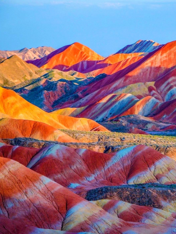
China holds the world's finest and most extensive examples of the danxia landform description— a dramatic landscape type defined by steep red sandstone and conglomerate cliffs that erosion has carved into pillars, arches, and isolated peaks. The most photographed site is Zhangye Danxia National Geological Park in Gansu, where mineral-banded hills glow in yellow, orange, and crimson stripes after rain. A second major destination, Danxiashan in Guangdong, serves as the type locality that gave the entire category its name. Both parks are open year-round and connect easily to major regional transport hubs. Visitors who want to understand the full range of this geological spectacle can also explore the six-component UNESCO World Heritage serial property scattered across seven provinces.
Quick Facts
The Danxia Landform Defined
A danxia landform is a steep, red-colored landscape carved from Cretaceous sandstone and conglomerate by uplift and subsequent erosion. The rock layers are terrestrial clastic sediments — sand, gravel, and mud — deposited in inland basins and later cemented by iron oxide, which gives them their characteristic crimson hue. Over millions of years, tectonic forces raised these red beds, and rivers, freeze-thaw cycles, and rainfall wore away the softer material, leaving behind near-vertical cliff faces, dome-shaped peaks, isolated pillars, and broad peak-forest panoramas. The term applies specifically to this Chinese type locality and the broader family of red-cliff landscapes found across the country's south and southwest.
Red Beds, Conglomerate, and Cliff Faces
The red beds are terrestrial clastic sedimentary rocks laid down in Cretaceous inland basins. Iron oxide — hematite — cements the grains together and imparts the red color. Within these strata, conglomerate layers hold rounded pebbles cemented in the same red matrix; these harder bands often cap cliff edges and resist erosion longer than surrounding sandstone. The result is a distinctive landscape of:
- Near-vertical cliff faces: harder conglomerate caps overlying softer sandstone walls
- Dome-shaped peak clusters: differential weathering rounds the upper surfaces
- Isolated pillars and towers: mass wasting and river incision isolate resistant cores
- Natural arches and caves: groundwater dissolution and mechanical weathering hollow the rock
The "Danxia" Name and Its Origin
The name "Danxia" (丹霞) translates roughly as "red glow" or "rosy clouds," a reference to the sunset-lit cliff faces that gave Mount Danxia its identity. The term was coined in 1928 by Chinese geologist Feng Jinglan while mapping Mount Danxia in Renhua County, Guangdong. Feng proposed the danxia landform as a distinct geological category, using this mountain as the type locality. Beyond geology, historical religious sites, rural settlements, and cultural traditions developed alongside these landscapes, sometimes grouped under the umbrella of "Danxia culture."
UNESCO's Six China Danxia Sites
The China Danxia serial property entered the UNESCO World Heritage List in 2010 under criteria vii (outstanding natural beauty) and viii (geological features). The 2014 IUCN Conservation Outlook Assessment rated its conservation status "good." The total inscribed area covers 821 km² across a landscape arc roughly 1,700 km long, spanning seven provinces from Guangdong east to Zhejiang and west to Guizhou. The six component clusters represent successive stages of the danxia landform lifecycle, from youthful canyons to aging solitary peaks.
🐫 Explore Northwest China's Silk Road: If you are visiting Zhangye Danxia in Gansu Province, you can easily extend your journey west along the Silk Road corridor to ancient desert oases and cave temples. Plan your route with our Dunhuang China Historical Sites Travel Guide.
Chishui, Taining, Langshan, Danxiashan, Longhushan, Jianglangshan
Zhangye Danxia Rainbow Mountains
The Zhangye Danxia National Geological Park in Gansu Province holds the most visually striking example of a mineral-banded danxia landform in China. Two distinct scenic areas make up the park. Linze (七彩丹霞) presents the iconic rainbow-striped hills — parallel bands of yellow, orange, red, and gray laid across the cliffs like painter's strokes. Sunan Binggou (冰沟丹霞) offers a sharper, more architectural character with red-grey cliff forms that appeal to visitors seeking a less crowded experience. The park sits roughly 30–40 minutes by taxi or tourist shuttle from Zhangye city and draws its highest visitor numbers during the summer months of July and August.
Getting There and Tickets
Zhangye Danxia Landform Description in China
Zhangye Ganzhou Airport (YZY) handles flights from Lanzhou, Dunhuang, and Beijing. The high-speed rail line from Lanzhou West to Zhangye West takes roughly 2.5 hours and costs about $21–28 (¥150–200) for second-class seats. Park entry runs about $10 (¥74) and the internal sightseeing bus adds roughly $3 (¥20). E-tickets are available on Trip.com and Klook, and the combined pass covers both Linze and Binggou areas. Travelers should note that some elevated walkways close during winter months when ice accumulates on the platforms.
Best Viewpoints and Viewing Times
Zhangye Danxia Landform Description in China
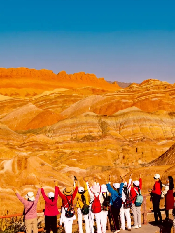
The Linze area is organized around numbered viewing platforms (1 through 5). Platform 4 — known as Qicai Aohu (七彩敖河) — provides the classic rainbow-sweep panorama that dominates most photographs of the site. The Binggou area rewards visitors who prefer the sharper, more geometric cliff forms over the rainbow banding. For photography, sunrise on the eastern platforms and late afternoon on the western ones produce the strongest color contrast. Post-rain lighting intensifies all hues considerably. Peak tourist season falls in July and August; shoulder months in late May and September offer thinner crowds while retaining vivid color saturation.
Danxiashan in Guangdong
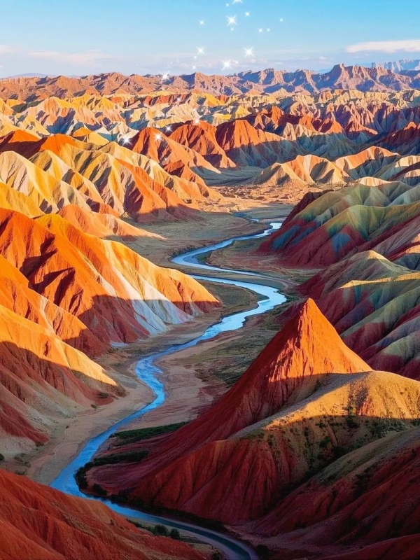
Danxiashan — Mount Danxia — in Renhua County, Shaoguan, is the type locality that gave the entire landform category its name. This UNESCO Global Geopark differs fundamentally from Zhangye: here, tall red cliffs rise above the Jin and Zhen rivers, experienced on foot along stairways and from cable-car observation decks. The landscape carries a late-mature character — open valleys, isolated peaks, and subtropical evergreen broad-leaved forest clinging to the cliff faces. The main scenic area gates open from 06:00 to 22:00 daily, with cable cars running 08:00–17:30. A combined ticket costs about $25 (¥180) and remains valid for two days, allowing visitors to split time between the Yangyuan-Shaoyun zone and the Jinshiyan zone.
Getting There and Tickets
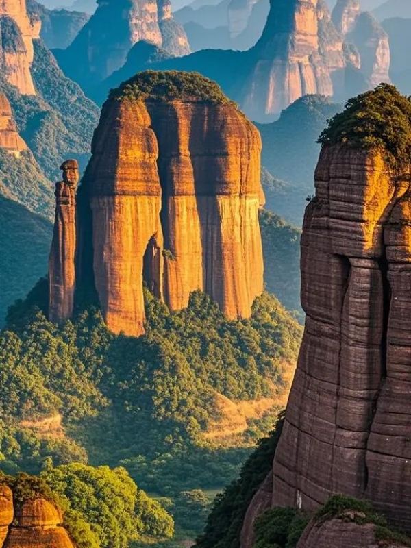
Guangdong Danxia Landform Description in China
Guangzhou Baiyun International Airport (CAN) serves as the main international gateway; Shaoguan Station (HSC) is also accessible by air. High-speed rail from Guangzhou South to Shaoguan takes about 45 minutes and costs roughly $21 (¥150). A bus or taxi from Shaoguan to Renhua adds approximately 30 minutes and about $5 (¥35). The two-day combined ticket covers both the Yangyuan and Shaoyun zones plus Jinshiyan. E-tickets are available on Trip.com and Klook; booking one day ahead is advisable during Chinese Spring Festival when visitor numbers surge.
Cable Cars and Key Peaks
Guangdong Danxia Landform Description in China
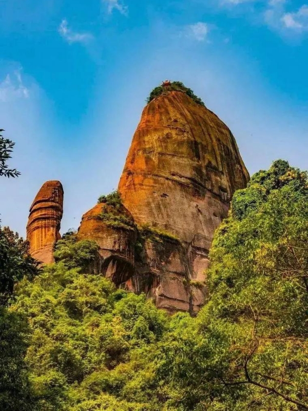
Two main zones define the experience. The Yangyuan-Shaoyun zone features the signature pillars — Yangyuan (the "male stone pillar") and Shaoyun (the "female counterpart") — separated by a ridge walk. A cable car ascends to the Yangyuan summit in about eight minutes; from the top, a stairway links down to the Shaoyun walkway. The Jinshiyan zone showcases the golden-stone wall and broader cliff panoramas, accessible without a cable car. For timing, sunrise at Yangyuan and sunset at Jinshiyan offer the most dramatic lighting. Visitors who walk from the main gate to the Yangyuan peak should budget roughly 1.5 hours of stair climbing; a full Yangyuan–Shaoyun loop using the cable car plus walking takes about 4–5 hours.
🏞️ Discover More Geological Marvels: Beyond the red cliffs of Danxia, China features extraordinary karst towers, alpine lakes, and dramatic canyons. Explore the country's most breathtaking landscapes in our guide to the Natural Wonders of China.
How Danxia Landforms Form
Danxia Landform Description in China
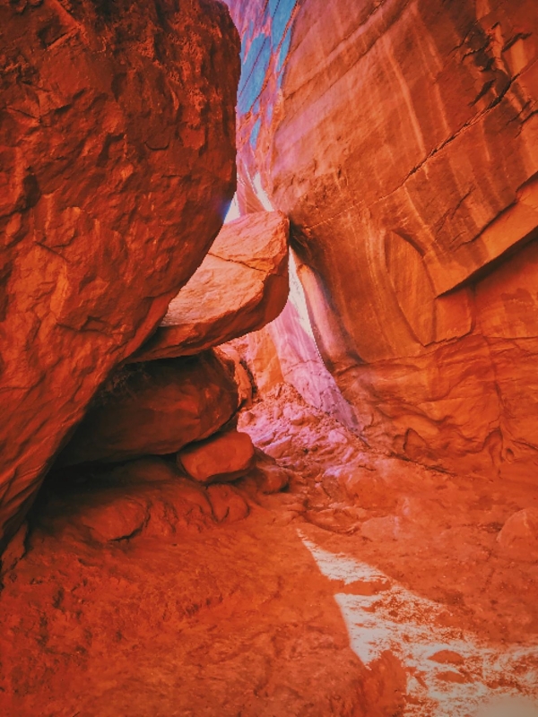
The formation of a danxia landform follows a four-stage sequence spanning hundreds of millions of years. First, Cretaceous inland basins accumulated red clastic sediment — sand, gravel, and mud — bound together by iron-oxide cement. Second, tectonic uplift, later amplified by the Himalayan orogeny, raised these red beds above the surrounding terrain. Third, rivers incised deep V-shaped gorges while freeze-thaw cycles, rainfall, and wind attacked the softer layers, leaving harder conglomerate bands as vertical cliffs. Fourth, gravity-driven cliff retreat and differential weathering over millions more years produced the characteristic pillars, arches, caves, and isolated peaks. The mineral-banded rainbow effect visible at Zhangye arises from varying iron-oxide concentrations and hydration states in the same red beds — yellow, orange, gray, and dark bands emerge where trace minerals differ along the sedimentary layers.
Uplift, Erosion, and Cliff Retreat
Tectonic forces raised the red beds; rivers cut V-shaped gorges; weathering attacked the weaker sandstone while conglomerate caps held firm. Mass wasting — rockfalls, slides, and toppling — isolated pillars and towers. Chinese geologists describe a lifecycle across the six UNESCO sites:
- Early youth: canyon-type landscape (Chishui, Guizhou)
- Late youth: peak-cluster canyons (Taining, Fujian)
- Early mature: dense peak clusters (Langshan, Hunan)
- Late mature: open valleys and river-cliff panoramas (Danxiashan, Guangdong)
- Early old: wide valleys with scattered residuals (Longhushan, Jiangxi)
- Old age: solitary residual peaks (Jianglangshan, Zhejiang)
Why the Rocks Are Red (and Sometimes Rainbow)
The red color stems from hematite — iron oxide — coating individual sand grains and filling the pore spaces between them. When iron occurs in different hydration states or concentrations, it produces yellow (goethite), orange, gray-white (carbonate or gypsum), and dark (chlorite or manganese) bands. At Zhangye, Cretaceous beds tilted by tectonic forces expose these mineral bands as the rainbow stripes that draw global visitors. Rain wets the rock surface and temporarily darkens the iron-rich layers, making the color contrast more vivid. The park's national-park status helps protect the exposure from quarrying or uncontrolled development.
Frequently Asked Questions
Q: What is a danxia landform description in simple terms?
A danxia landform is a landscape of steep, red sandstone and conglomerate cliffs carved by uplift and erosion. The name comes from Mount Danxia in Guangdong, which became the type example for this geological category. These landscapes are found across southern and southwestern China, with the best-developed examples protected as UNESCO World Heritage sites.
Q: How old are danxia landforms?
The source red beds are mostly Cretaceous (and locally Jurassic), roughly 65–145 million years old. The cliff shapes themselves are much younger — carved after tectonic uplift raised these rocks, mainly over the last few million years during the Cenozoic era.
Q: Are danxia landforms only found in China?
The term and the UNESCO World Heritage designation are specific to China, but red sandstone and conglomerate cliffs of similar origin occur in Utah and Arizona in the United States, parts of Australia, and Central Asia. Chinese geologists reserve "danxia landform" as a formal category for the type as it is developed in China.
Q: What is the difference between Zhangye Danxia and Mount Danxia?
Both are danxia landforms, but the visitor experience differs significantly. Zhangye Danxia in Gansu is famous for its mineral-banded rainbow hills seen from elevated viewing platforms. Mount Danxia (Danxiashan) in Guangdong features tall red cliffs above rivers, best experienced on foot and by cable car.
Q: When is the best time to visit Zhangye Danxia?
June through September offers the strongest color contrast, with sunrise or late afternoon providing the best natural light. Avoid midday during July and August when summer heat peaks. Post-rain conditions typically produce the most vivid color intensity across the mineral bands.
Q: How long does it take to climb Danxiashan?
Walking from the main gate to the Yangyuan peak takes roughly 1.5 hours on stairs. The cable car reduces this to about eight minutes. A full Yangyuan–Shaoyun loop using the cable car plus walking takes about 4–5 hours. The two-day combined ticket lets visitors split this across two days for a more relaxed pace.
Q: Is the China Danxia UNESCO World Heritage Site?
Yes, the China Danxia serial property was inscribed on the UNESCO World Heritage List in 2010 under criteria vii (outstanding natural beauty) and viii (geological features). The property covers six component sites in Guangdong, Jiangxi, Hunan, Fujian, Zhejiang, and Guizhou. Zhangye Danxia is on China's UNESCO World Heritage tentative list (since 2009) but is not part of the 2010 inscription.