Taklamakan Desert
The Taklamakan is big in a way that makes it feel unreal when you are standing next to it, and this is where the taklamakan desert highlights begin to reveal themselves. They say it takes up about one-fifth of Xinjiang, though the comparison that struck me was, “about fifty Shanghais.” The desert is about 1,000 km in length and 400 km from swelling feet to great head, or about 330,000 square kilometers of land, which is a number you hear given twice before you can believe it.
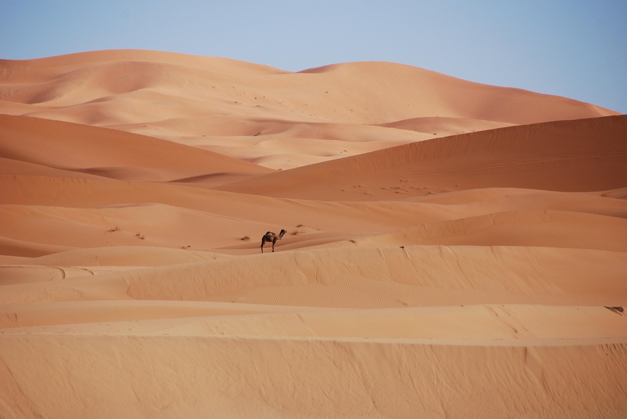
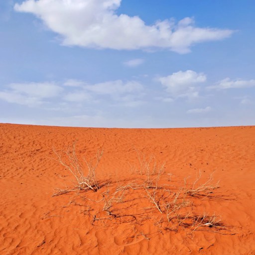
It rained nearly as much as two years ago, and rain is almost a rumor here, many places not reaching even 100 mm a year. Evaporation goes on at a rate of over 2,500 mm, so that your mouth is parched rapidly, even in a slight wind. The sand dunes rise like walls of sand 300 meters high, and they move as the wind arises. You watch them move and you know that this is not only a stupendous place, but it is filled with life.
Quick Facts about Taklamakan Desert Highlights
| Location | Southern Xinjiang, between the Kunlun Mountains and the Tianshan range |
| Total Area | Approx. 330,000 km² (about 50× the size of Shanghai) |
| Climate | Hyper-arid; annual rainfall often <100 mm, extreme day-night temperature shifts |
| Highest Sand Dunes | Up to 300 m tall in central zones |
| Main Roads | Tarim Desert Highway (塔里木沙漠公路), 315 National Road, 218 National Road |
| Best for | Travelers into remote landscapes, photography lovers, road-trip explorers |
| Average Elevation | Around 1,000–1,200 m depending on the route |
| Danger Level | High—strong winds, drifting sands, long distances without services |
| Best Photo Time | Sunrise for gold tones; sunset for red-copper dunes; clear nights for star shots |
Where the Taklamakan Desert Is — and Why Its Location Shapes Everything
-

- Hotan
-
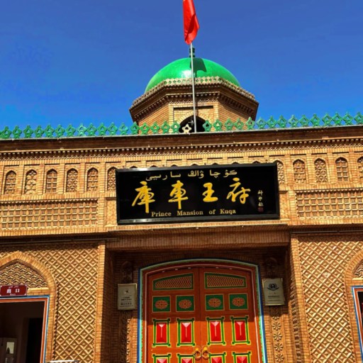
- Kuqa
Understanding the Taklamakan Desert Map
I remember reading from a book of maps in a Korla hotel lobby, and realizing I had judged distance inaccurately. In most online maps, the Taklamakan looks like a beige oval casually dropped into Xinjiang. But when the full Taklamakan Desert lies open before you, the thing spreads across the page like a great lid over Southern Xinjiang. Soon you ask yourself, “Where is the Taklamakan Desert?” and the answer appears at once: it lies snugly between the Kunlun mountains to the south and the Tianshan mountains to the north, a deeply sunken basin so dry that winds have no escape.
This geography explains half its traits. The mountains form walls that trap cold air, hot air and dust storms. The basin floor absorbs heat rapidly, yet cools sharply by midnight, even in late spring. This location also determines the routes taken by travelers, since most roads skim the edges, for cutting a center requires sandbreaks. Thus many taklamakan desert features gather around the highways, giving photographs strong contrasts between mountains and the open dune fields, a thing best understood when a large map shows how wide the emptiness runs.
The Size, Population & Who Actually Lives Near the Desert
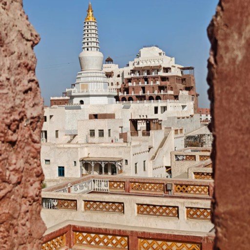
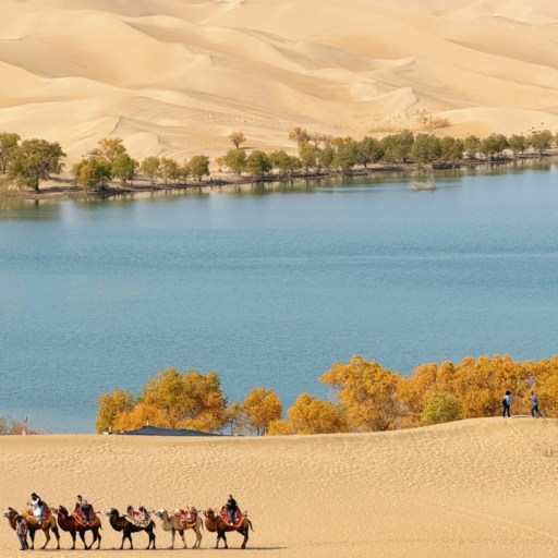
People often find it difficult to visualize regions as truly barren, but this is only half the truth. The population of the Taklamakan desert inside the sand dunes is almost totally nil, and no permanent abode can exist there, but around the rim of the desert there is life galore. The cities and towns in Aksu, Kuqa, Ruoqiang and Hotan lie along the edge, with irrigated fields reaching the sand dunes. Most inhabitants are Uyghurs, and some Han Chinese, like the Tajik and smaller groups called the “Tarim people,” whose customs show clear desert influences. Travelers ask how anyone can live with such heat and dryness, but the answer lies in ancient oases fed by mountain snow water.
As for size, the numbers always sound unreal: roughly 330,000 km², and one of the world’s largest shifting-sand deserts. You notice the scale when the scenery barely changes after long drives, or when distant sandstorms arrive from far away. Locals warn travelers not to trust “map distance,” since a short line can mean a full day of driving. This mix of huge empty space and human pockets shapes many taklamakan desert highlights, giving the desert both isolation and cultural warmth.
Taklamakan Desert Highlights on the Ground — The Best Places to See
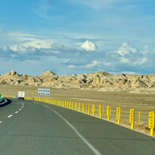
The Desert Highways: The Most Surreal Roads in China
If there’s a place where the taklamakan desert highlights whip up on you by surprise, it’s the tarim desert highway. People love to call it the “most lonely highway in china,” and near the same words are in tripadvisor reviews: “beautiful but in a way that shows you how small you are.” The highway goes straight through sand that is being blown, summer fashion, so the kustorees are always putting in rows of shrubs and doin parts devoured by dunes. When you go along enough the horizon will not behave itself. No towns and villages, no telephone signal, sometimes not even a car for an hour at a time. If the feeling of ancient silence fascinates you even more, you might like this place — Yarkhoto Ruins.
This is the classical taklamakan desert highway scene: the road spreading like a black ribbon through pale gold, the heat rising in wavering waves, and the impression given that the desert is not empty, it is listening. It is a dream and soothing, and this is one of the reasons why the traveller continues to come back.
The Lost Cities Beneath the Sand
People always come to hunt for the famous lost city buried in the sands of the Taklamakan Desert imagining something like a city of gold but the reality of its stories is stranger yet. For Niya and Loulan were cities of the ancient Silk Road and thrived on oasis channels fed by the glacial stream of the mountains which rose and dried up first and then buried the cities in the desert. Archaeologists still tell how unusually well preserved were the wooden beams, the baskets and even the woven cloth they dug out, for the dry air here acts like a giant time capsule.
Loulan, in particular, has this eerie reputation. The Chinese Academy of Social Sciences noted how quickly the environment changed there, and photos of the site show beams sticking out like ribs from the sand. What makes these ruins impressive isn’t just age; it’s the quiet around them. You stand there and realize how fragile an oasis city becomes when the desert decides to move. These ancient traces add a deeper layer to the desert’s story, and visitors say that learning about them makes the modern Taklamakan feel even larger.
Photo Spots: Where Taklamakan Desert Highlights Look the Most Unreal
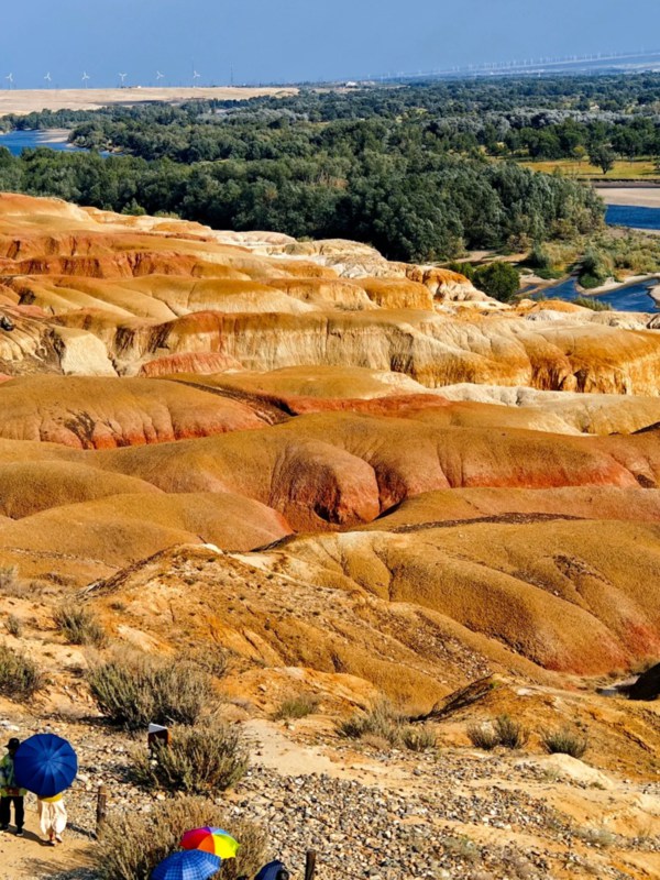
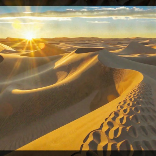
As you flip through the pics of the Taklamakan Desert, you wonder how they could all be real. Not until you see those colors yourself, they aren’t too much. Sunrise bathes the dunes in a soft golden hue, that kind of a light that makes footprints appear poetic. At sunset the scene changes; the sand has a red coppery appearance, and each sand ridge looks as if some artist had drawn it in charcoal. At night, when the stars are out and the sky full, the dunes appear to be slightly luminous with that light, a sensation you cannot understand until you put out your headlight and just stand there without moving.
Most of the good places are to be had along the central part of the Tarim Desert Highway, but it is well enough to practice caution. Photo seekers often drift off the road too far and forget for the moment how quickly the sand dunes shift and how shallow some of the patches feel underfoot. Local drivers are always warning travelers not to seek the “perfect angle” too far out of sight. The unreal scenes are well worth the trip, but only as long as one remembers the unpredictability of the desert.
Weather, Safety & Why Taklamakan Is Called the “Sea of Death”
The Taklamakan Desert
Weather: Extreme but Predictable—If You Know the Pattern
Many peoples tongue about Taklamakan Desert delights, but few mention how much it is the weather that conditions for the most part all the time in coming round. The weather is extreme, it would seem, in the Taklamakan Desert; it does not hide that to its advantages, but proclaims it. I have experienced many days in which the thermometer ranged above 38° C., and therefore that type of heat which dries the throat more quickly than one expects, and a few hours only after sundown i.e. after sundown the temperature plunged almost to single figures.
In this respect, the shift from one temperature to another of nearly 30° C. impresses itself very forcibly, I may say, at first upon the body, which knows not whether to sweat or shiver. Still, all becomes quite intelligible when with some time spent in watching the heavens. The mornings, for instance, are pleasant, to a certain extent mild, light cleanly. At noon in the basins the heat concentrates and the haze rises. In the late afternoon it cools sufficiently to make the sand comfortable under the pedestrian’s feet. The traveller who confines himself to the roads invariably reads the same words on Triposded : “extreme, yes, but not chaotic.” The desert beats its own (or produced its own) tempo. When man learneth to conform himself to it all is strange readable.
Why the Desert Is Considered Dangerous (Sea of Death) & How to Travel Smart
When people ask why is the Taklamakan Desert dangerous, the answers fly fast. Sandstorms, remoteness and the kind of silence that brings it home how far you are from help. The title Sea of Death sounds dramatic until you see how a storm from the west comes up, a yellow wall taking the horizon down it. Navigation in the sandstorms is perplexing. The pits are ephemeral, the tire marks go away in the wind, and your sense of direction disappears. Locals say the storms sometime spring up in two minutes and this is not an exaggeration.
A different risk involves the distance between services. Fuel stations along remote stretches can be 100 km or more apart and the mobile signal can drop for a long time. Once I lost my signal for nearly an hour south of Luntai and the empty road felt even longer, which is why most travelers opt for a licensed driver or a local tour company. It knows where the refueling points are located and it check wind forecasts obsessively. Carrying more water, a paper map and a full tank of fuel is not over-preparation, but simple survival. The desert is not unassailable without reason; if you prepare properly the journey will change from something which is frightening to something unforgettable.
FAQ About Taklamakan Desert Highlights
Q: Is the Taklamakan Desert safe to travel through?
Safety depends more on planning than luck. The desert is huge, services are far apart, and storms can reshape dunes quickly, so I wouldn’t call it casual. Most travelers rely on local drivers who know fuel stops and sandbreak belts. With enough water, a full tank, and updated wind forecasts, the journey feels demanding but manageable. Many people chase taklamakan desert highlights, but they do it with preparation, not bravado.
Q: What is the best season to see Taklamakan Desert highlights?
Spring and autumn are the sweet spots, usually April–June and late September–October. The heat is less aggressive, and the sky stays clear for long stretches, making colors sharper on the dunes. I once visited in early May and the sand felt warm, not scorching, which made walking easier. Photographers say these seasons bring the best light for taklamakan desert highlights without risking heat stress.
Q: How long does it take to cross the desert highways?
The Tarim Desert Highway takes around 5–7 hours if you drive steadily, though it feels longer because the scenery repeats in slow motion. Weather, sand drifts, or quick stops at the shrub belts can stretch it. Some travelers do it in a day; others prefer splitting it into two segments just to enjoy the emptiness. The distance looks short on paper but rarely feels that way in reality.
Q: Are there people living inside the Taklamakan Desert?
Inside the dunes, no. The Taklamakan Desert population in the core is essentially zero—no settlement can survive wind, dryness, and shifting terrain. But the rim is alive with Uyghur communities in Hotan, Aksu, Kuqa, and Ruoqiang. Their oasis systems rely on meltwater from the mountains. So when people ask about “Taklamakan Desert people,” they’re usually referring to those living just outside the sand sea, not within it.
Q: Why do some travelers call it the Sea of Death?
The nickname comes from old Silk Road accounts describing how storms erased caravan tracks and how distances played tricks on traders. Modern travelers still ask why is the Taklamakan Desert dangerous, and the reasons remain similar: sudden sandstorms, disorienting landscapes, and long gaps without fuel or signal. The place isn’t hostile on purpose; it’s just too big and too quiet to forgive mistakes.
Q: Can I drive through the desert myself?
Technically yes, practically questionable. Rental companies often refuse the route unless you show experience with remote driving. Even locals check tire pressure, spare tanks, and wind alerts before entering. Self-driving feels tempting, but the lack of signal in sections and unpredictable drifts make most visitors choose a professional driver. You enjoy more and worry less.
Q: Are there any ruins or lost cities in the Taklamakan?
Yes—Niya and Loulan are the most mentioned. They sit on the ancient Silk Road and were buried after rivers shifted. Archaeologists still find wooden beams, painted textiles, and handwritten documents preserved by the dry air. These spots aren’t open like regular attractions, but museum collections in Hotan and Urumqi display what’s been recovered. They remain a big reason history lovers search for a lost city in Taklamakan Desert.
Q: What should I pack for a desert trip?
Water—more than you think. A jacket for cold nights, sunglasses for harsh glare, and a scarf or mask for blowing sand. A paper map helps when your phone signal drops, which happens often. I also keep lip balm and a small thermos; the dryness sneaks up fast. For those chasing taklamakan desert highlights, packing smart makes the difference between a rough day and a memorable one.